
From the Stegmoosalm to the Erichhütte
The fastest route to this destination
From the Stegmoosalm to the Erichhütte
A SCENIC HIGH-ALTITUDE HIKE AT DIENTNER SADDLE ON THE SUNNY SIDE OF THE HOCHKÖNIG MASSIF BETWEEN MÜHLBACH AND DIENTEN.
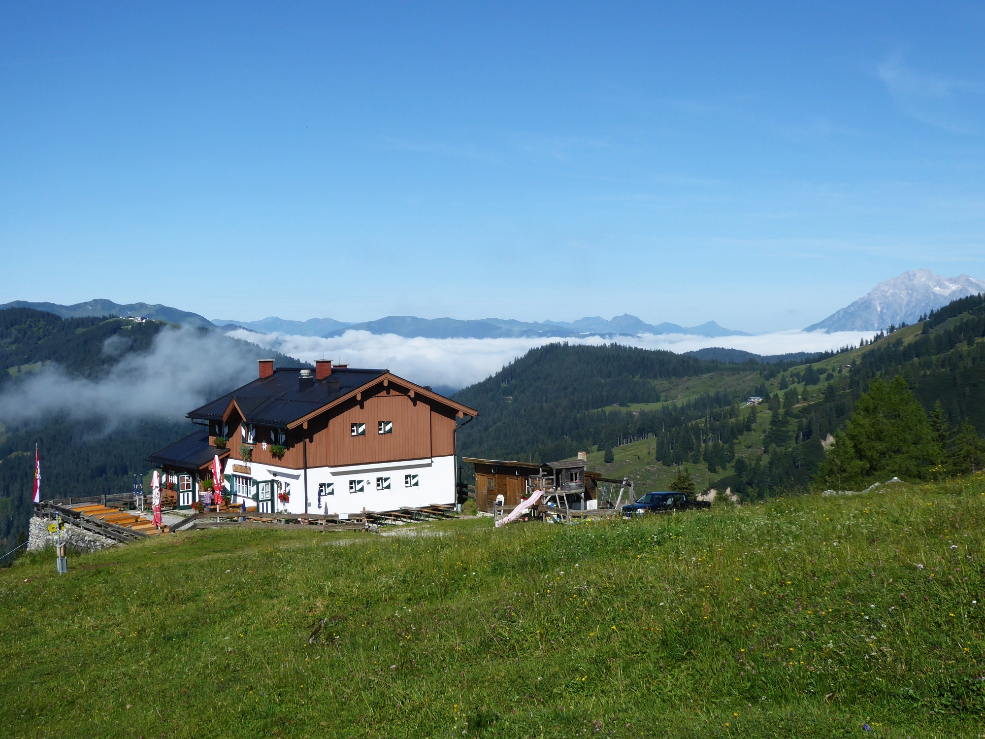
The Stegmoosalm (1,441 m) is situated in a picturesque location on the southeast foot of the Hochkönig massif at the beginning of the mighty Birgkar. There, along what is probably the most demanding approach to the Matrashaus on the Hochkönig summit (2,941 m), still sizable permanent snowfields steeply rise until midsummer. For visitors to the Stegmoosalm (end of May to early October, closed Fridays), an attractive contrast arises: lush greenery around the alm interrupted by vibrant Alpine rose, and higher up, bare rock framed by snow-white snow gullies. The picture is similar at the second dining destination of the hike, the scenic Erichhütte (open daily from May to mid-October). This time, the Taghaubenscharte and the Taghaube (2,159 m) form the rocky contrast. Other shared qualities are the excellent food offer and the stroller-accessible trails on the respective farm roads.
easy
2h 15min

5.18 km

Family-friendly

A to B

Muehlbach am Hochkoenig

Seasons


Directions
From the Stegmoosalm stop, a comfortable farm road (trail 90) leads through open forest to the Stegmoosalm (1,441 m) at the gentle outflow of the Birgkar in 30 minutes. Up to a distinctive “snack stone” at the transition to the rocky zone, the roughly one-hour ascent into the Birgkar is a worthwhile consideration for strong fitness altitude meters collectors. The trail to the Erichhütte (1,546 m) continues 100 altitude meters uphill but then joins a path crossing to the left. After a sunny hour, a small wetland with bulrush vegetation appears quite unexpectedly before the path passes comfortable loungers and a cross, traversing the gentle outlier of the Taughaubenkar towards the Erichhütte. From the picturesque alpine club hut, the half-hour descent to the Erichhütte parking lot bus stop on the B 164 follows the comfortable farm road.
Information & contact
Mag. Christian Heugl
5400 Hallein
Photo credit: Christian Heugl
By public transport
From Bischofshofen train station forecourt by bus 590 to Mühlbach am Hkg. town hall, then by bus 593 to Mühlbach Stegmoosalm parking lot. Return from Dienten Erichhütte parking lot by bus 593 to Mühlbach am Hkg. town hall and then by bus 590 back to Bischofshofen train station forecourt. Line 593 (hiking bus) operates only in summer from mid-May to end of September!
Frequency: hiking bus 593 hourly, connections to and from Mühlbach vary and require precise planning.
Schedule information and download: Online at www.salzburg-verkehr.at or on your smartphone via the free Salzburg Verkehr app for Android and iOS.
Route profile
All content has been researched by the editorial team to the best of their knowledge. However, the editorial team of Salzburger Verkehrsverbund GmbH cannot guarantee the completeness, accuracy, or timeliness of the information provided. We kindly ask you to verify the details when planning your trip, as opening hours, admission prices, or other information may change. Any liability claims against the editorial team or Salzburger Verkehrsverbund GmbH relating to material or non-material damages arising from the use of the information provided, or from the use of incorrect or incomplete information, are generally excluded.