
Sparber circular route
The fastest route to this destination
Sparber circular route
A circular route in Strobl at Wolfgangsee past wildlife enclosures, alpine pastures, and through the forest.
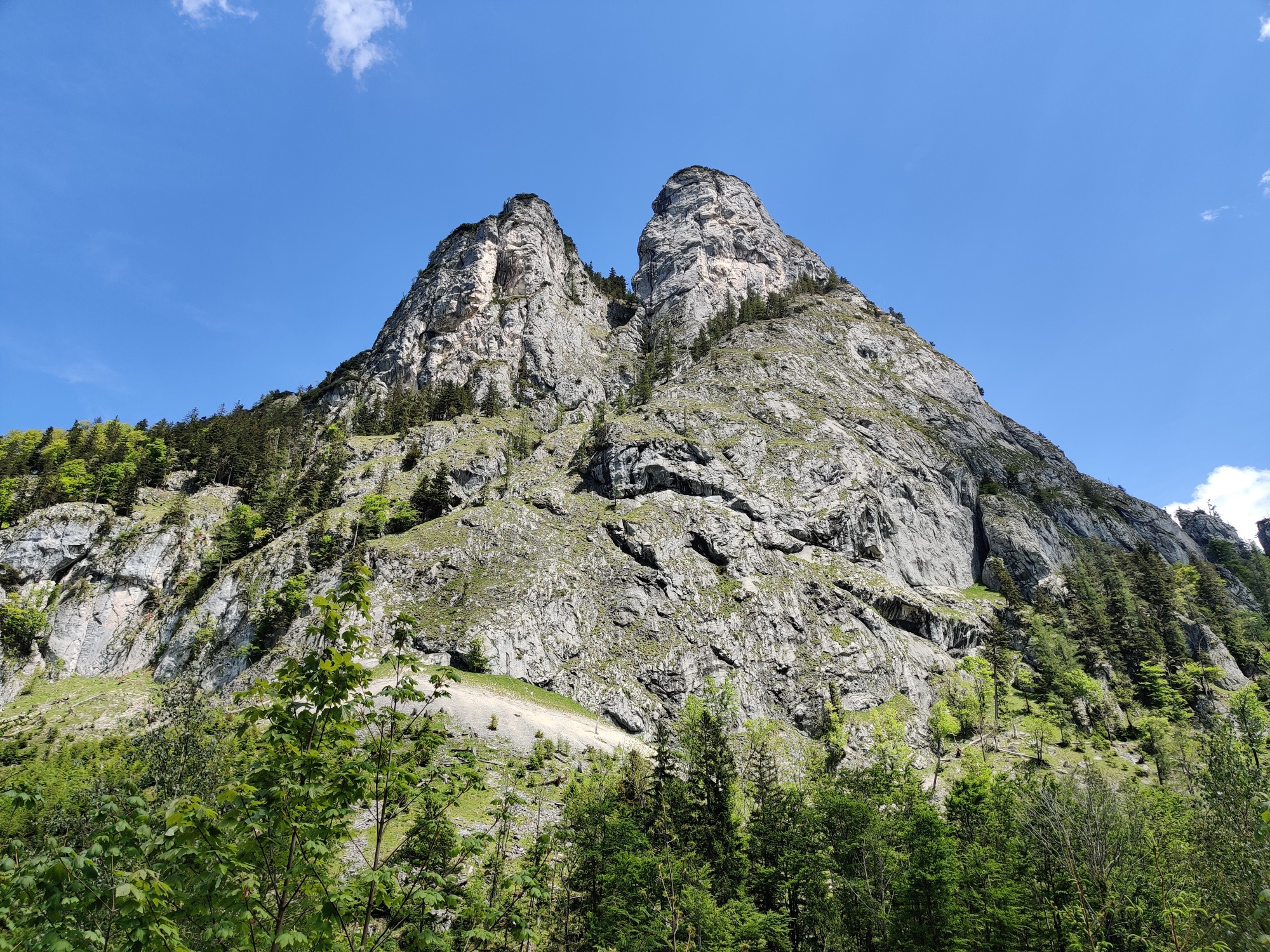
The Sparber is an impressive mountain at Wolfgangsee. The cable-protected, partially exposed ascent is not for everyone; however, the circular route around the two rock formations of the summit is an easy route for the whole family.
Direct arrival and details at: salzburg-erfahren.at
moderate
3h 30min

10.10 km

Family-friendly

A to B
Round trip

Strobl

Seasons


Directions
From the bus stop, walk a bit alongside the federal road towards Strobl and turn right onto the next forest road. The path leads up and down along the edge of the forest towards the east. The circular route then turns south and you reach Gasthof Kleefeld. Past the wildlife enclosure, follow the forest road to the south, initially through the meadow and then through the forest to Langeralm. If you already need a break here, you can descend a few meters to Postalmstraße to the Jausenstation Bergheimat. Otherwise, the path turns right after the hut, well marked at the edge of the alpine pasture into the forest. After stepping over a fence, the path climbs steeply once again to the forest road. Follow this further uphill. At a marker, the path leads back into the forest and eventually to Schartenalm. On the meadow between Sparber and Bleckwand, the two rock formations of the Sparber are probably most impressive to see. On the forest road towards the north and after the first hairpin bend, a forest path branches off to the right. Follow the well-marked trail down through the forest. You briefly meet the forest road again but here also take the right direct path through the forest to Gasthaus Mahdhäusl. Pass the parking lot and walk along Habergstraße to the federal road, where the bus stop is on the left side at the Aberseer Heimathaus.
Information & contact
Variant: Instead of the circular route or before it, the summit can of course also be climbed. From the Gasthof Kleefeld, the marked path leads through the forest to a steep grassy slope. The exposed sections at the summit rock, including ladders, require sure-footedness and a head for heights!
By public transport
Arrival: Bus 150 to (H) Strobl Urschlag
Return: (H) Strobl Breitenbacher Bus 150
Timetable information and download: Online at www.salzburg-verkehr.at or on your smartphone via the free Salzburg Verkehr app for Android and iOS.
Direct arrival and details at: salzburg-erfahren.at
Route profile
All content has been researched by the editorial team to the best of their knowledge. However, the editorial team of Salzburger Verkehrsverbund GmbH cannot guarantee the completeness, accuracy, or timeliness of the information provided. We kindly ask you to verify the details when planning your trip, as opening hours, admission prices, or other information may change. Any liability claims against the editorial team or Salzburger Verkehrsverbund GmbH relating to material or non-material damages arising from the use of the information provided, or from the use of incorrect or incomplete information, are generally excluded.