
Alpine hiking in Kuchl: From Nesslanger to Dürrfeichten Alm
The fastest route to this destination
Alpine hiking in Kuchl: From Nesslanger to Dürrfeichten Alm
A varied circular hike from Kuchl via the district of Gasteig to the sunny alpine pastures on the southeast side of the Rossfeldkamm.
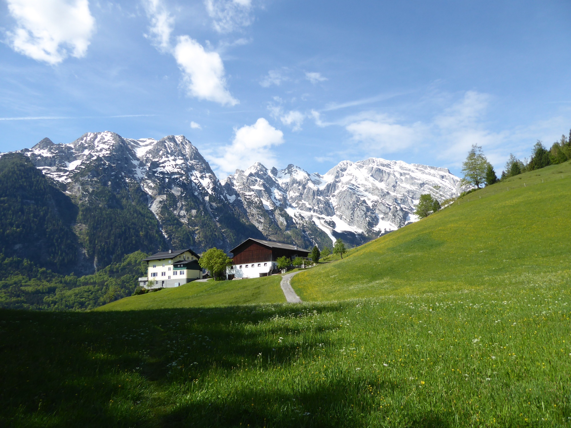
At first glance, the alpine pasture landscape around the woodworking stronghold of Kuchl is not yet visible. However, this changes quickly when you follow the rapidly ascending forest path over Gasteig up to the Kuchl ski hut and the neighboring Nesslangeralm (1,240 m). Now the wide views open up over the Tennengebirge and the Osterhorn group all the way to the Dachstein. The Hohe Göll (2,522 m), which almost overshadows everything, is naturally dominant. But no worries, the sun also shows itself at its best when crossing over to the Dürrfeichten Alm (1,344 m). The Kuchl path builders and maintainers have done excellent work on this stretch. Massive stepping stones and thick planks help comfortably over smaller ditches and hummocky meadows; in the forest, wooden steps are used where necessary. The round trip is long, but such a well-maintained path provides the ultimate hiking pleasure!
easy
6h 0min

15.22 km

Round trip

Kuchl

Seasons


Directions
From the train station or the town center of Kuchl, the route leads over the Salzach bridge, then turns right and immediately left towards "Gasteig." Shortly after the motorway underpass, forest path 3 runs on the right side for half an hour up to the farm group "Hochschaufler." Like a theater stage, the forest curtain briefly opens and reveals magnificent views of the Göll massif. After crossing the idyllic Hochschaufler clearing, the forest path 100 becomes steeper before the view opens from a height (1,235 m) to the opposite Nesslangeralm. For a small charge, chilled drinks are available there in the trough. The path continues steeply uphill for another 15 minutes, then turns left following the "Kuchler Sonnenweg 451" to Dürrfeichten Alm. The well one-hour descent into the high valley of Kühschwalb (path 451) is continuously steep, followed by a flat section along the access road downhill toward "Hochschaufler." After 1 km, the "Wanderweg Seidl" (path 6) branches right, passing the pretty Kienberg farm with a slight ascent into the known ascent route again.
Information & contact
Mag. Christian Heugl
5400 Hallein
christian.heugl@gmail.com
Image credit: Christian Heugl
By public transport
By train to Kuchl station or by bus 470 to Kuchl Marktstraße.
Frequency: Excellent accessibility, even on Sundays and public holidays.
Timetable information and download: Online at www.salzburg-verkehr.at or on your smartphone via the free Salzburg Verkehr app for Android and iOS.
Route profile
All content has been researched by the editorial team to the best of their knowledge. However, the editorial team of Salzburger Verkehrsverbund GmbH cannot guarantee the completeness, accuracy, or timeliness of the information provided. We kindly ask you to verify the details when planning your trip, as opening hours, admission prices, or other information may change. Any liability claims against the editorial team or Salzburger Verkehrsverbund GmbH relating to material or non-material damages arising from the use of the information provided, or from the use of incorrect or incomplete information, are generally excluded.