
From Hammerau to Johannishögl in Piding
The fastest route to this destination
From Hammerau to Johannishögl in Piding
BETWEEN BAVARIA AND SALZBURG THERE ARE GOOD CONNECTIONS. ONE OF THEM LEADS BY TRAIN TO HAMMERAU, THE STARTING POINT FOR A WONDERFUL HIKING ROUTE TO JOHANNISHÖGL.
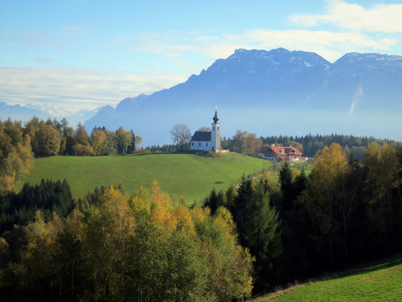
The Johannishögl (705 m) in the municipality of Ainring is an excellent vantage point with views over the Salzburg basin and the most famous peaks of the Berchtesgadener Alps. It is a suitable hiking destination at any time of the year; even in winter there are enough ascents that are quite certainly well-trodden even in heavier snow conditions. However, sturdy footwear is always recommended. The Johannishögl offers not only great views but also surprising insights. In the widely visible St. Johannes church, once part of the Archbishopric of Salzburg, there is a valuable late Gothic winged altar and no less impressive frescoes from the mid-15th century. Things are especially festive in the church and subsequently in the neighboring inn on June 24, the feast day of John, which ends with the burning of the Midsummer fire.
Direct arrival and details at: salzburg-erfahren.at
easy
2h 15min

7.10 km

Family-friendly

Round trip

Piding

Seasons


Directions
The starting point is Hammerau station. Along Bahnhofstraße the route continues a few meters south, then crosses the tracks and at the next intersection turns right towards the St. Erasmus church in Bicheln. A first mention dates back to 923; the owners of the lands and the church in “Puhila” were the Nonnberg monastery in Salzburg. At the next farm, path 10 turns right towards Johannishögl, follows the driveway to the last farm, then the farm track into the forest and joins a steep logging path. This short section is often wet and slippery, but the inn and church at Johannishögl soon come into view. The return route from the inn on the right (north) briefly follows the sunny Piding Bee Path and after 400 m turns right again, first towards Ainring and then towards Hammerau. Shortly after, this forest path joins the route known from the ascent, along which it returns to Hammerau station.
Information & contact
www.piding.de/johannishoegl; www.berchtesgaden.de/johannishoegl;
Mag. Christian Heugl
5400 Hallein
Image credit: Christian Heugl
By public transport
From Salzburg main station with S 3 or with BRB RE 5 (change at BRB S 4 in Freilassing) to Hammerau station.
Schedule information and download: Online at www.salzburg-verkehr.at or on your smartphone via the free Salzburg Verkehr app for Android and iOS.
Direct arrival and details at: salzburg-erfahren.at
Route profile
All content has been researched by the editorial team to the best of their knowledge. However, the editorial team of Salzburger Verkehrsverbund GmbH cannot guarantee the completeness, accuracy, or timeliness of the information provided. We kindly ask you to verify the details when planning your trip, as opening hours, admission prices, or other information may change. Any liability claims against the editorial team or Salzburger Verkehrsverbund GmbH relating to material or non-material damages arising from the use of the information provided, or from the use of incorrect or incomplete information, are generally excluded.