
Kleine Pleißlingkeil in Obertauern
The fastest route to this destination
Kleine Pleißlingkeil in Obertauern
South Vienna Hut and surrounding summits
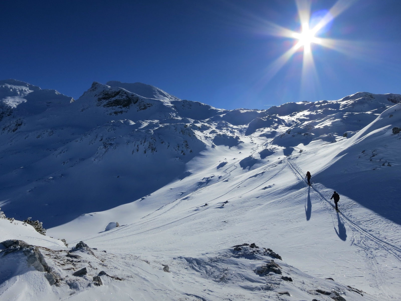
Around the South Vienna Hut in the Radstadt Tauern is an ideal and snow-safe ski touring area. For beginners, apart from the hut itself (with sled rental), the Spirzinger, the Hengst and the Scheibenkogel are suitable. The described route goes a bit higher to the Kleine Pleißlingkeil. For this, physical condition, orientation skills, and good visibility are required; the descent is never really steep, unless you choose appropriate slopes under good conditions. For advanced skiers, the Große Pleißlingkeil is also an option. Up top, a wild and lonely winter landscape with a wonderful panorama awaits.
moderate
4h 0min

17.30 km

Round trip

Obertauern

Seasons


Directions
First, it goes relatively flat for 2 kilometers to the Hintergnadenalm. Good skating technique is an advantage for the return trip here. Then, depending on conditions, you follow the sledding route or through open terrain over 2 steeper sections to the South Vienna Hut. From there, via a steep section to the Hengst. Alternatively, you ascend directly between Hengst and Scheibenkogel, without the summit, as on the descent. At the top, you reach a plateau with somewhat confusing terrain. To the left of the Kleine Pleißlingkeil, there is usually a ski depot to leave your skins and tackle the last 50 vertical meters on foot to the exposed east or west summit. Beware of cornices both at the ski depot and in the summit area. The descent leads into a basin, where skins are put on again to take the Scheibenkogel as the last summit before returning via the South Vienna Hut and the sledding path back to the Gnadenalm.
Information & contact
Refreshment options:
www.alpenverein.at/suedwienerhuette
Theresa Schilling
5020 Salzburg
theresaschilling@googlemail.com
Photo credits: Theresa Schilling, Per Oftedal, Christian Heugl
By public transport
By train to Radstadt. From there by bus 280 to Untertauern Gnadenalm.
Starting point 5 minutes from the bus stop.
Timetable information and download: Online at www.salzburg-verkehr.at or on your smartphone via the free Salzburg Verkehr app for Android and iOS.
Safety information
Observe avalanche warning level. Ski touring equipment, avalanche transceiver set. Information on weather and avalanche situation at www.lawine.salzburg.atRoute profile
All content has been researched by the editorial team to the best of their knowledge. However, the editorial team of Salzburger Verkehrsverbund GmbH cannot guarantee the completeness, accuracy, or timeliness of the information provided. We kindly ask you to verify the details when planning your trip, as opening hours, admission prices, or other information may change. Any liability claims against the editorial team or Salzburger Verkehrsverbund GmbH relating to material or non-material damages arising from the use of the information provided, or from the use of incorrect or incomplete information, are generally excluded.