
From Schneizlreuth through the Aschauerklamm to Reith
The fastest route to this destination
From Schneizlreuth through the Aschauerklamm to Reith
A COOL SUMMER WALK THROUGH THE MAGICAL ASCHAUER KLAMM FROM BAVARIAN SCHNEIZLREUTH TO THE SMALL LOCALITY OF REITH BEI UNKEN.
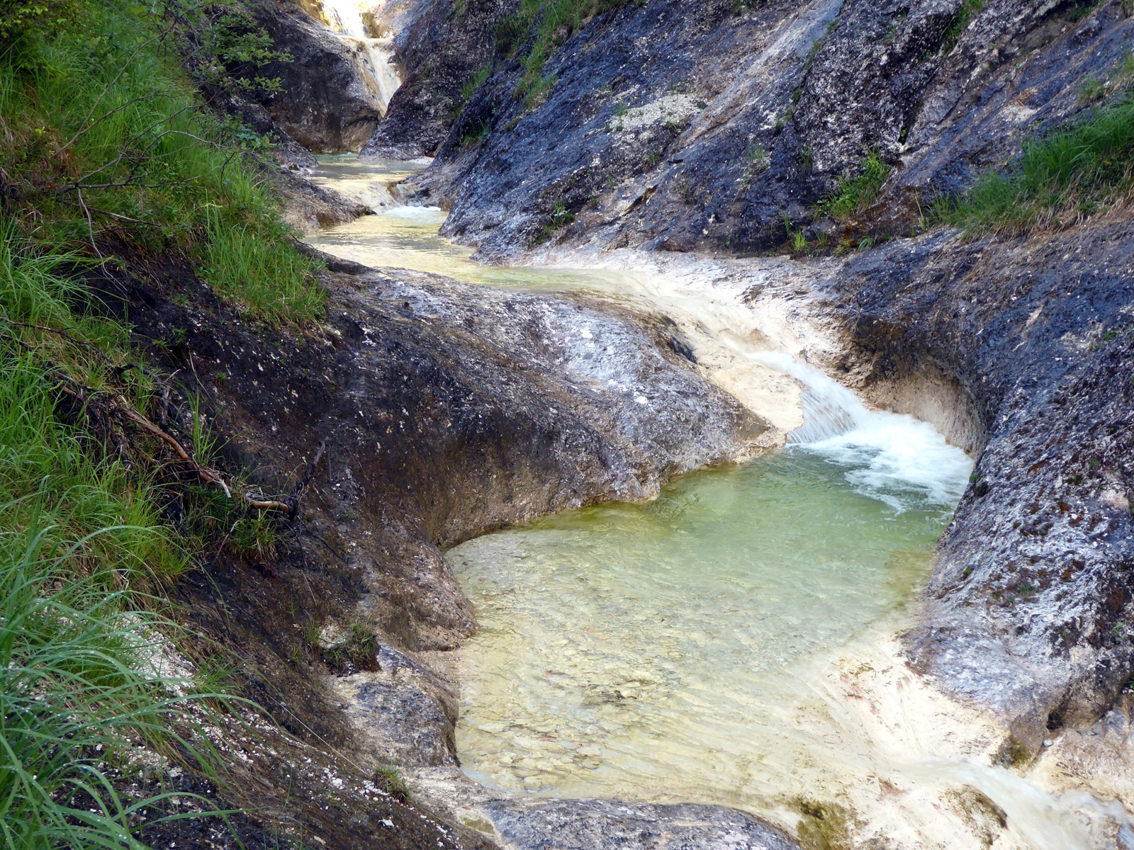
The Aschauer Klamm lives a quiet existence alongside the many large gorges in the Saalach valley. And that’s a good thing, because you should take your time for the hidden beauty. It may lack the very big spectacular features, like a cascading waterfall, but over the considerable gorge length of 2.5 kilometers there are many astonishing twists. Instead of rushing violently, the Aschauer brook flows through the steep ravine with calming serenity, creating a wonderland of pools and gentle thresholds that is deeply impressive. The perhaps most charming part of the gorge comes towards the end, and there the bus network opens up yet another worthwhile route option. To avoid returning the same way or taking a rather lengthy farm road, simply continue for the same distance to Reith. There awaits the Innersbachklamm, a very special, though only 200 m long, “gorge treat”.
moderate
4h 0min

11.69 km

Family-friendly

A to B

Schneizlreuth

Seasons


Directions
The starting point is the newly redesigned Schneizlreuth Renner parking lot stop. The well-signposted path into the Aschauer Klamm initially follows the 2.5 km gravel access road along the Saalach to the Haiderhof inn (open Sat, Sun, holidays from 11 am). The path into the Aschauerklamm branches off to the left and soon narrows into that narrow path which the somewhat exaggerated warning sign would suggest. With some caution, there is hardly any danger; open eyes are important anyway with so much beauty. After the large footbridge and a dozen stacked rock basins, the historic Aschauer Klause recalls the brook's former importance as a timber carrier into the Saalach. Those who have to return to the start turn left over the bridge here. The path to Reith leads gently uphill straight through bright forest to the Aschauer Sattel (853 m) and then 3 km downstream to the Innersbachklamm junction shortly before Reith. To finish, another quite different jewel from the Saalach valley's string of pearls! At the end of the short gorge, 10 minutes on the Saalach riverside path to the left and over the bridge to the Lofer Reith stop.
Information & contact
www.berchtesgaden.de/wandern/see-klamm-wanderungen/aschauerklamm
Mag. Christian Heugl
5400 Hallein
cheugl@a1.net
Image credit: Christian Heugl
By public transport
From Sbg. Main Station (Engelbert-Weiß-Weg) by bus 260 to Schneizlreuth Renner parking lot.
Return from Lofer Reith by bus 260.
Timetable information and download: Online at www.salzburg-verkehr.at or on your smartphone via the free Salzburg Verkehr app for Android and iOS.
Route profile
All content has been researched by the editorial team to the best of their knowledge. However, the editorial team of Salzburger Verkehrsverbund GmbH cannot guarantee the completeness, accuracy, or timeliness of the information provided. We kindly ask you to verify the details when planning your trip, as opening hours, admission prices, or other information may change. Any liability claims against the editorial team or Salzburger Verkehrsverbund GmbH relating to material or non-material damages arising from the use of the information provided, or from the use of incorrect or incomplete information, are generally excluded.