
Guggenthal Koppl – Nockstein – Gaisberg – City of Salzburg
The fastest route to this destination
Guggenthal Koppl – Nockstein – Gaisberg – City of Salzburg
Temporarily closedThe two local mountains of the “Stodinger” are a popular training and hiking destination in every season.
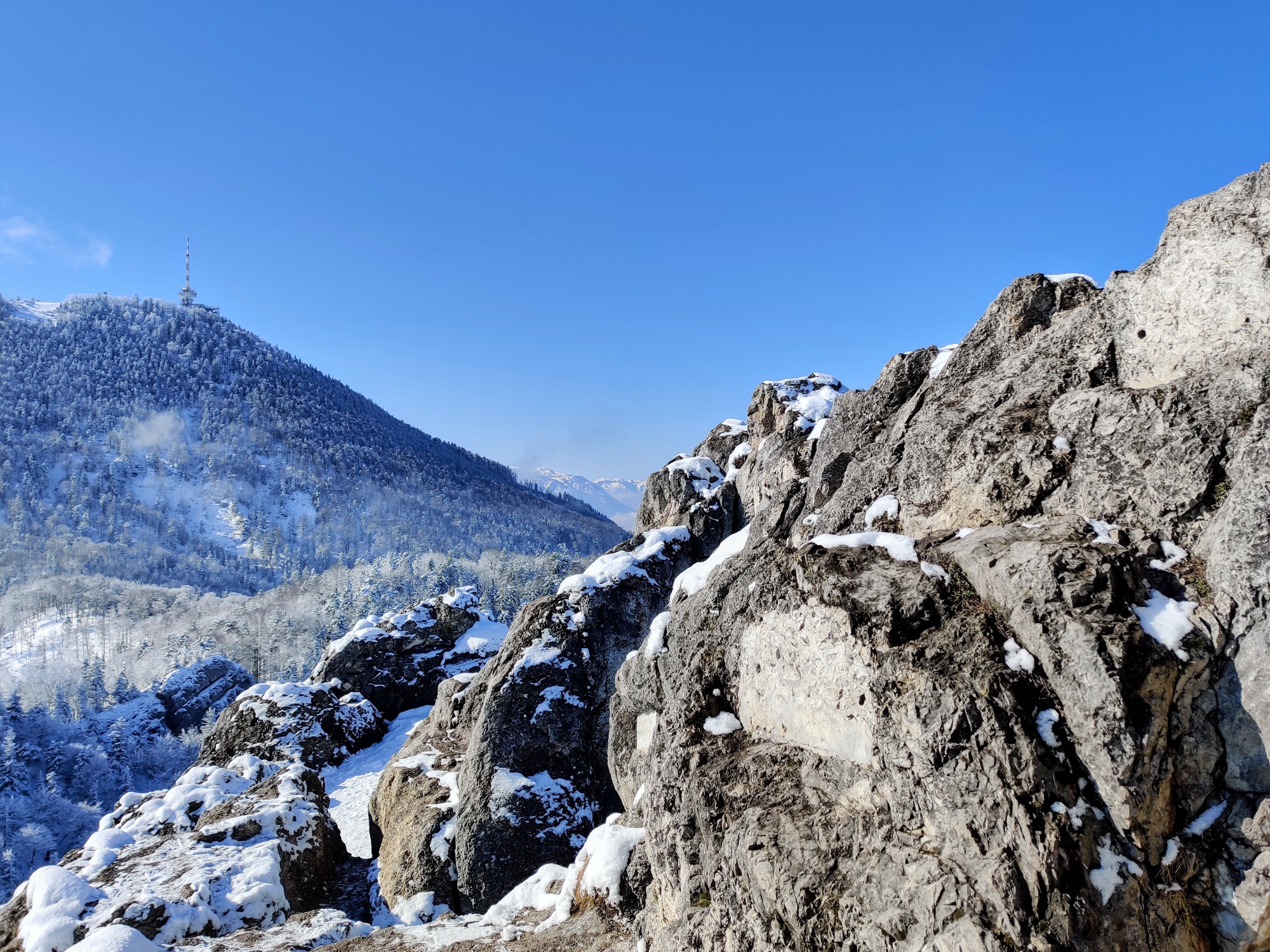
The two local mountains of Salzburg can be wonderfully crossed together with bus arrival. Over the Nockstein Gorge, you reach the distinctive rock tooth. Then through the forest uphill via the circular hiking trail to the Gaisberg summit. In inversion weather conditions, you stand above the clouds on the Gaisberg. On the descent via the route of the cog railway, discontinued in 1928, public transport enthusiasts may get a little nostalgic. Or to spare the knees, simply take the Gaisberg bus downhill.
moderate
4h 30min

10.67 km

A to B

City of Salzburg

Seasons


Directions
Just behind the Guggenthal bus stop, turn left into Georg-Weickl-Weg. At the forest kindergarten, the forest road to Nockstein branches off to the left, which can be shortened via two forest paths. The forest trail over the Nockstein Gorge becomes narrower and steadily leads uphill, well marked. At a fork, take the left path over the wooden stairs. Passing a viewpoint bench, you reach the saddle between Nockstein and Gaisberg. If you want to include the Nockstein summit, follow the path left with slight ups and downs to the stone sculpture below the summit ascent. To the right, hike up the steep, in one section secured with rope, trail to the exposed summit cross. Return the same way and follow the path through the forest on Gaisberg. After some hairpin bends, you reach the circular hiking trail. Go slightly right on the wide forest road to the indicated junction. The many small, nicely laid serpentine paths ease the steep ascent through the forest to the summit cross (1,287 m) of the Gaisberg, right next to the mighty transmitter. At the summit plateau, the Goasnalm invites you to stop for refreshments. A few meters east of the hut, the Büffelsteig trail for the descent branches off to the right. It initially leads over the road and then in a wide curve down to Zistelalm. From Zistel, descend the old route of the discontinued cog railway down to Parsch. Via the road of Judenbergweg, you reach Schmedererplatz, where the Obus line 6 bus stop is located. Those who want to save the descent can take the Gaisberg bus 151 into the city.
Information & contact
Information & Contact:
Stefanie Ruep
5020 Salzburg
stefanie.ruep@gmail.com
Photo credit: Stefanie Ruep
For checking the weather on Gaisberg, the webcam is very suitable. Here you can also check whether the sun is shining at the summit during inversion weather, even if it is dull and cloudy in the city.
By public transport
Arrival: Bus 150 or 155 to (H) Koppl/Guggenthal
Return trip: (H) Ludwig-Schmederer-Platz Obus 6
Timetable information and download: Online at www.salzburg-verkehr.at or on your smartphone via the free Salzburg Verkehr app for Android and iOS.
Safety information
The summit ascent to Nockstein is exposed and requires sure-footedness and a head for heights. It can also be easily skipped when crossing.Route profile
All content has been researched by the editorial team to the best of their knowledge. However, the editorial team of Salzburger Verkehrsverbund GmbH cannot guarantee the completeness, accuracy, or timeliness of the information provided. We kindly ask you to verify the details when planning your trip, as opening hours, admission prices, or other information may change. Any liability claims against the editorial team or Salzburger Verkehrsverbund GmbH relating to material or non-material damages arising from the use of the information provided, or from the use of incorrect or incomplete information, are generally excluded.