
Hoher Göll with views of Berchtesgaden, Schönau and Königssee
The fastest route to this destination
Hoher Göll with views of Berchtesgaden, Schönau and Königssee
Temporarily closedBeautiful ridge route along the German-Austrian border with via ferrata sections in the Berchtesgadener Alps
Ludwig Purtscheller described the 2522 m high Hoher Göll as a “landmark in the magnificent mountain crown of the old Salzach city of Salzburg.” Such a high alpine mountain with a view of the big city is quite unique. The Hoher Göll is the highest peak of the Göll massif, a mountain block on the eastern edge of the Berchtesgadener Alps, between the Salzach valley and Königssee.
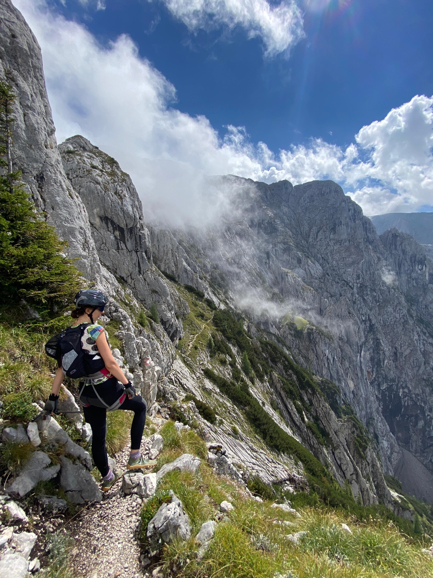
For enduring, experienced, sure-footed and fearless hikers with via ferrata experience (B-C, not continuously secured) an impressively scenic and varied route!
The route requires a stable fine weather situation; there is no retreat or shelter on the long ridge. A lengthy emergency descent from the exposed location leads through the Alpetal, a popular ski tour route in winter.
Unfortunately, the beautiful mountain also experienced a sad chapter of world history; Hitler spent a third of his term of office on the Obersalzberg, important decisions were made there, in the second center of power next to the capital Berlin. The “Documentation Obersalzberg” and the Kehlsteinhaus built by the NSDAP remind of this today.
difficult
7h 30min

13.68 km

A to B

Berchtesgaden

Seasons


Directions
From the Kehlsteinhaus, follow the hiking path towards Mannlgrat. Soon we leave the many tourists trying themselves on the rock terrain behind and put on helmet, gloves and a via ferrata set. Many exciting secured but also several unsecured rock and ridge passages lead us up and down without significant altitude gain. Sometimes you even have to crawl between the rocks. At the end of the ridge it gets steeper and the air thinner, heading towards the summit. We now take off the via ferrata gear again. The Schustersteig from the Purtschellerhaus meets our path here and we ascend easily to the summit. From Göll we take the crossing to Hohe Brett in hand. Please definitely stay on the path, there are numerous deep holes and dolines! Before the Große Archekopf the path branches off into the karstified Alpetal. However, we continue straight ahead towards Hohe Brett. After crossing the Archekopf below via marked rocks, a steep narrow and wire rope secured ascent comes onto the next ridge. There the path is initially a little wider before a narrow section requires fearlessness of heights again. Then easy ascent to the summit of Hohe Brett. Afterwards, continue straight ahead, after a descent turn left towards Carl-von Stahl Haus. After passing the rock walls, follow a path at about 1900 m above sea level to the right through meadow terrain to the Mitterkaseralm (for a descent to Schönau) or go straight ahead over the Pfaffenkegel to the Jennerbahn mountain station for a descent by cable car. From the Mitterkaseralm we walk on a forest road to the Krautkaserlift mountain station, there we turn onto the hiking path towards the Hinterbrand car park. After entering the forest and passing the Krautkaserbach, we take the lowest path, first towards Vorderbrand and then left downhill over the Stufensteig to the Jennerbahn valley station.
Information & contact
Theresa Schilling
5020 Salzburg
theresaschilling@googlemail.com
Image credits: Theresa Schilling, Per Oftedal
By public transport
Not included in the Salzburg KlimaTicket
Bus 840 to Berchtesgaden Schießstättbrücke
Bus 838 to Obersalzberg Documentation Center
Paid bus to Kehlsteinhaus, one way 22 € (status: 2022)
Bus service daily from 8:55 am – 4:00 pm every 25 minutes, last descent 4:50 pm (The Kehlsteinhaus and the Kehlstein bus line are closed in winter).
Timetable information and download: Online at www.salzburg-verkehr.at or on your smartphone via the free Salzburg Verkehr app for Android and iOS.
Safety information
Absolute sure-footedness and fear of heights required, T5, via ferrata B-C, many unsecured spots, sense of direction, absolutely stable fine weather required for the long unprotected ridge routeRoute profile
All content has been researched by the editorial team to the best of their knowledge. However, the editorial team of Salzburger Verkehrsverbund GmbH cannot guarantee the completeness, accuracy, or timeliness of the information provided. We kindly ask you to verify the details when planning your trip, as opening hours, admission prices, or other information may change. Any liability claims against the editorial team or Salzburger Verkehrsverbund GmbH relating to material or non-material damages arising from the use of the information provided, or from the use of incorrect or incomplete information, are generally excluded.