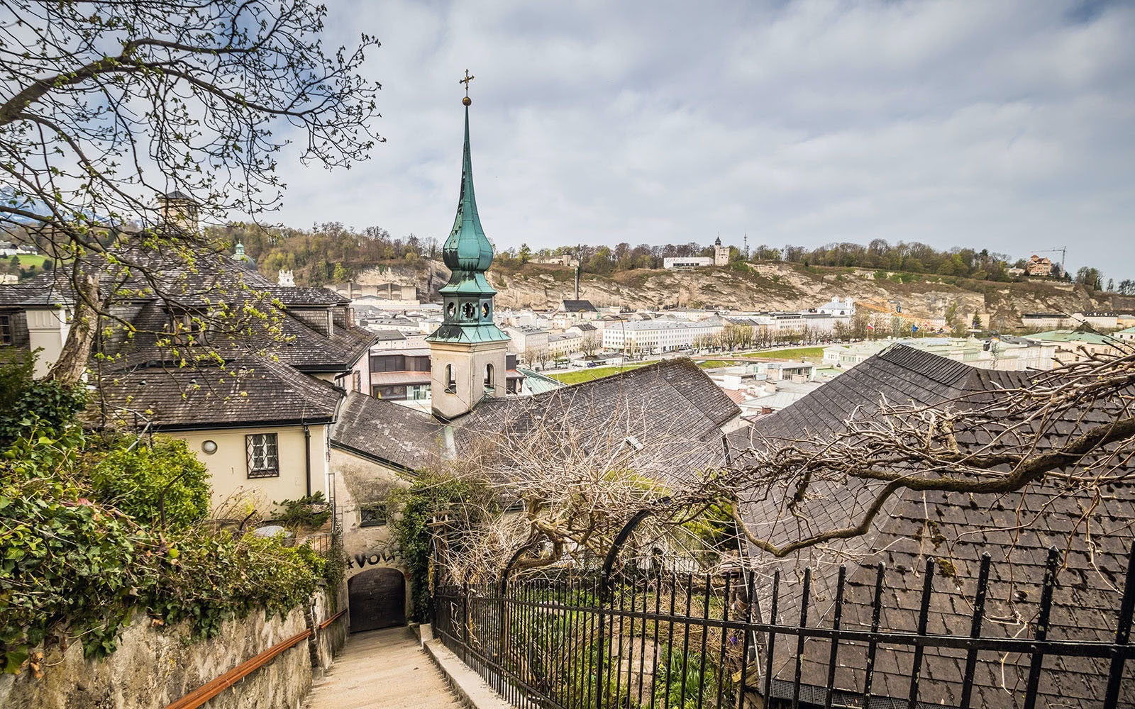

The Kapuzinerberg in the city of Salzburg
The fastest route to this destination
The Kapuzinerberg in the city of Salzburg
CITY VIEW AND ENJOYMENT OF NATURE ON THE BASTEI PATH
The inscription on the venerable Franziskustor in Linzergasse points the way for you: “To Kapuzinerberg.” The densely wooded Salzburg city mountain is also hard to miss even without signs. It measures just 637 meters above sea level at its highest point and is inhabited by the world’s unique city chamois. Maybe you will be lucky and encounter these shy animals during your walk. The Bastei path is named after the Hettwer Bastei below the Kapuziner monastery, a stately fortification wall from the Thirty Years’ War. The hiking trail leads from the Kapuziner monastery over several viewing terraces with a magnificent view of the old town to the Franziskischlössl. Mozart fans do not miss the little detour to the composer’s bust on the meadow behind the monastery garden. Stefan Zweig admirers can enjoy a view of his former villa and commemorate him at his bronze statue by sculptor Josef Zenzmeier. After a wonderful forest walk, you reach the beer garden of the Franziskischlössl, which with its four magnificent, ancient linden trees is considered one of the most beautiful in all of Salzburg. As for the return journey, the motto is: “Many roads lead to Salzburg!” Either choose the one you came up or try one of the other paths that wind down through the lush green beech forest into the alleys of the city.
easy
2h 18min

5.00 km

Family-friendly

A to B
Round trip

City of Salzburg

Seasons


Directions
Always along the fortification wall: The Bastei path follows an old soldier’s trail and lives up to its name. The current route was established around 1929 by the Salzburg city association for hikers. Nevertheless, you should not do without good footwear. It can especially get slippery in autumn.
Information & contact
Tourismus Salzburg GmbH
Auerspergstraße 6
5020 Salzburg
Tel.: +43 (0)662 88987-0
Image credit: Adobe Stock
By public transport
The Kapuzinerberg rises at old town height north of the Salzach. For the described hike, simply take the nearest bus to Makartplatz and go to Linzergasse. You can also take one of the regional buses from the main station, for example lines 120, 130, 131, 140, 150, 151, 155, and get off at the Hofwirt stop. From here, it is only a few meters to Linzergasse.
Timetable information and download: Online at www.salzburg-verkehr.at or on your smartphone via the free Salzburg Verkehr app for Android and iOS.
Route profile
All content has been researched by the editorial team to the best of their knowledge. However, the editorial team of Salzburger Verkehrsverbund GmbH cannot guarantee the completeness, accuracy, or timeliness of the information provided. We kindly ask you to verify the details when planning your trip, as opening hours, admission prices, or other information may change. Any liability claims against the editorial team or Salzburger Verkehrsverbund GmbH relating to material or non-material damages arising from the use of the information provided, or from the use of incorrect or incomplete information, are generally excluded.