


High-altitude route from Thalgau to Mondsee
The fastest route to this destination
High-altitude route from Thalgau to Mondsee
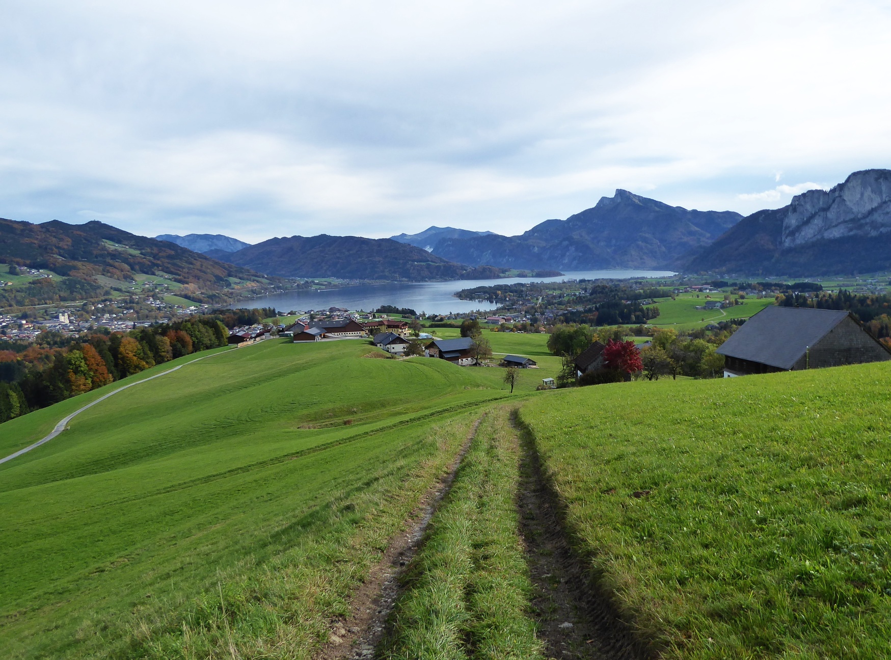
A VERY SUNNY AND SCENIC HIGH-ALTITUDE HIKE FROM THALGAUBERG TO KOLOMANSBERG AND ON TO MONDSEE.
The route is long, but you should definitely plan some sightseeing time both for Thalgau and the destination Mondsee. The most interesting sights in both towns are described in detail, the gastronomy is excellent in both places, and the attractive half-hourly bus service allows generous time planning. The first part of the sunny hike leads with rapid altitude gain from the town of Thalgau over the romantic high plateaus at Thalgauberg, then continues in a long, extraordinarily scenic traverse to the southeast ridge of Kolomansberg, and from there past the Leidingerhof to the end point Mondsee.
Direct travel and details at: salzburg-erfahren.at
easy
3h 40min

12.60 km

A to B

Thalgau

Seasons


Directions
From the Thalgau town center bus stop, the route passes the 400-year-old Moser Linden tree and the tourism office and then turns left into Ischlerbahnstraße. Over the Fischach bridge it continues to the pear-chestnut avenue and at its end makes a left curve through the motorway underpass. Then path 34 turns into mixed forest, crosses a fairytale-like clearing higher up, and meets the Reitbauerweg in front of a farm. Along this driveway, turning left once, to the next farm and then again on a meadow path to a solid farming property. Route 34 then follows, turning right once, 500 m along Kolomanstraße to the junction with Thalgaubergstraße. Unfortunately, there is no signpost here, but our route follows Thalgaubergstraße on the right side for another half kilometer to the turnoff to Buchschachstraße. We follow the sunny, now again signposted Panoramaweg 33 past Grundnerhof to the almost highest point Schernthan (925 m). After 300 m the forest road enters the woods, immediately afterward route 8 turns sharply right towards Mondsee. On a partly somewhat muddy path, the way leads to the beautifully situated Leidingerhof restaurant and then follows along the driveway the signposted route 35. The bus terminal is located on the east side of the cemetery.
Information & contact
www.thalgau-tourismus.at, www.mondsee.salzkammergut.at
Mag. Christian Heugl
5400 Hallein
christian.heugl@gmail.com
Photo credit: Christian Heugl
By public transport
By bus 140 from Salzburg main station (Südtiroler Platz) to Thalgau town center. Return from Mondsee bus terminal with bus 140.
Frequency: Very good, even on Sundays and public holidays.
Timetable information and download: Online at www.salzburg-verkehr.at or on your smartphone via the free Salzburg Verkehr app for Android and iOS.
Direct travel and details at: salzburg-erfahren.at
Route profile
All content has been researched by the editorial team to the best of their knowledge. However, the editorial team of Salzburger Verkehrsverbund GmbH cannot guarantee the completeness, accuracy, or timeliness of the information provided. We kindly ask you to verify the details when planning your trip, as opening hours, admission prices, or other information may change. Any liability claims against the editorial team or Salzburger Verkehrsverbund GmbH relating to material or non-material damages arising from the use of the information provided, or from the use of incorrect or incomplete information, are generally excluded.