


Alpine hiking from Dientner Sattel to Dienten
The fastest route to this destination
Alpine hiking from Dientner Sattel to Dienten
A wonderfully scenic high-altitude hike on the border between Pinzgau and Pongau and between grassy mountains and limestone giants.
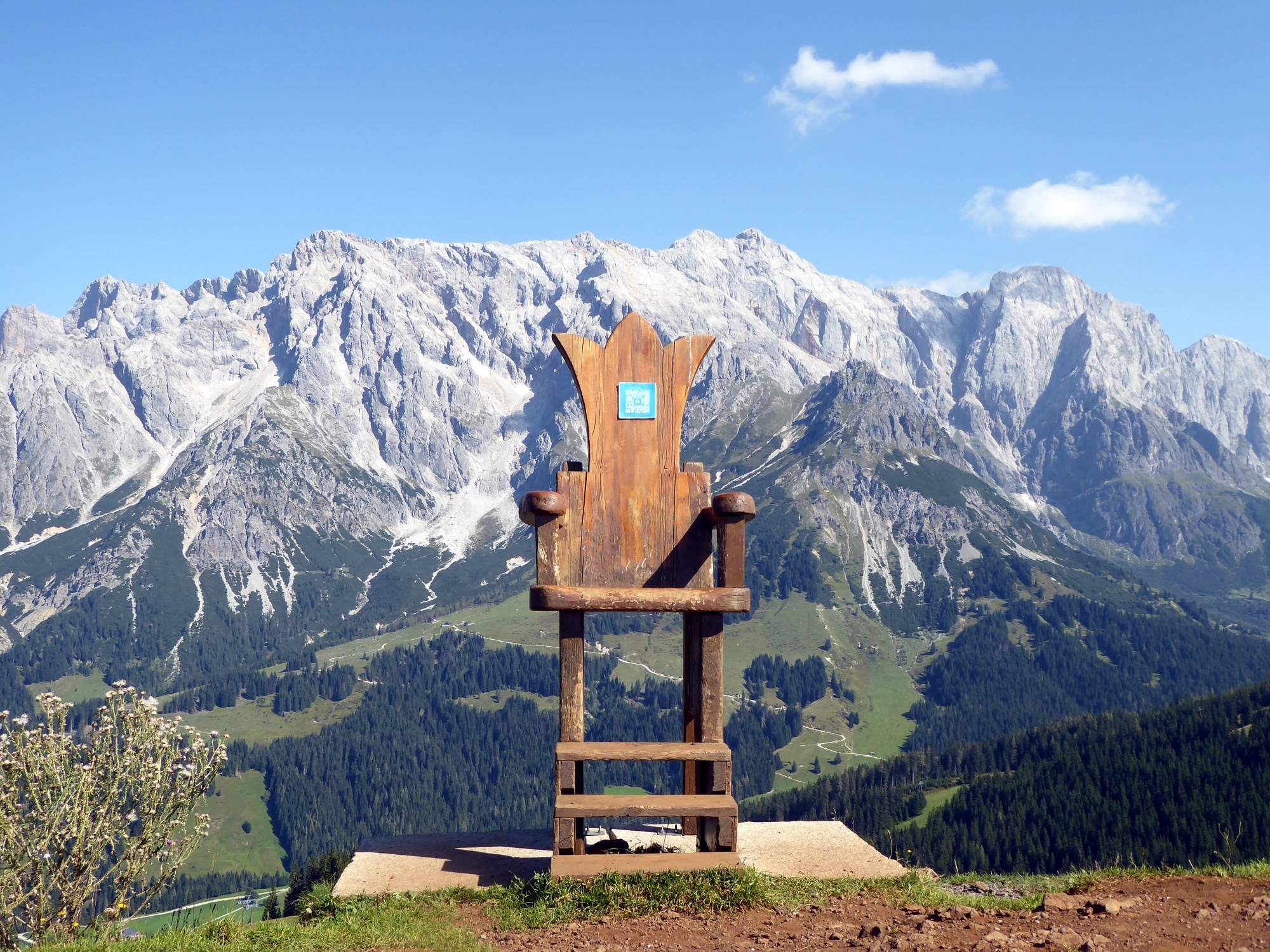
His Majesty the grey Hochkönig is always present. But only visually, at a reassuring distance to the north, while our hiking area extends enjoyably on the alpine meadows of the Dientner grassy mountains. The hike starts at the highest point of the Hochkönigstraße, at the Dientner Sattel (1,379 m), which also marks the border between Pinzgau and Pongau. There are plenty of places to eat along the route, from gourmet alpine huts to simple snack stations, and at the highest point of the hike, the Wastlhöhe (1,737 m), there is a wooden throne with a view of the Hochkönig ready for an audience. The route is ideal for an outing with children who are fit for hiking.
moderate
3h 5min

8.37 km

Family-friendly

A to B
Multi-day tour

Dienten am Hochkönig

Seasons


Directions
The starting point is the Dientner Sattel Birgkarhaus bus stop. Route 75 to Tiergartenalm passes just a few meters below the Dientalm. With its adventure playground and petting animals, it is a popular family destination. But also the three-quarter-hour path to Tiergartenalm arouses the childlike play instinct with its original puzzle questions and shortens the perceived time. Halfway, the steeper "forest path" forks off to the right, which then changes into the charming ant educational trail at the height of Tiergartenalm. At its end, the route follows the wide forest road again, which passes the Dacheggbahn mountain station and the Sunn Hüttl snack station, crossing to Wastlhöhe (path 63) within 40 minutes. In another half hour, the Bürglalm (1,581 m) is reached. Two descent options are now available: either very leisurely but significantly longer along the alpine access road (paths 63, 65), or a steep path 15 shortly after Bürglalm turning left, descending in 1.5 hours to the village of Dienten. The bus stop Dienten Arzthaus is located in the town center.
Information & contact
Mag. Christian Heugl
5400 Hallein
christian.heugl@gmail.com
Photo credit: Christian Heugl
By public transport
From Bischofshofen station (forecourt) take bus 590 to Mühlbach town center and bus 593 to Dientner Sattel Birgkarhaus. The hiking bus 593 only runs from early July to the end of September!
Return from Dienten Arzthaus with bus 631 via Mühlbach and then bus 590 to Bischofshofen station or with bus 631 to Lend station.
Timetable information and download: Online at www.salzburg-verkehr.at or on your smartphone via the free Salzburg Verkehr app for Android and iOS.
Route profile
All content has been researched by the editorial team to the best of their knowledge. However, the editorial team of Salzburger Verkehrsverbund GmbH cannot guarantee the completeness, accuracy, or timeliness of the information provided. We kindly ask you to verify the details when planning your trip, as opening hours, admission prices, or other information may change. Any liability claims against the editorial team or Salzburger Verkehrsverbund GmbH relating to material or non-material damages arising from the use of the information provided, or from the use of incorrect or incomplete information, are generally excluded.