


Alpine hiking in the Dientner Mountains
The fastest route to this destination
Alpine hiking in the Dientner Mountains
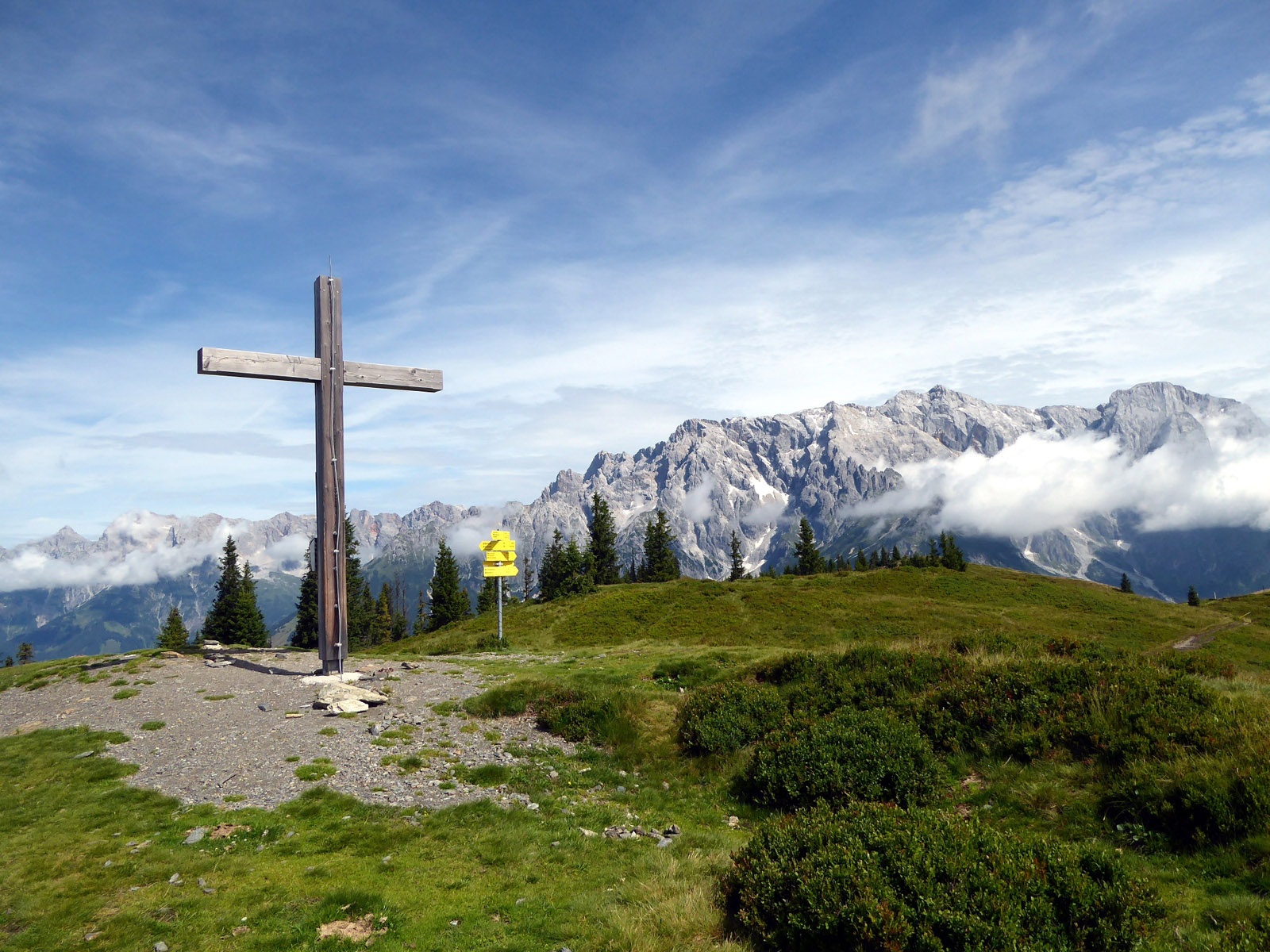
THE NORTH-SOUTH CROSSING OF THE DIENTNER MOUNTAINS FROM DIENTNER SADDLE VIA AHORNSTEIN LEADS THROUGH A TRUE ALP MEADOW PARADISE IN THE MUNICIPAL AREA OF DIENTEN AM HOCHKÖNIG.
The Dientner Mountains and the opposite Hochkönig massif offer an appealing contrast. There is the bare, almost 3,000-meter-high rocky giant, crowned even with a small glacier remnant, and on the other side the green grassy mountains, a magical paradise equally for alpine animals and hikers. No doubt where the journey leads; during the crossing of the Dientner Mountains, besides four inviting alpine huts and two peaks, one will certainly encounter numerous curious marmots.
Direct journey and details at: salzburg-erfahren.at
easy
4h 30min

12.27 km

A to B

Dienten am Hochkönig

Seasons


Directions
The starting point is the Dienter Sattel – Birgkarhaus stop at 1,379 m above sea level. Trail 75 leads past the Dientalm, located only a few minutes below, towards the Tiergartenalm. This three-quarter-hour ascent is suitable for strollers, and the original quiz questions along the route also shorten the time for young hikers. From Tiergartenalm, trail 76 (Kollmannsegg) initially follows the wide ski slope and then turns left after the mountain station. From Kollmannsegg (1,848 m), the wonderfully scenic high-altitude path leads in 15 minutes to the equally high Ahornstein summit (total walking time so far 2 hours). The descent towards the "Königsbergalm, Huberalm" follows trail 60 through beautiful hiking terrain to a fork in the path. Two roughly equally long and equally interesting options are available: right via Huberalm (1,418 m), or left on trail 59a to Königsbergalm (1,325 m). The last section, about one and a half hours, from the alpine huts into the Schwarzenbach valley and further to the Feroli sawmill (bus stop), mostly follows access roads.
Information & contact
www.hochkoenig.at, www.tiergartenalm.at, www.urlaubambauernhof.at/de/hoefe/dientalm, www.hochkoenig.at/de/infrastruktur/dienten-huberalm-1422-m.html, www.hochkoenig.at/de/infrastruktur/dienten-koenigsbergalm-1325-m.html
Mag. Christian Heugl
5400 Hallein
Image credit: Christian Heugl
By public transport
By bus 590 from Bischofshofen station (forecourt) to Mühlbach municipal office and by bus 593 to Dientner Sattel Birgkarhaus. Please note the summer timetable!
Return from the Dientenbachtal Feroli stop with bus 631 to Lend station (forecourt), then by REX or S3 to the destination station.
Frequency / interval: Precise planning is especially necessary on weekends!
Timetable information and download: Online at www.salzburg-verkehr.at or on your smartphone via the free Salzburg Verkehr app for Android and iOS.
Direct journey and details at: salzburg-erfahren.at
Route profile
All content has been researched by the editorial team to the best of their knowledge. However, the editorial team of Salzburger Verkehrsverbund GmbH cannot guarantee the completeness, accuracy, or timeliness of the information provided. We kindly ask you to verify the details when planning your trip, as opening hours, admission prices, or other information may change. Any liability claims against the editorial team or Salzburger Verkehrsverbund GmbH relating to material or non-material damages arising from the use of the information provided, or from the use of incorrect or incomplete information, are generally excluded.