


Around the Rettenstein near Filzmoos
The fastest route to this destination
Around the Rettenstein near Filzmoos
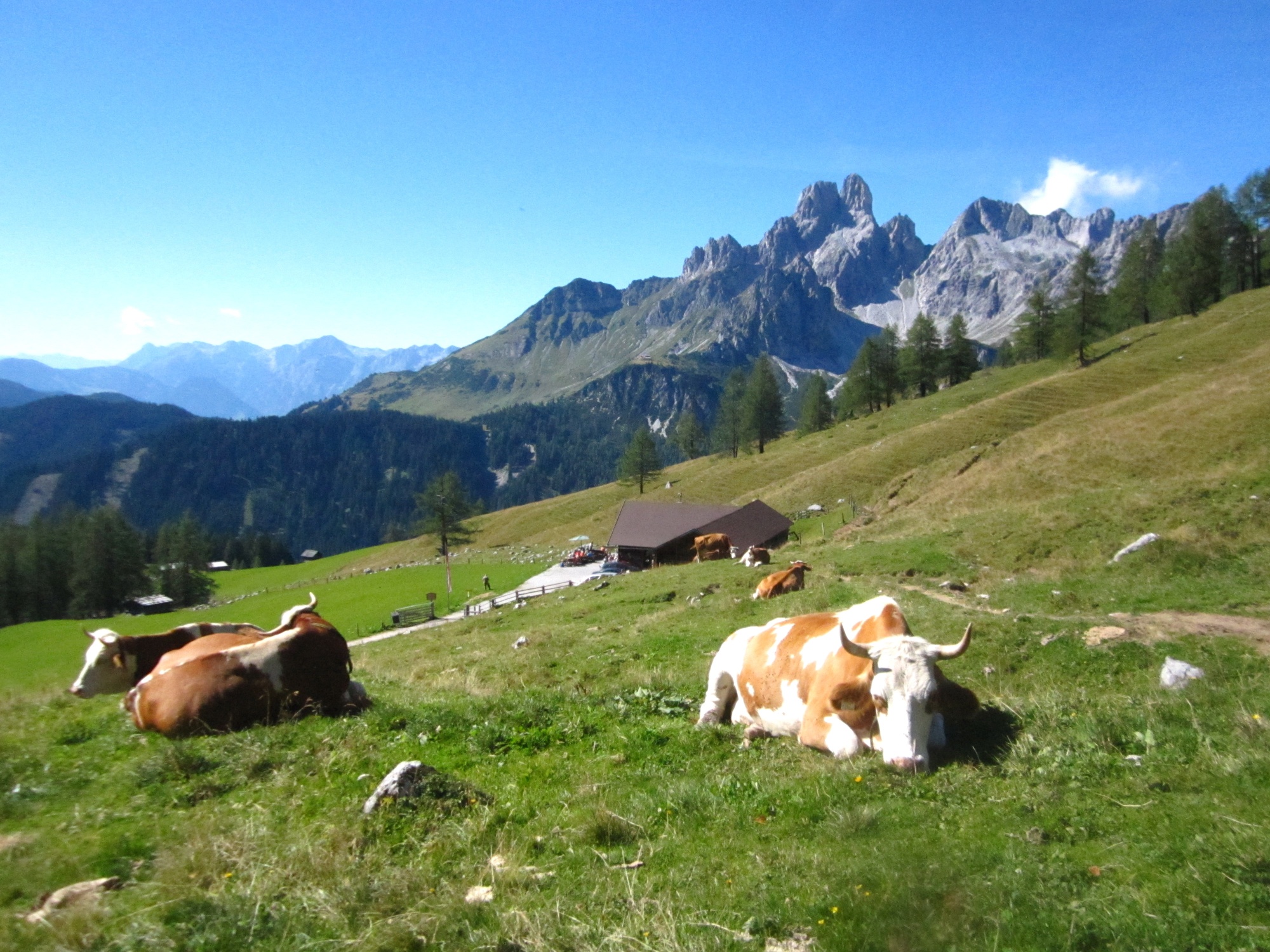
The long but extremely enjoyable hike leads along the foot of the steeply rising Rettenstein and crosses the most beautiful alpine pasture areas in Filzmoos.
The fertile alpine soils around the distinctive Rettenstein stand in stark contrast to this steeply rising rock block, which is also called Rötelstein due to its reddish coloring. The gentle Sulzenhals on the north side separates the Rettenstein from the neighboring Gosaukamm and Dachstein mountain ranges. Over this 1827 meter high saddle runs the path from Schaidlalm into the fairy-tale-like area of the Sulzenalm. With the attractive Bischofsmütze in the background, the Wallehen and Krahlehen huts there are not only popular photo motives but also come at exactly the right time as rest stops. About half of the hike is behind us, the second part downhill to Filzmoos now leads increasingly through the beautiful high forest.
Direct arrival and details at: salzburg-erfahren.at
difficult
4h 30min

12.86 km

A to B

Filzmoos

Seasons


Directions
From the Schaidlalm parking lot bus stop (junction to Bachlalm), the first approximately one-hour section generally follows the access road to Bachlalm (path 39). At the height of Schaidlalm, the path continues northwards straight through the sparse larch forest and after an uphill left loop reaches the Sulzenhals junction (1827 m). Path 638 leads from this highest point of the hike into the picturesque Sulzenalm area and first meets the Wallehen hut and 15 minutes later the Krahlehen hut (both operated). After a few meters on the alpine pasture access road, the signposted path to Filzmoos branches off to the left. Three equally long and equally attractive variants are available: via Wallehen (path 638), via Reithof (path 31 C), and via Leopichl (path 31 D). All routes deviate from the forest paths in the last half hour to paved farm access roads.
Information & contact
Mag. Christian Heugl
5400 Hallein
christian.heugl@gmail.com
Photo credit: Christian Heugl
By public transport
Fastest connection from Salzburg main station (E.-Weiß-Weg) with bus 270 to Eben P+R, with bus 521 to Filzmoos town center and with bus 8607 to Schaidlalm parking lot. Or get here with the hiking bus "Fidibus" www.filzmoos.at/de/aktivitaeten/filzmooser-wanderbus.html
Timetable information and download: online at www.salzburg-verkehr.at or on your smartphone via the free Salzburg Verkehr app for Android and iOS.
Direct arrival and details at: salzburg-erfahren.at
Route profile
All content has been researched by the editorial team to the best of their knowledge. However, the editorial team of Salzburger Verkehrsverbund GmbH cannot guarantee the completeness, accuracy, or timeliness of the information provided. We kindly ask you to verify the details when planning your trip, as opening hours, admission prices, or other information may change. Any liability claims against the editorial team or Salzburger Verkehrsverbund GmbH relating to material or non-material damages arising from the use of the information provided, or from the use of incorrect or incomplete information, are generally excluded.