
Family route from Arthurhaus via the Marmot Trail to the Mitterfeldalm
The fastest route to this destination
Family route from Arthurhaus via the Marmot Trail to the Mitterfeldalm
Beautiful circular hike from Arthurhaus via the Marmot Trail to the Mitterfeldalm: brilliant views, child-friendly paths, and as a highlight, the best nut sticks in the Salzburg region.
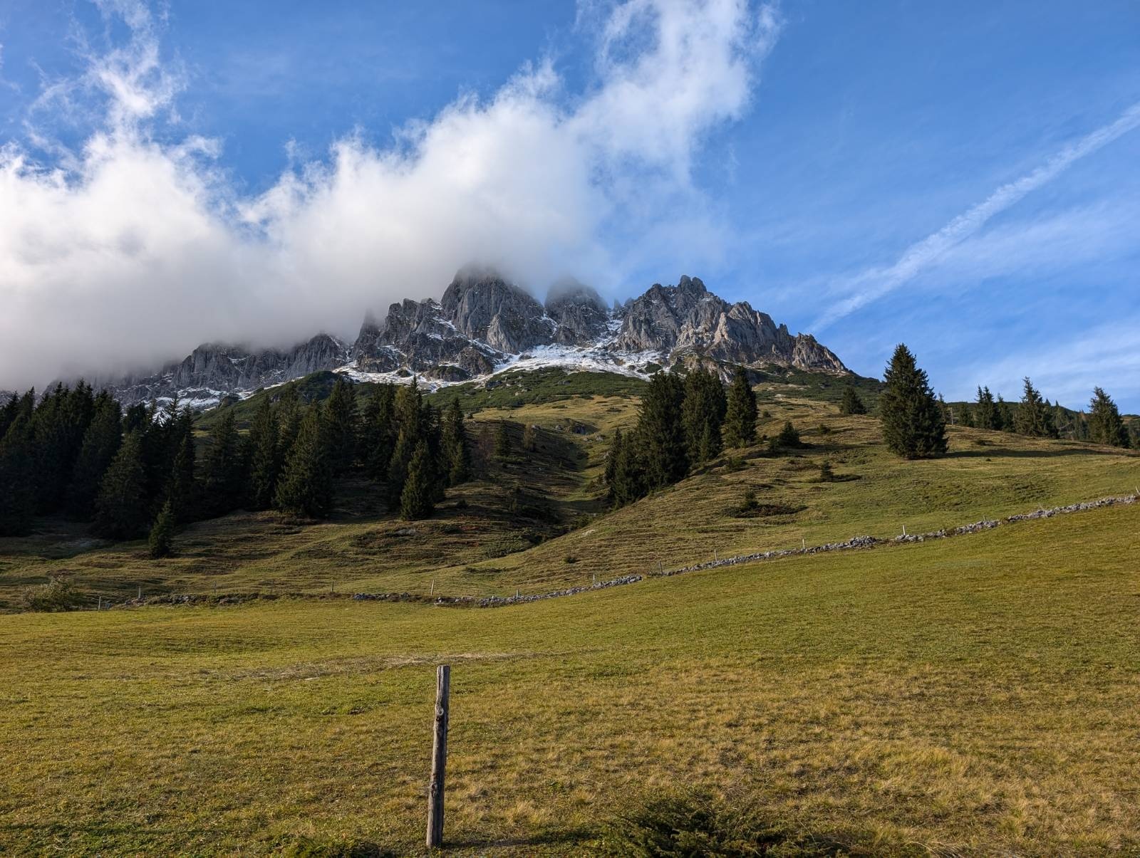
This varied circular route starts at Arthurhaus and leads via the popular Marmot Trail to the Mitterfeldalm. The path goes through wild mountain landscapes with dreamy views of the surrounding mountains and the impressive Mandl walls. On the Marmot Trail, young and old can experience the animals up close and even observe them with a bit of luck. After a moderate ascent via alpine hiking trails, you reach the idyllic Mitterfeldalm. Here, not only a cozy refreshment spot awaits but also probably the best nut sticks far and wide! The alm invites you to linger, and the view over the mountain panorama is breathtaking. After the refreshment, the circular trail leads back to the starting point.
moderate
1h 50min

4.83 km

Family-friendly

Stroller-friendly

Round trip

Muehlbach am Hochkoenig

Seasons


Directions
The starting point is Arthurhaus. From here, you head on well-marked, wide paths towards the Marmot Trail. The child-friendly path winds through alpine meadows and offers repeated opportunities to observe marmots in the wild. At the end of the path, the wide trail becomes a hiking path, which with increasing incline turns more and more into a narrow trail. After the brisk ascent, you are rewarded with a sensational 300° panorama at the Mitterfeldalm. The return path is easy and leads back along a well-developed gravel path with a gentle downhill slope.
Information & contact
Thomas Grah & Kristina Karl
5061 Elsbethen
IG: @adventuremo.de
FB: @adventuremo
Blog: www.adventuremo.de
Photo credit: Thomas Grah & Kristina Karl
By public transport
Arrival with buses of line 590 from Bischofshofen station to Mühlbach and from there with the hiking bus 593 onwards to Arthurhaus. Please check whether the hiking bus is running - it is offered from early May to early November.
Timetable information and downloads: Online at www.salzburg-verkehr.at or on your smartphone via the free Salzburg Verkehr app for Android and iOS.
Safety information
After heavy rain, waterproof shoes should definitely be worn, as the path can be quite wet and muddy in places. Trekking poles can be especially helpful for the ascent.Route profile
All content has been researched by the editorial team to the best of their knowledge. However, the editorial team of Salzburger Verkehrsverbund GmbH cannot guarantee the completeness, accuracy, or timeliness of the information provided. We kindly ask you to verify the details when planning your trip, as opening hours, admission prices, or other information may change. Any liability claims against the editorial team or Salzburger Verkehrsverbund GmbH relating to material or non-material damages arising from the use of the information provided, or from the use of incorrect or incomplete information, are generally excluded.