
From Thalgau over Wartenfels to Fuschl
The fastest route to this destination
From Thalgau over Wartenfels to Fuschl
THE PATH FROM THALGAU TO THE RUIN OF WARTENFELS AND FURTHER TO THE TOWN OF FUSCHL LEADS OVER A GENTLE ELEVATION. IF YOU PREFER IT MORE CHALLENGING, TAKE THE STEEP DETOUR VIA THE SCHOBER.
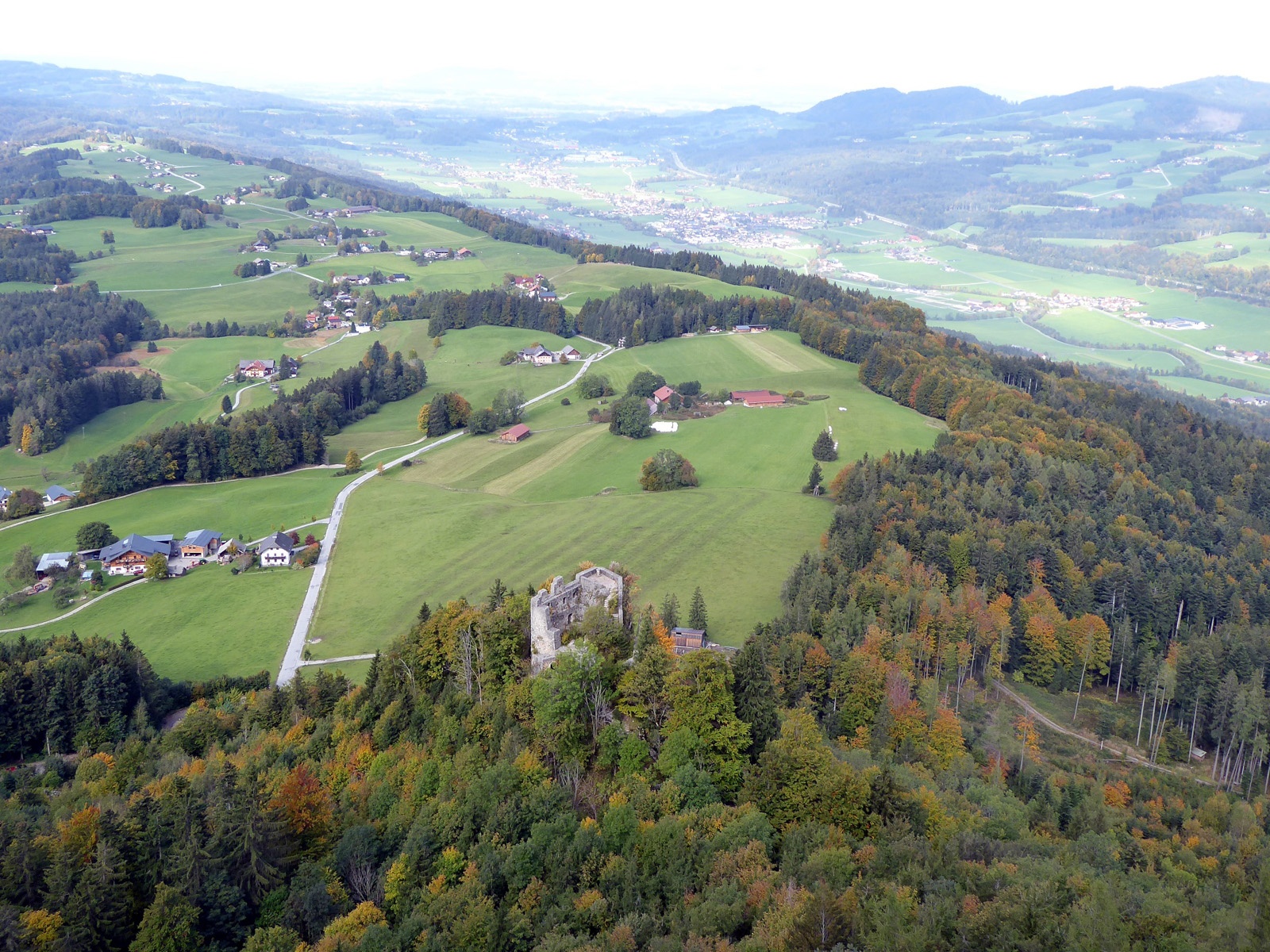
The orientation is easy: From the starting point in Thalgau, the striking Schober immediately draws attention. The rock ridge belongs to the Tyrolean Cover, which is responsible for prominent mountains such as Hochstaufen, Nockstein, or Traunstein and closes the Northern Limestone Alps along this line. However challenging the last 300 meters in elevation to the Schober are, the solitary path there is harmonious and opens numerous lasting landscape impressions. Also wonderful is the view from the easily accessible, historic ruin of Wartenfels back towards Thalgau. Until 1564, the castle was the seat of the caretaker; with the construction of the new courthouse in Thalgau, its decline began. It is definitely worth seeing before the path leads directly, or for sure-footed hikers via the Schober, down to the romantic Lake Fuschl.
Direct access and details at: salzburg-erfahren.at
moderate
3h 0min

9.00 km

Family-friendly

A to B

Thalgau

Seasons


Directions
From the Thalgau town center bus stop, the path leads past the church, turns right before the Spar market onto Fuschlerstraße, crosses the bridge after 400 m, and then follows the signage on the left for "Ruin Wartenfels, Schober. Path 18." The Schober with its striking rock formation appears immediately; the route 18 leading there initially follows the access road (Wartenfelserstraße) and then ascends more steeply through the forest on a service road after the last houses. After this first steep stage, the terrain opens again; the sunny path turns left before a chapel, shortly after turns right, and merges into the 2 km long access road "Wartenfels." After a total of 2 hours, reaching the inn at the end of the road, the 15-minute climb to the ruin of Wartenfels is a very recommendable enjoyment, while the equally possible one-and-a-half-hour crossing of the Schober (1,328 m) must be described as difficult and demanding. With or without summit—the one-hour descent to Fuschl follows path 10 past the golf course and the Waldhofalm. The lakeside promenade in Fuschl offers lovely places to rest and eat before the hike ends at the Fuschl town center bus stop opposite the parish church.
Information & contact
www.thalgau-tourismus.at; www.fuschlsee.salzkammergut.at
Mag. Christian Heugl
5400 Hallein
Photo credit: Christian Heugl
By public transport
By bus 140 from Salzburg central station (Suedtiroler Platz) to Thalgau town center. Return by bus 150 from Fuschl town center to Salzburg central station (Suedtiroler Platz).
Timetable information and download: Online at www.salzburg-verkehr.at or on your smartphone via the free Salzburg Verkehr app for Android and iOS.
Direct access and details at: salzburg-erfahren.at
Route profile
All content has been researched by the editorial team to the best of their knowledge. However, the editorial team of Salzburger Verkehrsverbund GmbH cannot guarantee the completeness, accuracy, or timeliness of the information provided. We kindly ask you to verify the details when planning your trip, as opening hours, admission prices, or other information may change. Any liability claims against the editorial team or Salzburger Verkehrsverbund GmbH relating to material or non-material damages arising from the use of the information provided, or from the use of incorrect or incomplete information, are generally excluded.