


Gennerhorn Gruberhorn Regenspitz
The fastest route to this destination
Gennerhorn Gruberhorn Regenspitz
A pleasure route for endurance and sure-footed hikers between idyllic alpine pastures and rocky ridges
From Lämmerbach, the route initially goes easily to Genneralm, a saddle between Gennerhorn and Holzeck. Several huts invite you to stop there.
Direct access and details at: salzburg-erfahren.at
difficult
7h 0min

14.17 km

A to B

Hintersee

Seasons


Directions
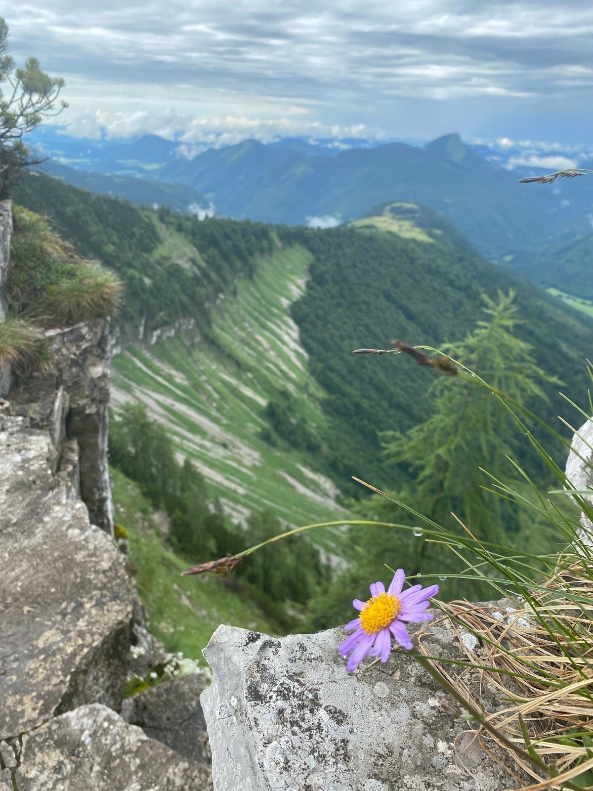
Via the forest road or the old alpine path to Genneralm. There you can replenish your strength at some alpine huts. The signposting towards Gennerhorn is not so easy to find. Steeply upwards over scree and grassy slopes, before the summit there are first exposed sections. The descent, surrounded by many mountain pines, is unpleasant when wet. At the saddle, there is the option to turn back and return to Genneralm. Further, partly exposed, to Gruberhorn. There, the path initially leads steeply down the mountain pine-lined ridge, the further way to Regenspitz is technically not difficult but does not allow any misstep on the exposed bands. From Regenspitz over the partly exposed northern ridge to the increasingly flatter alpine terrain of Feichtensteinalm, which invites you to stop. Those who want can also make a detour to Feichtenstein; the view of Hintersee is worth it. Descent via the forest road to Hintersee to the bus stop.
Information & contact
Theresa Schilling
5020 Salzburg
theresaschilling@googlemail.com
Image credit: Theresa Schilling, Per Oftedal
By public transport
Take bus 155 to Faistenau, then change to bus 157 to Lämmerbach (connection), runs hourly
Start: Hintersee Lämmerbach
Destination: Hintersee village center
Timetable information and download: Online at www.salzburg-verkehr.at or on your smartphone via the free Salzburg Verkehr app for Android and iOS.
Direct access and details at: salzburg-erfahren.at
Safety information
Sure-footedness and a head for heights required, caution, very unpleasant to dangerous when wetRoute profile
All content has been researched by the editorial team to the best of their knowledge. However, the editorial team of Salzburger Verkehrsverbund GmbH cannot guarantee the completeness, accuracy, or timeliness of the information provided. We kindly ask you to verify the details when planning your trip, as opening hours, admission prices, or other information may change. Any liability claims against the editorial team or Salzburger Verkehrsverbund GmbH relating to material or non-material damages arising from the use of the information provided, or from the use of incorrect or incomplete information, are generally excluded.