


Hochplatten loop high above Bayerisch Gmain
The fastest route to this destination
Hochplatten loop high above Bayerisch Gmain
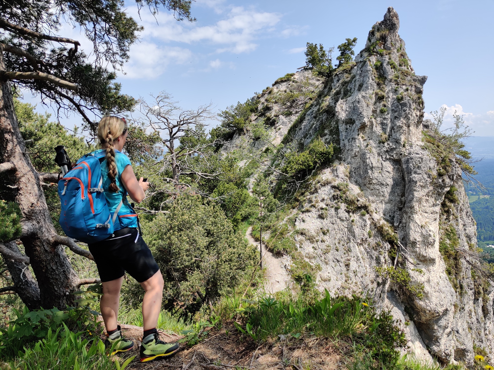
The small peaks in the Lattengebirge are as charming as the large ones and are perfect for a half-day route. The Hochplatte offers narrow forest paths, a beautiful view, and a cool descent into the Speik Gorge.
On the lonely ascent through the forest, you can repeatedly enjoy great views into the Lattengebirge and the Reichenhaller basin. Even those who skip the short climb on the exposed rock spires of the Lattenbergstoa will experience a wonderful route with the Bavarian neighbors here. During the descent through the Speik Gorge, you can also refresh yourself in the water of the Weißbach.
moderate
3h 30min

7.65 km

Round trip

Bavarian Gmain

Seasons


Directions
At the bus stop, first cross the street and head south through the underpass. At Lattenbergstraße, directly turn left, climb the steps, and take the narrow path next to the railway tracks. After the rehab center, turn right and follow Alpentalstraße to the Alpgarten hiking parking lot. Various hikes are signposted here. Follow the Hochplatten loop, cross the winter toboggan run to the left, and continue keeping left along the narrow steep path up through the forest. After about an hour, you reach a viewing platform from where the view extends to Bad Reichenhall and the Staufen. The circular route then continues southeast to the Hochplatte (911 m). After a short descent, continue uphill south towards the Lattenbergstoa. The rugged rock spire is quite exposed, requires a short climb, and should only be climbed if you are surefooted and not afraid of heights. Back at the junction, the path now leads left down into the Speik Gorge. When crossing the stream, walk a bit further right into the ditch – the view is worth it. Descend on the other side of the Weißbach to the corn path. The forest road now leads back beside the railway tracks to the hiking parking lot. Then return the same way as the ascent to the bus stop in the town.
Information & contact
Information & Contact
Stefanie Ruep
5020 Salzburg
stefanie.ruep@gmail.com
@stefitzka
Image credit: Stefanie Ruep
By public transport
Getting there: Bus 180 to (H) Bayrisch Gmain town center
Timetable information and download: Online at www.salzburg-verkehr.at or on your smartphone via the free Salzburg Verkehr app for Android and iOS.
Safety information
During the short climb on the rock spires of the Lattenbergstoa, absolute surefootedness and a head for heights are required.Route profile
All content has been researched by the editorial team to the best of their knowledge. However, the editorial team of Salzburger Verkehrsverbund GmbH cannot guarantee the completeness, accuracy, or timeliness of the information provided. We kindly ask you to verify the details when planning your trip, as opening hours, admission prices, or other information may change. Any liability claims against the editorial team or Salzburger Verkehrsverbund GmbH relating to material or non-material damages arising from the use of the information provided, or from the use of incorrect or incomplete information, are generally excluded.