


Lifeline Taugl in Bad Vigaun
The fastest route to this destination
Lifeline Taugl in Bad Vigaun
An exciting circular hike along the Taugl from the wide gravel field to the gorge-like narrowing at the Römerbrücke and back via the Tauglmauth.
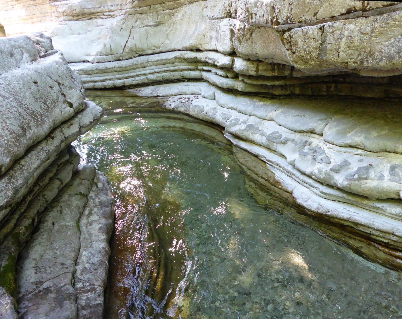
Depending on weather conditions and season, the wild river Taugl repeatedly causes surprises. After longer dry spells, the wide lower course appears completely dry, but the massive impact banks shortly before show that things can get really foamy and wild here. For a handful of life artists, these are exactly the right conditions. The river plover uses the dry period to lay eggs in the gravel, and special grasshopper species have also retreated here. These zones have a temporary access ban between April 1 and July 31. Nevertheless, there is enough to see along the paths. Good conditions for successful observation in the Natura 2000 wild river landscape Tauglgries are plenty of time, good binoculars, or the guided tours taking place during the summer season (meeting point Tourism Office Bad Vigaun. Information and registration at +43 (0)6245 84116, info@bad-vigaun.at or www.bad-vigaun.at).
easy
2h 0min

6.10 km

Family-friendly

Round trip

Bad Vigaun

Seasons


Directions
From the Bad Vigaun - Tauglmauth bus stop, the signposted path 6 leads in fifteen minutes first on a forest path then along the driveway through the motorway underpass to the start of the nature trail „Lifeline Taugl“. Past an original playground, it goes to a viewing platform, then the path narrows. The terrain with house-sized conglomerate rocks forces charming little detours. At the so-called Römerbrücke, which was only built in 1631, the path crosses to the other bank and follows, past the access points to the unique natural swimming area, the municipal road for 1 km to a fork. Path 6 turns right into Kullergasse, another fork follows after 300 m. Path 6 stays on Kullergasse, but much more attractive is the alternative route branching right, shown on maps but unfortunately no longer continuously marked, via Rehrlweg. This beautiful path passes left of the cluster of houses, crosses meadows and woods, and finally runs along the works premises of the company Haba-Beton back to the Tauglmauth bridge.
Information & contact
www.lebensader-taugl.at, www.tennengau.com, www.bad-vigaun.at
Mag. Christian Heugl
5400 Hallein
Photo credit: Christian Heugl
By public transport
By bus 170 from Salzburg Central Station (South Tyrolean Square) and bus 470 from Hallein station (west side) to Bad Vigaun Tauglmauth.
Timetable information and download: Online at www.salzburg-verkehr.at or on your smartphone via the free Salzburg Verkehr app for Android and iOS.
Route profile
All content has been researched by the editorial team to the best of their knowledge. However, the editorial team of Salzburger Verkehrsverbund GmbH cannot guarantee the completeness, accuracy, or timeliness of the information provided. We kindly ask you to verify the details when planning your trip, as opening hours, admission prices, or other information may change. Any liability claims against the editorial team or Salzburger Verkehrsverbund GmbH relating to material or non-material damages arising from the use of the information provided, or from the use of incorrect or incomplete information, are generally excluded.