


Ridge walk in Obertauern
The fastest route to this destination
Ridge walk in Obertauern
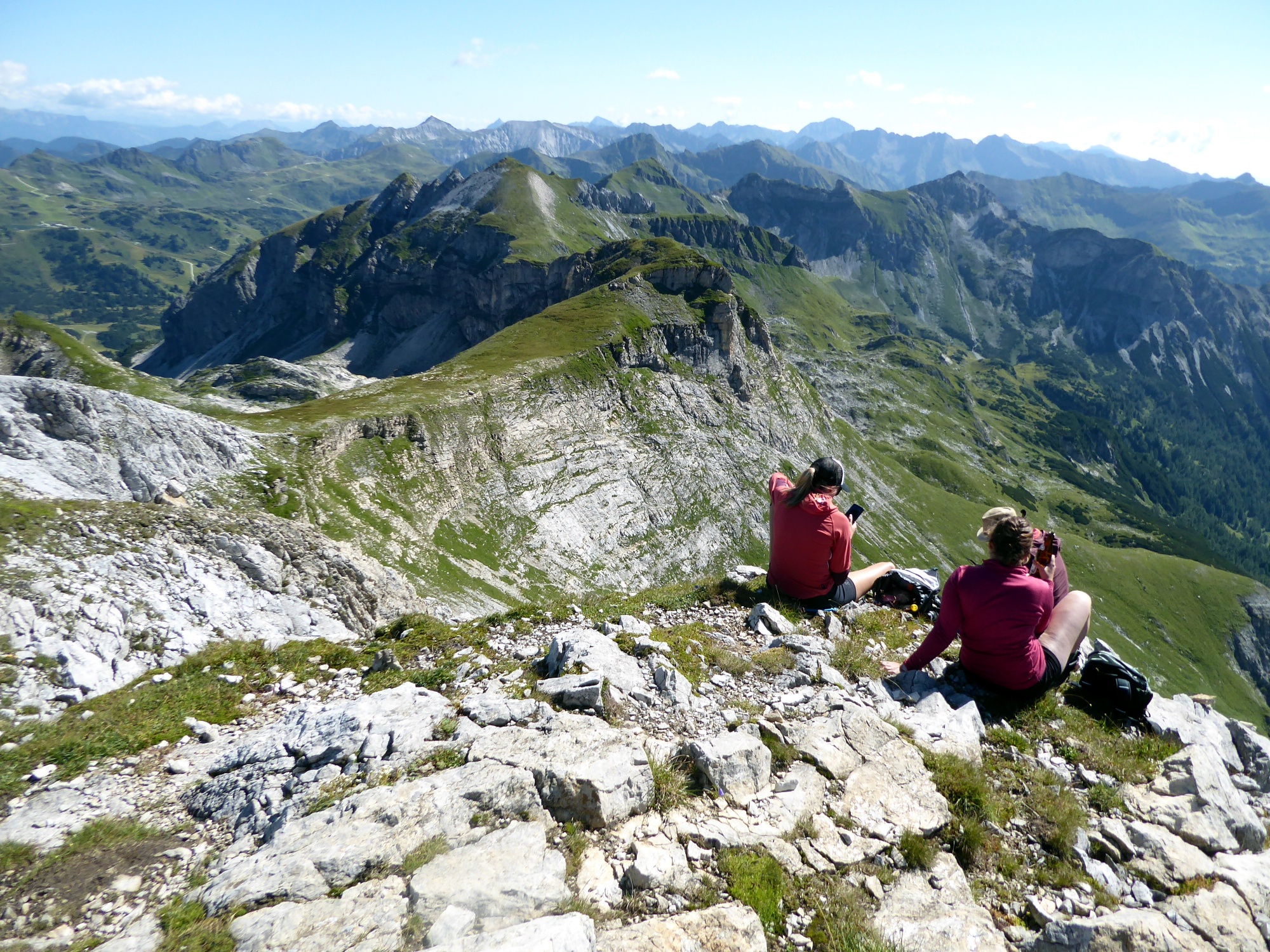
The solitary route from the pass summit in Obertauern over the challenging Zehnerkarspitze to the Glöcknerin first follows wide ski slopes, then steep rocky ridges.
There is no higher starting point than the one at the pass summit in Obertauern along the entire line 280. At 1,739 meters above sea level lies the bus stop, and exactly here begins the challenging route over the Zehnerkarspitze and the Glöcknerin to the Felseralm. The start of the crossing along the wide ski slope to the mountain station of the Zehnerkarbahn is basically the warm-up stretch; the following section to the Zehnerkarspitze (2,382 m) is the highlight. It requires light climbing skills, surefootedness, and a head for heights. This is followed by the surprisingly easy crossing to the Glöcknerin (2,433 m). This first section is lonely; much more traffic occurs on the descent to the Felseralm. No wonder, since this part also includes the picturesque Wildsee, which offers refreshing views especially on hot summer days.
difficult
5h 0min

11.01 km

A to B
Multi-day tour

Obertauern

Seasons


Directions
From the bus stop Obertauern pass summit, the route leads right past the Hotel Zehnerkar to the yellow trail signs at the edge of town, and the Zehnerkar lift mountain station (2,192 m) is the first goal after an hour of walking. A few meters above lies perhaps the most beautiful reservoir in the Salzburg ski area. Shortly before, the path that becomes noticeably steeper toward Zehnerkarspitze branches off to the right. After the challenging summit trail with light climbing passages, the descent on the grass-covered west side is almost child's play. The path bypasses the rocky Predigtstuhl (2,361 m) on the harmless south side but noticeably loses height. The descent from the Glöcknerin first follows the west ridge, then turns right at the saddle into the broad cirque and runs above the Wildsee to a fork. Turning left begins a steep, north-facing section through the larch forest, which ends shortly before the youth hotel Felseralm. Along the driveway, the bus stop Obertauern Felseralm is reached in 25 minutes.
Information & contact
Mag. Christian Heugl
5400 Hallein
christian.heugl@gmail.com
Image credit: Christian Heugl
By public transport
By train or bus to Radstadt station (forecourt). By bus 280 to Obertauern pass summit.
Return by bus 280 from Obertauern Felseralm.
Timetable information and download: Online at www.salzburg-verkehr.at or on your smartphone via the free Salzburg Verkehr app for Android and iOS.
Route profile
All content has been researched by the editorial team to the best of their knowledge. However, the editorial team of Salzburger Verkehrsverbund GmbH cannot guarantee the completeness, accuracy, or timeliness of the information provided. We kindly ask you to verify the details when planning your trip, as opening hours, admission prices, or other information may change. Any liability claims against the editorial team or Salzburger Verkehrsverbund GmbH relating to material or non-material damages arising from the use of the information provided, or from the use of incorrect or incomplete information, are generally excluded.