


Rossbrand high trail/hiking trail
The fastest route to this destination
Rossbrand high trail/hiking trail
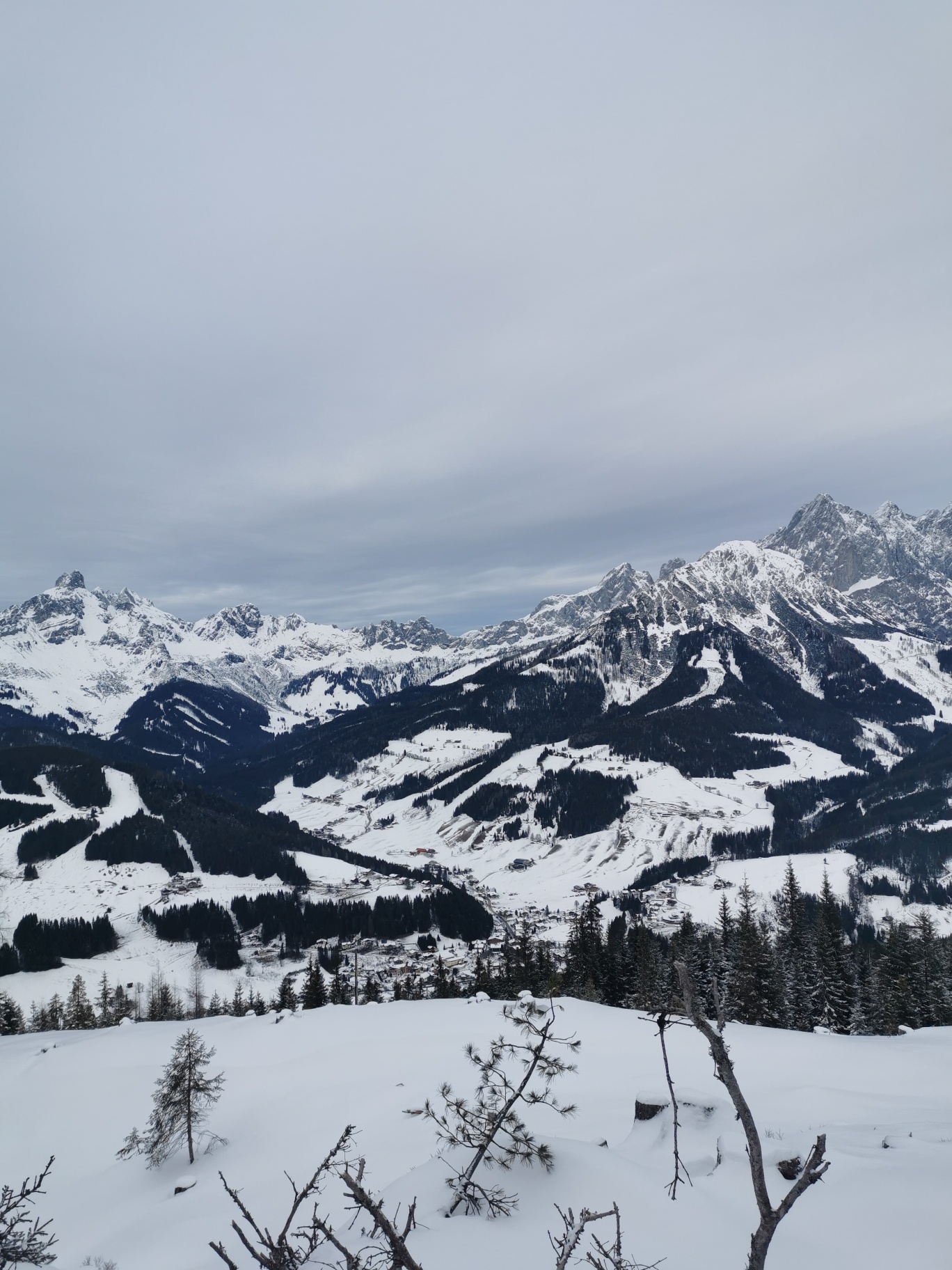
THE SAME HIKING TRAIL IS ALSO ACCESSIBLE IN SUMMER! On the Rossbrand high trail, a 16-kilometer long, excellently groomed cross-country and skating track makes every cross-country skier’s heart beat faster. Snowshoe hikers and walkers will be delighted by the romantic winter hiking trails. Up here, the 360-degree panorama, around 150 distinctive mountain peaks, and an unforgettable winter landscape are pure enjoyment. All those seeking silence and unspoiled nature will find their happiness at Rossbrand while cross-country skiing, ski touring, or snowshoe and winter hiking. The Rossbrand high trail can be reached in just 7 minutes from the village by using the Papageno gondola. At over 1600 meters above sea level, the Schörgi Alm and the Radstädter hut also ensure the physical well-being of our guests.
The Rossbrand high trail offers a 16-kilometer long, excellently prepared cross-country and skating track that especially excites cross-country skiers. Snowshoe hikers and walkers can fully enjoy the romantic winter hiking trails. The hiking trail runs along the track and also allows staying on a shorter section of 5 km instead of the entire 16 km route.
The trail is easy to walk and barrier-free, making it accessible to everyone – ideal for those seeking peace and unspoiled nature.
To reach the high trail, it is best to take the Papageno cable car, which reaches Rossbrand from the village in just 7 minutes. This ensures a relaxed ascent at over 1600 meters above sea level. There, the Schörgi Alm and the Radstädter hut invite you to enjoy a snack while admiring the magnificent panorama and to regain strength.
moderate
2h 30min

16.74 km

Family-friendly

Stroller-friendly

A to B

Filzmoos

Seasons


Directions
The same hiking trail is also accessible in summer! After ascending with the Papageno cable car, turn right along the trail and be careful not to disturb the athletes. The hiking trail is well signposted and easy to walk.
Information & contact
www.filzmoos.ski/winter/langlaufen/
Zsófia Gábor-Flaskay
flaskay.zsofia@gmail.com
Photo credit: Zsófia Gábor-Flaskay
By public transport
By train & bus to the Filzmoos Ortsmitte bus stop🚏
Coming from Salzburg, you can reach the Filzmoos Ortsmitte bus stop as follows: first take bus 270 to Eben P+R, then change at Eben P+R to bus 521 to the Filzmoos Ortsmitte bus stop.
Timetable information and download:
Online at www.salzburg-verkehr.at or on your smartphone via the free Salzburg Verkehr app for Android and iOS.
Route profile
All content has been researched by the editorial team to the best of their knowledge. However, the editorial team of Salzburger Verkehrsverbund GmbH cannot guarantee the completeness, accuracy, or timeliness of the information provided. We kindly ask you to verify the details when planning your trip, as opening hours, admission prices, or other information may change. Any liability claims against the editorial team or Salzburger Verkehrsverbund GmbH relating to material or non-material damages arising from the use of the information provided, or from the use of incorrect or incomplete information, are generally excluded.