


Ski tour to the Loibersbacher Höhe (Faistenau)
The fastest route to this destination
Ski tour to the Loibersbacher Höhe (Faistenau)
The Loibersbacher Höhe is a popular destination easily accessible from two sides. You can quite safely expect a track for ascending.
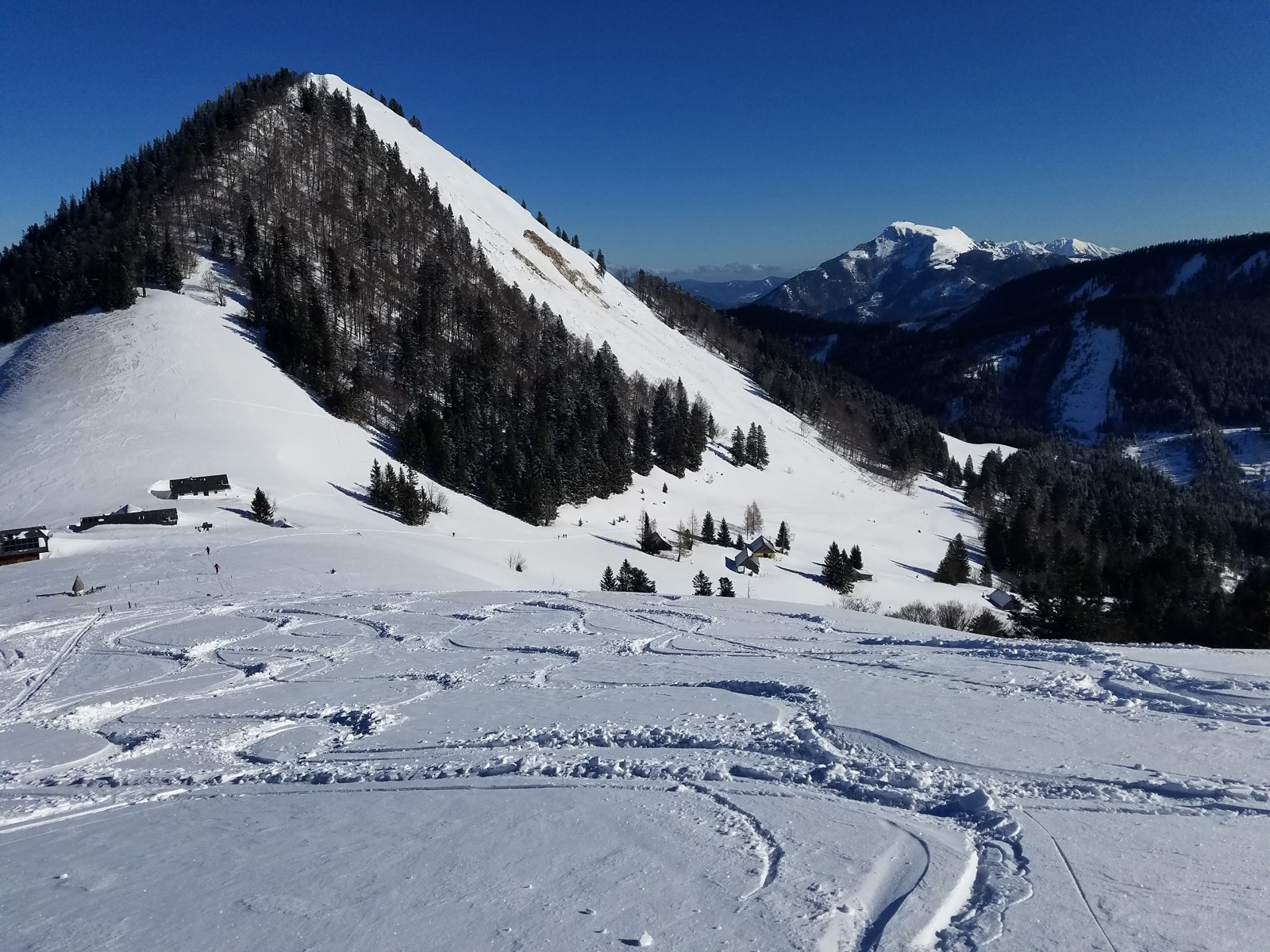
Since the 2022 timetable change, the Faistenau district Tiefbrunnau is perfectly accessible by the hourly regional bus 155. The romantic Tiefbrunnau is especially well known among cross-country skiers. Up to here runs the longest branch of the extensively branched Faistenau trail network. But many snowshoers and sledders also gather in Tiefbrunnau at the Keflau car park. Their destination: the former Schafbachalm (1036 m), to which the toboggan run along the three-kilometre access road is usually prepared. Depending on mood and conditions, snowshoers also hike one level higher to Lanznalm or even to the Loibersbacher Höhe (1456 m). Ski tourers are also drawn here by a comfortable, almost always tracked ascent.
moderate
2h 35min

10.63 km

Family-friendly

Out and back

Faistenau

Seasons


Directions
From the Keflaubrücke bus stop, follow the Schafbachstraße branching off opposite for 700 m to the car park at the start of the closed toboggan run. Toboggans are available here for a fee to rent, the toboggan run simply follows the 3 km long access road to the Hatzn- and Schafbachalm. Walking time 1 hour, 250 m ascent. However, ski tourers do not follow the toboggan run but turn off immediately at the beginning before the bridge to the left side of the ravine. The ascent meets a forest road. Now gently along this road (the Grögernalm junction is ignored) and then right over a forest path to the toboggan run. Shortly after the bridge, cross the initially gentle slope to the left, which then transitions into a steep clearing on the east foot of the Faistenau Schafberg. The track turns left (SW) and continues at the foot of the steep southern slope (caution with avalanche danger) to the gentle saddle between Faistenau Schafberg and Loibersbacher Höhe (left). Passing the alpine huts, the last quarter of an hour is orientation-wise simply along the moderately steep northern ridge to the Loibersbacher Höhe (1456 m). An interesting descent variant under safe conditions leads southeast along the right edge of the slope, then crosses left into the gentle hollow and continues flat or slightly ascending to the ascent track. In the final part, depending on snow conditions, stay along the ascent or on the toboggan run.
Information & contact
www.faistenau.at, ww.langlaufdorf.at
Mag. Christian Heugl
5400 Hallein
cheugl@a1.net
Image credit: Christian Heugl
By public transport
By regional bus 155 from Sbg Hbf Südtirolerplatz to Faistenau Mechaniker Wörndl and by bus 157 to Tiefbrunnau Keflaubrücke.
Timetable information and download: Online at www.salzburg-verkehr.at or on your smartphone via the free Salzburg Verkehr app for Android and iOS.
Route profile
All content has been researched by the editorial team to the best of their knowledge. However, the editorial team of Salzburger Verkehrsverbund GmbH cannot guarantee the completeness, accuracy, or timeliness of the information provided. We kindly ask you to verify the details when planning your trip, as opening hours, admission prices, or other information may change. Any liability claims against the editorial team or Salzburger Verkehrsverbund GmbH relating to material or non-material damages arising from the use of the information provided, or from the use of incorrect or incomplete information, are generally excluded.