

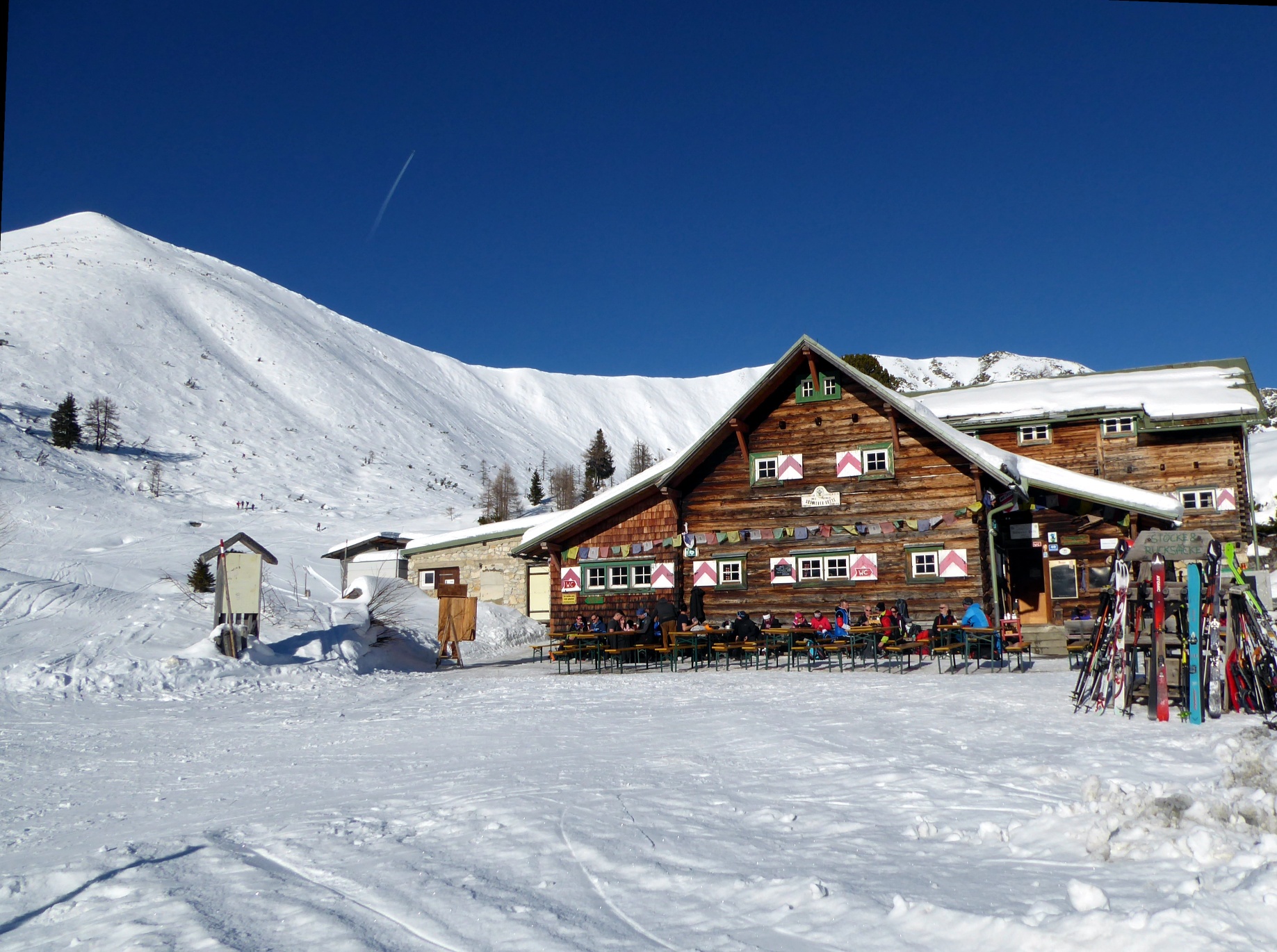

Südwiener Hut and Spirzinger in the Obertauern ski region
The fastest route to this destination
Südwiener Hut and Spirzinger in the Obertauern ski region
The Spirzinger (2,066 m) is the local mountain of the winter-operated Südwiener Hut. Under safe conditions, there is almost always a marked ascent trail to the summit.
Whether the ski tour ends at the Südwiener Hut (1,802 m) or 250 vertical meters higher on the Spirzinger depends on current avalanche conditions. Both destinations are certainly a great experience, as besides the phenomenal view from the Spirzinger, the luxury of a winter-operated shelter hut should not be underestimated. By the way, the Untertauern Gnadenalm stop is not only a popular address for tour enthusiasts but also for cross-country skiers. Less than ten minutes from the bus stop, a fantastic 19-kilometer-long network of cross-country ski trails begins, stretching from Vordergnadenalm to Hintergnadenalm. Winter hikers will also find numerous romantic snow paths with cozy huts to rest in this area.
Direct arrival and details at: salzburg-erfahren.at
easy
3h 0min

12.20 km

Out and back

Obertauern

Seasons


Directions
From the Untertauern Gnadenalm bus stop, it’s a 10-minute walk to the Gnadenalm. The first half hour from Vordergnadenalm to Hintergnadenalm follows more or less the nearly flat winter hiking trail, then the hut access road branches off to the right. The hut keeper ensures a firm surface with his Ski-Doo, as the service road also serves as a toboggan run. Between the many hairpin bends, shortcuts are often available, though in the shaded location they tend to be icy in early midwinter. After just under two hours and one last long bend, the sunny saddle opens with the very inviting “Süwi”. Under suitable conditions, the Spirzinger (2,066 m) in the background is no less enticing. If the avalanche situation allows, there is almost always a trail leading to the local mountain of the Südwiener Hut. It follows the southeast flank, which becomes increasingly steep towards the end. The descent generally follows the ascent route.
Information & contact
www.gnadenalm.com/langlaufen/loipe;
www.obertauern.com/winterurlaub-oesterreich/skitouren;
Mag. Christian Heugl
5400 Hallein
Image credit: Christian Heugl
By public transport
From Salzburg main station by train to Radstadt station. Then take bus 280 to the Untertauern Gnadenalm stop.
Timetable information and download: Online at www.salzburg-verkehr.at or via the free Salzburg Verkehr app for Android and iOS on your smartphone.
Direct arrival and details at: salzburg-erfahren.at
Safety information
Observe avalanche warning service! www.lawine.salzburg.atRoute profile
All content has been researched by the editorial team to the best of their knowledge. However, the editorial team of Salzburger Verkehrsverbund GmbH cannot guarantee the completeness, accuracy, or timeliness of the information provided. We kindly ask you to verify the details when planning your trip, as opening hours, admission prices, or other information may change. Any liability claims against the editorial team or Salzburger Verkehrsverbund GmbH relating to material or non-material damages arising from the use of the information provided, or from the use of incorrect or incomplete information, are generally excluded.