


The Great Ochsenhorn near Lofer
The fastest route to this destination
The Great Ochsenhorn near Lofer
Great rock route to the highest peak of the Loferer Steinberge
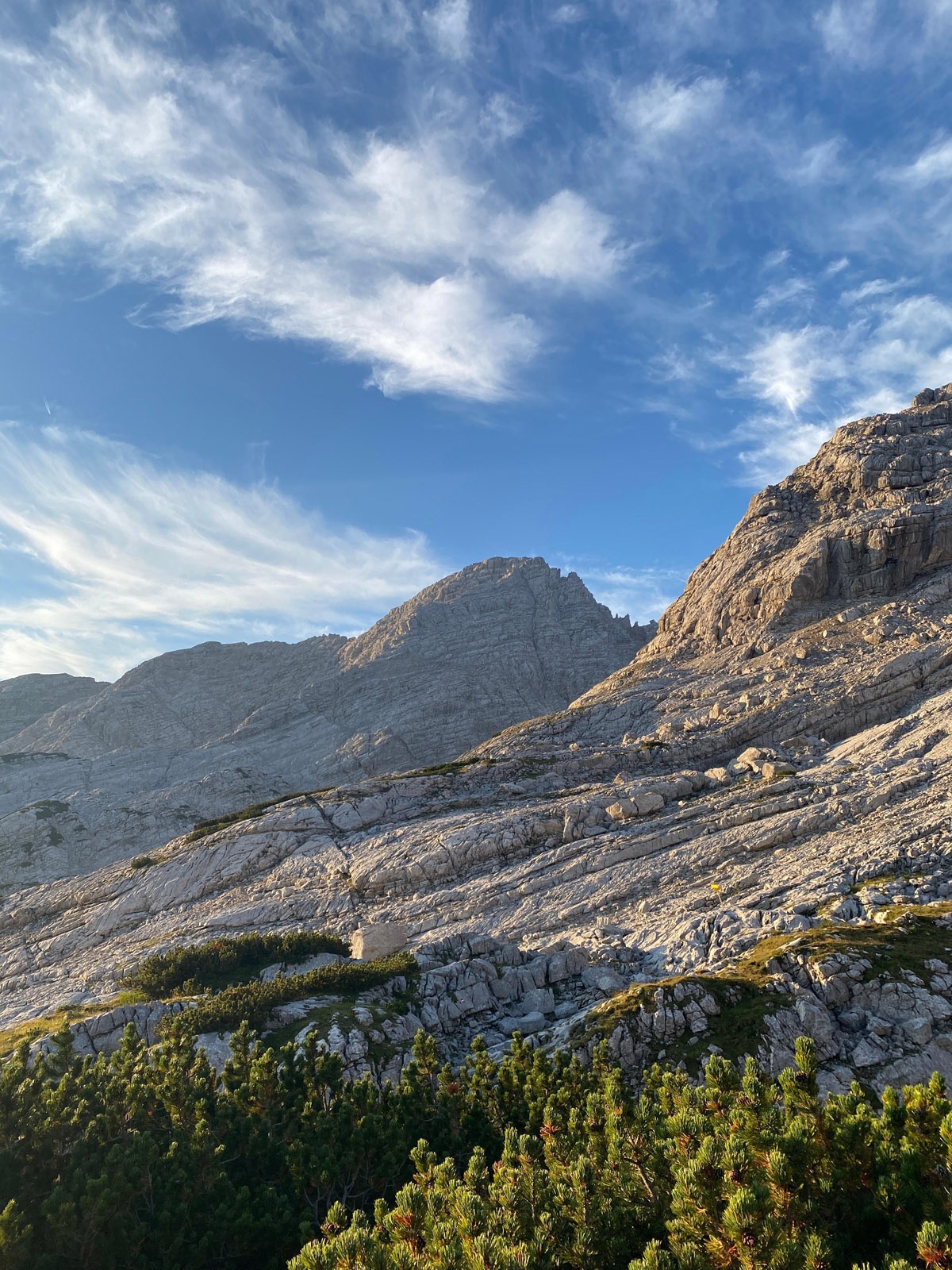
For lovers of great rock routes, the Loferer Steinberge offer several possibilities. The large plateau massif with steep edge cliffs and a wavy, karstified plateau with countless deep dolines is a treat for endurance and climbing-experienced hikers.
difficult
10h 0min

17.98 km

Out and back

Lofer

Seasons


Directions
From the bus stop on the road into the Loferer Hochtal, follow the path about 2 km slightly uphill to the parking lot. The Schmidt-Zabierow Hut is signposted there. Soon it becomes steeper in the forest, quickly gaining altitude and the view gets more beautiful. The path runs over steep and rocky alpine meadows to a signpost just below the Schmidt-Zabierow Hut. Now we follow the Schärdinger Steig heading east; the Great Ochsenhorn is always in view from here. The path runs below the Reifhorn peaks in heavily karstified terrain. After a small descent, a scree field (“kleine Wehrgrube”) is crossed. After a short climb, the Great Ochsenhorn is signposted. From here, it becomes significantly steeper and rockier. Hiking terrain and climbing terrain alternate, with the path always well marked. In a steep gully, there are brief grade I sections, always on solid rock. A steep, loose cirque just before the summit has been secured with a steel cable. A few short climbing sections (I and II) follow until you reach the summit cross with fantastic views. Descent is the same as ascent.
Information & contact
Theresa Schilling
5020 Salzburg
theresaschilling@googlemail.com
Photo credit: Theresa Schilling
By public transport
Take bus 260 to Lofer Mittelschule/ Tourismusverband, then transfer to bus 4012 to Lofer Hochtal
Timetable information and downloads: online at www.salzburg-verkehr.at or on your smartphone via the free Salzburg Verkehr app for Android and iOS.
Safety information
Climbing sections up to grade II, long sections grade I, sense of direction, surefootedness, and no fear of heights requiredRoute profile
All content has been researched by the editorial team to the best of their knowledge. However, the editorial team of Salzburger Verkehrsverbund GmbH cannot guarantee the completeness, accuracy, or timeliness of the information provided. We kindly ask you to verify the details when planning your trip, as opening hours, admission prices, or other information may change. Any liability claims against the editorial team or Salzburger Verkehrsverbund GmbH relating to material or non-material damages arising from the use of the information provided, or from the use of incorrect or incomplete information, are generally excluded.