


Through the Riedingtal to Mühlbach
The fastest route to this destination
Through the Riedingtal to Mühlbach
FOUR HUTS, TWO WATERFALLS, FORGOTTEN SKI JUMPING HILLS AND COPPER MINES AS WELL AS AN ABUNDANCE OF SUNSHINE AWAIT ON THE SOUTH SIDE OF THE HOCHKÖNIG.
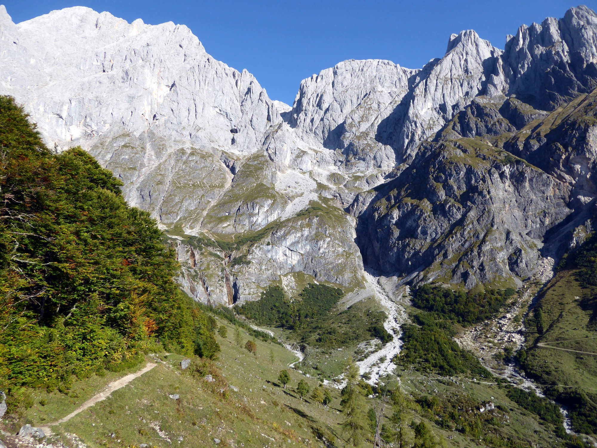
You can hardly find sunnier conditions! The path from the foothill of the mighty Birgkar over to the picturesque “Four Huts” below the Bratschenkopf, then the descent into the Riedingtal to the waterfalls and finally the last section past the Kopphütte to the village of Mühlbach is therefore best experienced late in the season when the soft autumn sun is especially welcome. A highlight are the two waterfalls in the Riedingtal, which, although not reached by a marked path, are easy to locate due to their distinctive position. Nearby was a ski jumping center designed by “Buwi” Pradl with three hills, which are now barely visible in the terrain. The hill record of 96.5 meters was set in 1982 by Ernst Vettori, shortly before the facility was closed. Mining in Mühlbach, the most important copper center of the Eastern Alps, was first discontinued around 300 BC, rediscovered by chance in 1827, before final closure in 1977.
easy
3h 30min

10.17 km

Family-friendly

A to B

Muehlbach am Hochkoenig

Seasons


Directions
The starting point is the stop “Mühlbach Trockenbach.” For a short section, trail 89 follows the asphalted private road that begins here, but soon the route switches to the forest road and reaches after a total of one hour the Molterauhütte as well as the neighboring Schartenhütte (1,535 m). The highest point of the hike below the mighty Bratschenkopf has thus already been passed, continuing along the ridge to the junction that leads slightly below to the left into the Riedingtal (trail 436). At the fork in the valley floor, an unmarked 20-minute detour leads to the unmistakable waterfalls up-valley into the Gamskarl, but the further descent runs down-valley past the barely visible ski jumping hills to the Kopphütte (1,307 m). At this alpine inn, trail 87 branches off to the left towards Mühlbach. Partly on narrow forest paths, partly on the forest roads used as toboggan runs in winter, the path leads through the beautiful beech forest to the Aldiana Hotel. Now either steeply uphill on the forest trail to the left or comfortably further on the toboggan run (trail 87a) in 20 minutes into the village. The Mühlbach town center stop is located opposite the tourist information office.
Information & contact
www.hochkoenig.at, www.molteraugut.at, www.kopphuette.at
Mag. Christian Heugl
5400 Hallein
Photo credit: Christian Heugl
By public transport
From Bischofshofen station (forecourt) by bus 590 to Mühlbach municipal office and by bus 593 to Mühlbach Trockenbach.
Return from Mühlbach town center by bus 590 to Bischofshofen station (forecourt).
Frequency: good service also on weekends. Hiking bus 593 runs until early November!
Timetable information and download: online at www.salzburg-verkehr.at or on your smartphone via the free Salzburg Verkehr app for Android and iOS.
Route profile
All content has been researched by the editorial team to the best of their knowledge. However, the editorial team of Salzburger Verkehrsverbund GmbH cannot guarantee the completeness, accuracy, or timeliness of the information provided. We kindly ask you to verify the details when planning your trip, as opening hours, admission prices, or other information may change. Any liability claims against the editorial team or Salzburger Verkehrsverbund GmbH relating to material or non-material damages arising from the use of the information provided, or from the use of incorrect or incomplete information, are generally excluded.