
From St. Gilgen via the Lärchenhütte to Tiefbrunnau
The fastest route to this destination
From St. Gilgen via the Lärchenhütte to Tiefbrunnau
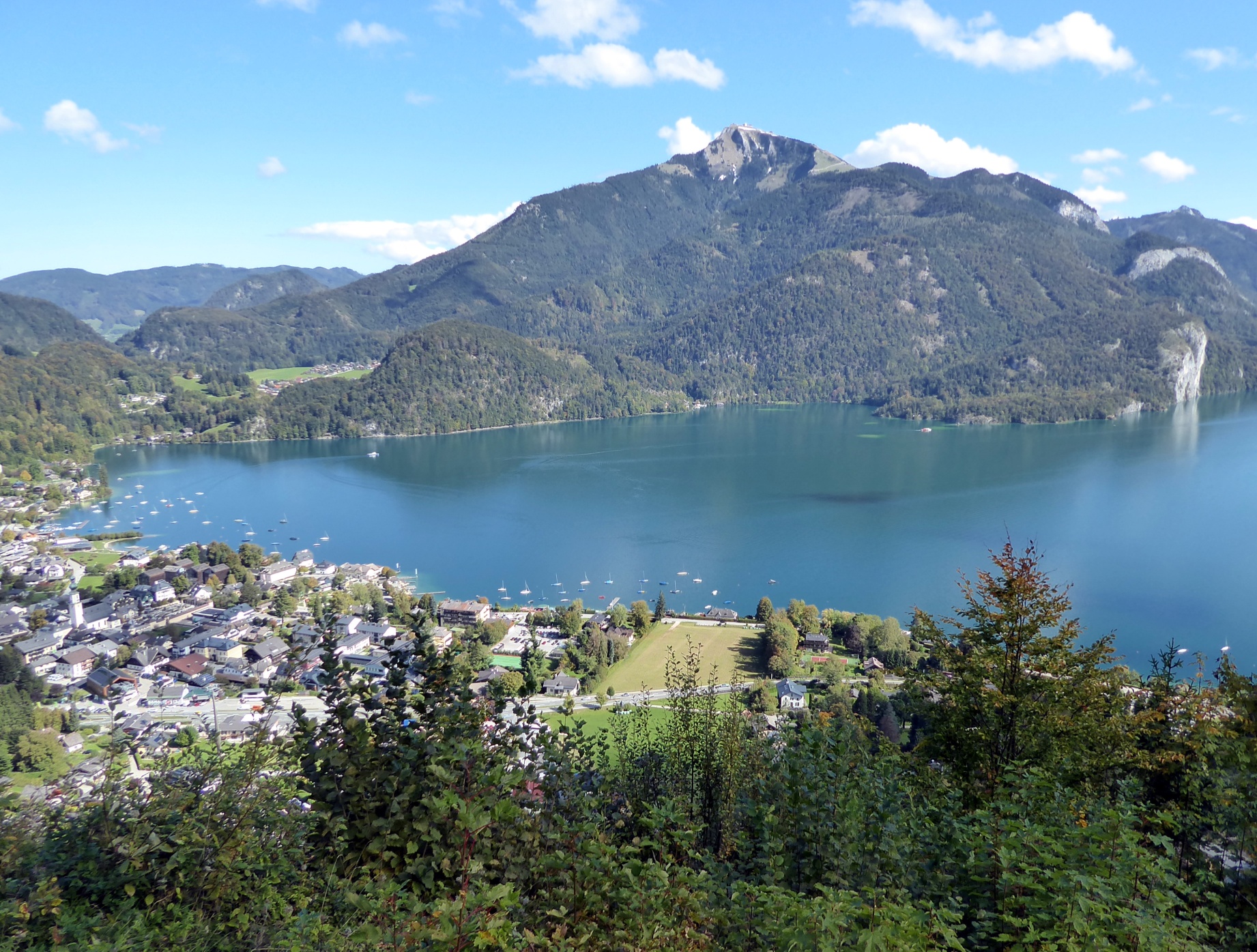
Many paths lead from St. Gilgen at Wolfgangsee to Tiefbrunnau. The most beautiful view and the best snack are offered by the route via the Lärchenhütte.
The steep first part from St. Gilgen to the Lärchenhütte runs along the cool north side of the Zwölferhorn, then the path becomes sunnier and offers better views. Those who want to avoid the climb entirely can also take the Zwölferhorn cable car, which in an airy short 11 minutes floats up to the lively summit (1,522 m) with the famous Seven Lakes view. From there, a 40-minute path leads down to the junction at the Lärchenhütte. For the descent to Tiefbrunnau, there is the choice between the secluded path via Kühleiten or the well-travelled standard route along the driveway.
Of course, the crossing can also be done in the opposite direction. Starting from Tiefbrunnau saves about 150 meters of ascent; its disadvantage is the steep north-facing descent.
moderate
2h 30min

5.63 km

Family-friendly

A to B
Multi-day tour

Region Wolfgangsee

Seasons


Directions
The starting point is the St. Gilgen bus station. The route leads under the Zwölferhorn cable car to the pedestrian crossing, crosses it, and then follows the signposting "Zwölferhorn, Sausteigalm" (path 855) turning left through the villa district uphill. Further up, route 855 splits into the forest path (left) and the farm road, which then meet again below the Weiβwand snack station (closed on Tuesdays). After a total of 1 1/4 hours, arriving at the Lärchenhütte (1,050 m) on the Zwölferhorn, the steep north ascent ends; the magnificent sun terrace at the highest point of the hike is the right place to relax. The descent towards Tiefbrunnau proceeds either by turning left along the gravel driveway or straight ahead on the secluded path 28 towards Kühleiten. Choosing the latter variant, after 30 minutes you reach the broad saddle Kühleiten; from there, the path follows the driveway to the left to the Tiefbrunnau car park. The next stop Tiefbrunnau Laimerbauer is located 1.5 km downhill on the right-hand side.
Information & contact
https://wolfgangsee.salzkammergut.at
Mag. Christian Heugl
5400 Hallein
christian.heugl@gmail.com
Photo credit: Christian Heugl
By public transport
By bus 150 from Salzburg main station (Südtiroler Platz) to St. Gilgen bus station.
Return from the Tiefbrunnau Laimerbauer stop with bus 157 (runs hourly Mon–Fri) to Faistenau Mechaniker Wörndl. By bus 155 to Salzburg main station.
Timetable inquiries and downloads: Online at www.salzburg-verkehr.at or on your smartphone via the free Salzburg Verkehr app for Android and iOS.
Route profile
All content has been researched by the editorial team to the best of their knowledge. However, the editorial team of Salzburger Verkehrsverbund GmbH cannot guarantee the completeness, accuracy, or timeliness of the information provided. We kindly ask you to verify the details when planning your trip, as opening hours, admission prices, or other information may change. Any liability claims against the editorial team or Salzburger Verkehrsverbund GmbH relating to material or non-material damages arising from the use of the information provided, or from the use of incorrect or incomplete information, are generally excluded.