
Ski tour Hohe Zinken and Osterhorn
The fastest route to this destination
Ski tour Hohe Zinken and Osterhorn
THE HOHE ZINKEN IS ONE OF THE SHOWPIECE DESTINATIONS IN THE OSTERHORN GROUP, THE NAMESAKE NEIGHBORING OSTERHORN REMAINS ALMOST UNNOTICED.
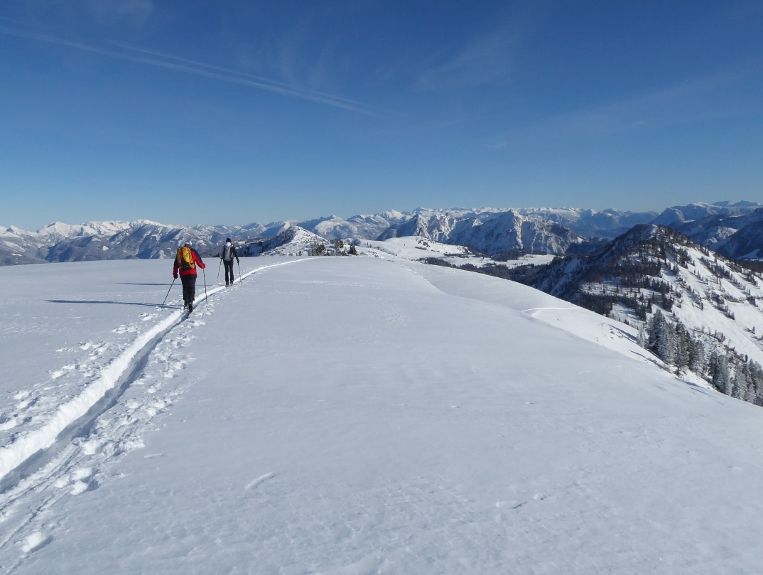
When snow conditions and weather are favorable, there is high activity in the otherwise quite remote valley end of Lämmerbach, 3 km south of the village of Hintersee. On weekends the large, fee-paying parking lot is often too small, but fortunately there is bus 157, which serves the Hintersee Lämmerbach stop every hour. The reason for the popularity is the many rewarding ski tours in the area around the Genneralm (1,295 m), which start in Lämmerbach. After the one-hour, forested initial section, the most beautiful mountains present themselves around the sunny alpine plateau: the Gennerhorn (1,735 m) to the west is the challenging one, the Hohe Zinken (1,764 m) to the east opposite it is the most visited, and the even further east adjoining Osterhorn (1,746 m) is the loneliest destination. Our ski tour leads to this rather insignificant peak to the east (= Osterhorn) via the Hohe Zinken, which alone is of course already a very rewarding destination.
Direct travel info and details at: salzburg-erfahren.at
moderate
4h 15min

16.36 km

Out and back

Hintersee

Seasons


Directions
From the Lämmerbach bus stop it is just a few minutes along the access road into the valley end (parking lot), then the ascent “Genneralm” begins first on the forest road and higher up as a shorter, also steeper variant via a branching trail. Shortly before the alpine huts, the two routes meet again. The Hohe Zinken already shows its attractive northwest slopes on the left; the trail to them branches off past the first hut eastwards (left). A slight drawback is the dip, which also requires re-skinning during the descent. After the open terrain, light forest begins, which becomes increasingly steeper. The last section before the summit cross at Hohe Zinken (1,764 m) brings open slopes again, which promise plenty of space for individual tracks on the descent. If you feel like it and have enough fitness for another 200 vertical meters, the overall roughly one-hour detour to the eastward Osterhorn could still be done beforehand. Navigationally simple, it goes along the ridge at first flat, then over a short ascent to the inconspicuous summit with the simple aluminum cross. The descent leads over the dwarf pine-covered southwest slopes into the cirque; after re-skinning, the ascent track goes northwest back onto the ridge and from there continues to Hohe Zinken. From Hohe Zinken, descent is the same as the ascent.
Information & contact
Mag. Christian Heugl
5400 Hallein
Photo credit: Christian Heugl
By public transport
From Salzburg main station (Südtiroler Platz) take bus 155 to Faistenau Schule, then bus 157 to Hintersee Lämmerbach.
Timetable information and download: Online at www.salzburg-verkehr.at or on your smartphone via the free Salzburg Verkehr app for Android and iOS.
Direct travel info and details at: salzburg-erfahren.at
Safety information
Information on weather and avalanche conditions at www.lawine.salzburg.atRoute profile
All content has been researched by the editorial team to the best of their knowledge. However, the editorial team of Salzburger Verkehrsverbund GmbH cannot guarantee the completeness, accuracy, or timeliness of the information provided. We kindly ask you to verify the details when planning your trip, as opening hours, admission prices, or other information may change. Any liability claims against the editorial team or Salzburger Verkehrsverbund GmbH relating to material or non-material damages arising from the use of the information provided, or from the use of incorrect or incomplete information, are generally excluded.