
The Kreuzkogel in Sportgastein
The fastest route to this destination
The Kreuzkogel in Sportgastein
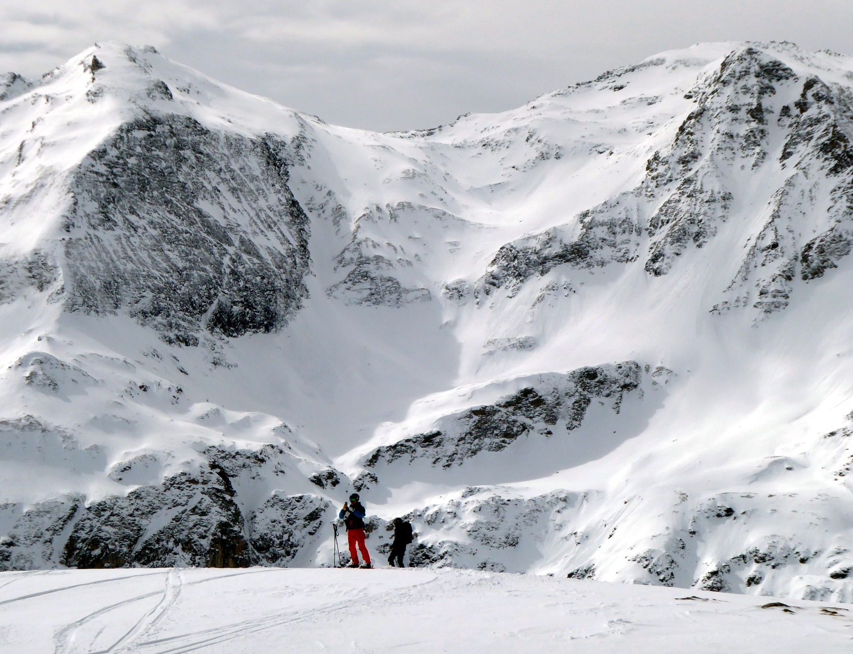
HALF PISTE ROUTE, HALF OFF-PISTE TERRAIN, WITH OR WITHOUT LIFT SUPPORT – THE SKI ROUTE ON THE KREUZKOGEL (2,686 m) ALLOWS MANY VARIANTS.
During the operating hours of the Sportgastein mountain railways, mostly until Easter, buses run almost every half hour from Bad Gastein station to the snow-sure winter sports area at just under 1,600 meters above sea level. The variety of different winter sports is enormous: kilometer-long winter hiking trails and cross-country ski runs back to the sunny Nassfeld are just as much a part of it as the large offering of pistes and ski routes. Ski tourers can choose between off-piste terrain and a prepared piste route. For the latter, a ski tourer ticket must be purchased (€15 as of 2023), which entitles the holder to ascend to the middle station of the Goldbergbahn. There the signposted piste route S 6 begins (2 hours, 700 m altitude difference, 3.3 km). Another option is the piste-adjacent ascent from the valley floor, which remains on the right, southern side of the ski area. The piste is not touched on this route; orientation is easy thanks to the signposted, unprepared freeride descent.
moderate
3h 0min

8.55 km

Out and back

Bad Gastein

Seasons


Directions
If the ski route ascent is made without cable car support, the trace passes the cable car valley station southwards towards Nassfeld, crosses the bridge and immediately then branches off to the right from the descent into the free terrain. The steep slope, interspersed with groups of trees, can be crossed in wide loops relatively sparingly, diagonally southwards. After 300 meters of altitude, the first steep section is past, and the basin-like terrain structure allows for easier trace setting. Here you meet the signposted descent "Skiroute 2", which is a good orientation aid thereafter. The ascent trace always remains close to the piste on the right side. After a breather in the gently rolling middle section, two steep cirques follow, which can either be climbed directly or, in uncertain conditions, bypassed by a left turn via the signposted piste route. From the mountain station, it is 5 minutes to the summit. Descent via the piste or via the freeride variants signposted as "Skiroute". Or, as a bonus for public transport users, but only in the best conditions, via the legendary north descent through unsecured terrain to the bus stop Böckstein Heilstollen, or below, Böckstein toll station.
Information & contact
Ski and bus operation in Sportgastein season 2022/23 until April 16 (Easter)!
Mag. Christian Heugl
5400 Hallein
Photo credit: Christian Heugl
By public transport
By train or bus to Bad Gastein station (forecourt) and by ski bus or bus 550 to Sportgastein Goldbergbahn. For the ski descent Kreuzkogel-North, return from the stop Böckstein Heilstollen or Böckstein toll station. Winter timetable to Sportgastein valid until Easter.
Timetable information and download: Online at www.salzburg-verkehr.at or on your smartphone via the free Salzburg Verkehr app for Android and iOS.
Safety information
Information on weather and avalanche situation at www.lawine.salzburg.at. Complete tour equipment.Route profile
All content has been researched by the editorial team to the best of their knowledge. However, the editorial team of Salzburger Verkehrsverbund GmbH cannot guarantee the completeness, accuracy, or timeliness of the information provided. We kindly ask you to verify the details when planning your trip, as opening hours, admission prices, or other information may change. Any liability claims against the editorial team or Salzburger Verkehrsverbund GmbH relating to material or non-material damages arising from the use of the information provided, or from the use of incorrect or incomplete information, are generally excluded.