
From Dienten to the Klingspitz
The fastest route to this destination
From Dienten to the Klingspitz
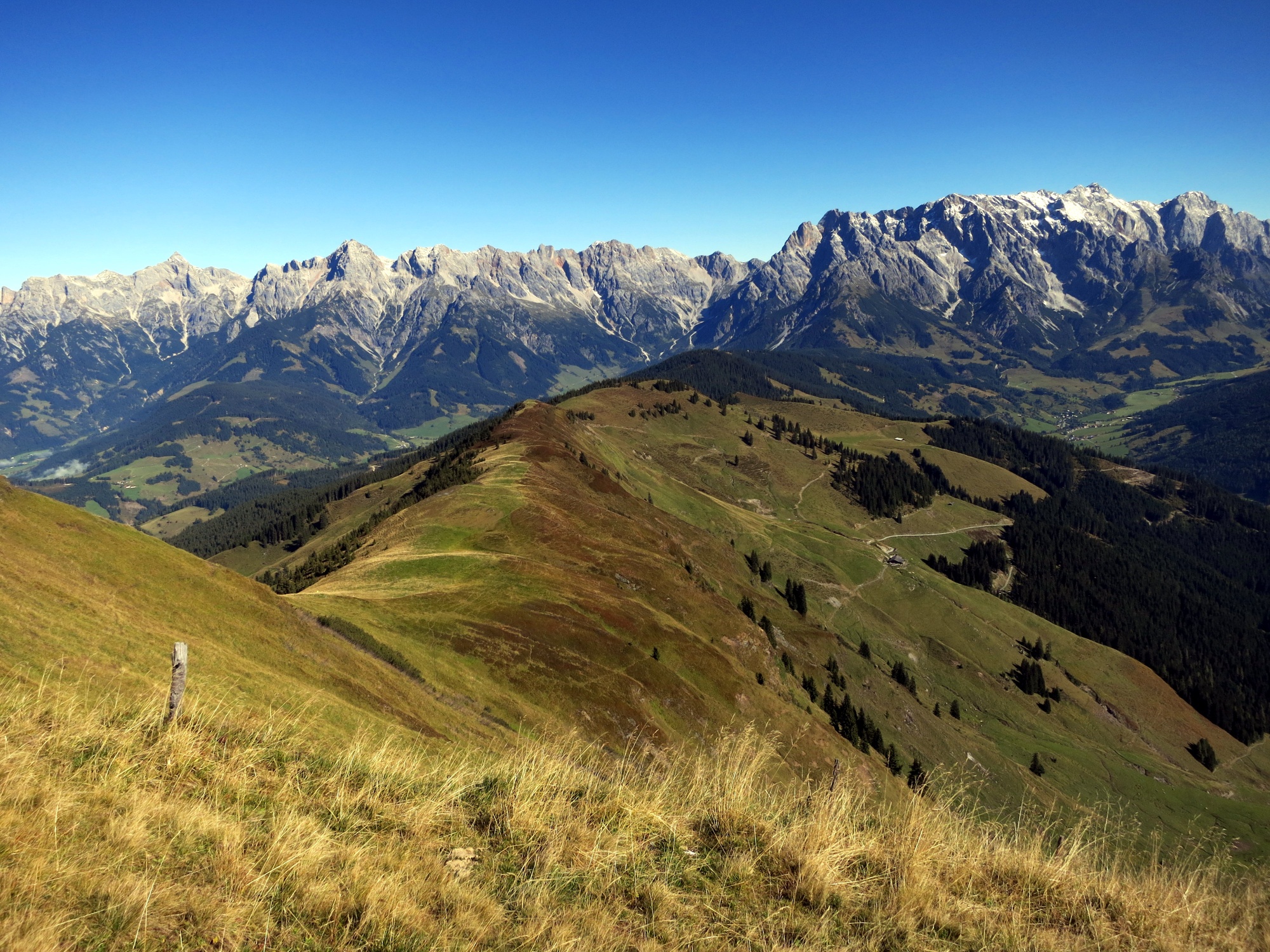
Increasingly scenic, the long route from the mountain village of Dienten leads over magnificent alpine meadows to the pyramid-shaped summit that makes the hiking heart sing.
The crossing from Dienten on the Hochkönig via the Klingspitz (1,988 m) is mostly in the sun, making it quite suitable for late summer or early autumn days. The path is not very difficult technically, but enough time should be planned for crossing the beautifully shaped mountain pyramid, as there is much to see along the way. Right at the start, the mountain church dedicated to St. Nicholas in 1505 invites for an atmospheric visit; shortly after, so does the generously redesigned Grünegg snack station (closed on Tuesdays), although under different conditions. It is also quite a highbrow place here, as the fine brandies presented in a display room have won many awards. Then it becomes quieter, but the summit panorama gets more extensive during the hike over the mountain ridge. At the end, the highest mountains of Austria stand lined up on the horizon.
difficult
5h 40min

14.49 km

A to B
Multi-day tour

Dienten am Hochkönig

Seasons


Directions
From the Dienten Pfarrhof stop, path 440 branches off to the right in front of the building that gives the place its name and reaches the plateau after a steep 15 minutes, where the picturesque church and the 500-year-old lime tree from the time of its origin stand. Path 440 stays right, then loses some altitude in the forest and leads directly onto the terrace of the neat snack station Grünegg. The further route to Lettenalm follows the forest road briefly, then branches off to the left and leads below the serviced Sommereralm (1,405 m) in a wide arc over to the private Lettenalm. After 20 minutes, path 440 continues toward Klingspitz to the right and leads over the Marbachhöhe to the summit in 2 hours. The descent follows the steep south ridge to the striking Hochkaser chapel (1,687 m). At this saddle, follow path 55 to the left and pass Rettenfeldalm either on the forest trail or the farm road down to the Dacheben service road. Follow this downstream to the state road to the Dientenbachtal Keilbrücke stop, which is located 200 meters further to the right.
Information & contact
www.hochkoenig.at/de/infrastruktur/dienten-tourismusverband-hochkoenig-infobuero-dienten.html
Mag. Christian Heugl
5400 Hallein
christian.heugl@gmail.com
Photo credit: Christian Heugl
By public transport
By train to Lend station (forecourt) and by bus 681 to Dienten Pfarrhof. Return from Dientenbachtal Keilbrücke with bus 681 to Lend station.
Hourly service, low frequency on Sundays and public holidays. Pay close attention to the timetable!
Timetable information and download: Online at www.salzburg-verkehr.at or on your smartphone via the free Salzburg Verkehr app for Android and iOS.
Route profile
All content has been researched by the editorial team to the best of their knowledge. However, the editorial team of Salzburger Verkehrsverbund GmbH cannot guarantee the completeness, accuracy, or timeliness of the information provided. We kindly ask you to verify the details when planning your trip, as opening hours, admission prices, or other information may change. Any liability claims against the editorial team or Salzburger Verkehrsverbund GmbH relating to material or non-material damages arising from the use of the information provided, or from the use of incorrect or incomplete information, are generally excluded.