
Through the Nockstein Gorge to Koppl
The fastest route to this destination
Through the Nockstein Gorge to Koppl
Temporarily closedA north-facing summer hike on the distinctive Nockstein, which continues over the eastern ridge to Koppl.
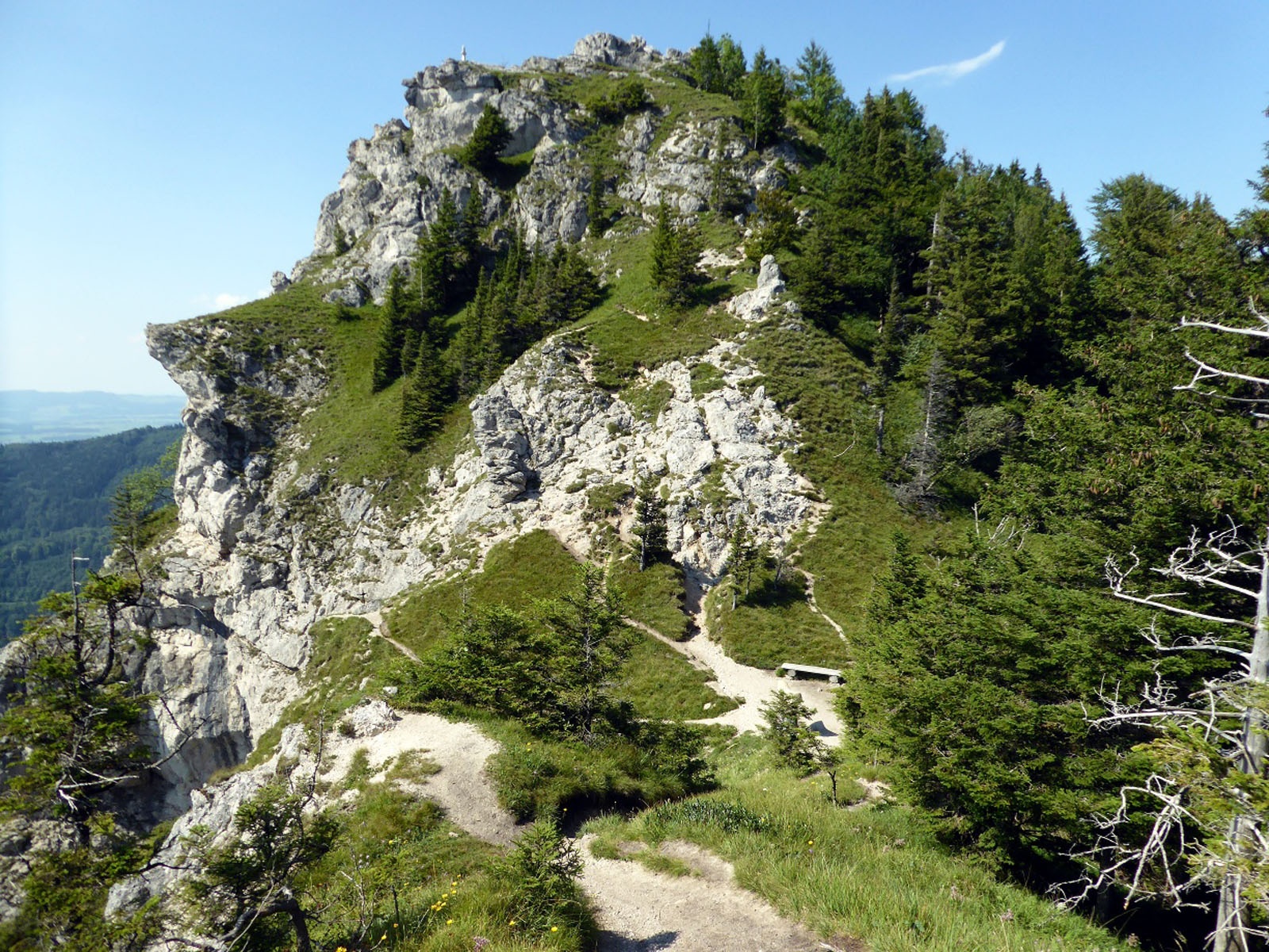
Ascents to the Nockstein (1,043 m) run from all directions, the most daring being the path starting in Guggenthal and leading through the Nockstein Gorge to the saddle below the summit. But even this trail is not dangerous; only the last quarter hour to the summit requires sure-footedness and a head for heights. If you don’t feel completely confident there, you can simply skip the narrow rock peak, as the further route over the eastern ridge to the Riedlwirt in Koppl leads to wonderful viewpoints as a replacement. This section was transformed several years ago into an original open-air gallery as part of an art project. What remains of the ephemeral artworks are only a colorful graffiti on an old barn and a huge boulder that lies like a sliced loaf of bread in the middle of the path. The many rock towers along the trail, bizarre artworks of nature, fit well with this project. Because the slender Nockstein stands out so prominently and is clearly visible from Salzburg’s old town, it already appears as an important landmark in the oldest Salzburg property documents from the 9th century.
easy
2h 30min

6.03 km

A to B

Koppl

Seasons


Directions
From the Guggenthal bus stop, the route leads a few meters back towards the city of Salzburg, then follows left along the Georg Weickl Way to the Kramer House (No. 20) and turns opposite into forest path 72 (Nockstein Gorge). Initially still on the wide path, the terrain soon becomes rockier and the trail narrower. A wooden staircase signals the end of the gorge; soon after follows a first scenic resting spot, which shortly afterward leads to the saddle adorned with a stone sculpture. The short summit ascent to the exposed cross (1,043 m) is rocky and steep but can also be skipped, as the return path to Koppl passes here again. This path 70 (additionally green sign "Riedlwirt") follows the loosely wooded ridge and at a chapel branches left to the Riedlwirt (temporarily closed). From here, either along the access road or traffic-calmed streets, a few meters to the left via Wagner Street and then right via Sperrweg to the Koppl Sperrbrücke bus stop.
Information & contact
Mag. Christian Heugl
5400 Hallein
cheugl@a1.net
Image credit: Christian Heugl
By public transport
From Salzburg main station (Südtiroler Platz) by bus 150 or 155 to Koppl Guggenthal stop.
Return from Koppl Sperrbrücke by bus 150 or 155. Quarter-hour intervals on weekdays, half-hour intervals on Sundays and public holidays!
Timetable information and download: Online at www.salzburg-verkehr.at or on your smartphone via the free Salzburg Verkehr app for Android and iOS.
Safety information
The last meters to the summit require sure-footedness and a head for heights.Route profile
All content has been researched by the editorial team to the best of their knowledge. However, the editorial team of Salzburger Verkehrsverbund GmbH cannot guarantee the completeness, accuracy, or timeliness of the information provided. We kindly ask you to verify the details when planning your trip, as opening hours, admission prices, or other information may change. Any liability claims against the editorial team or Salzburger Verkehrsverbund GmbH relating to material or non-material damages arising from the use of the information provided, or from the use of incorrect or incomplete information, are generally excluded.