
Circular routes in the Ainringer Moos
The fastest route to this destination
Circular routes in the Ainringer Moos
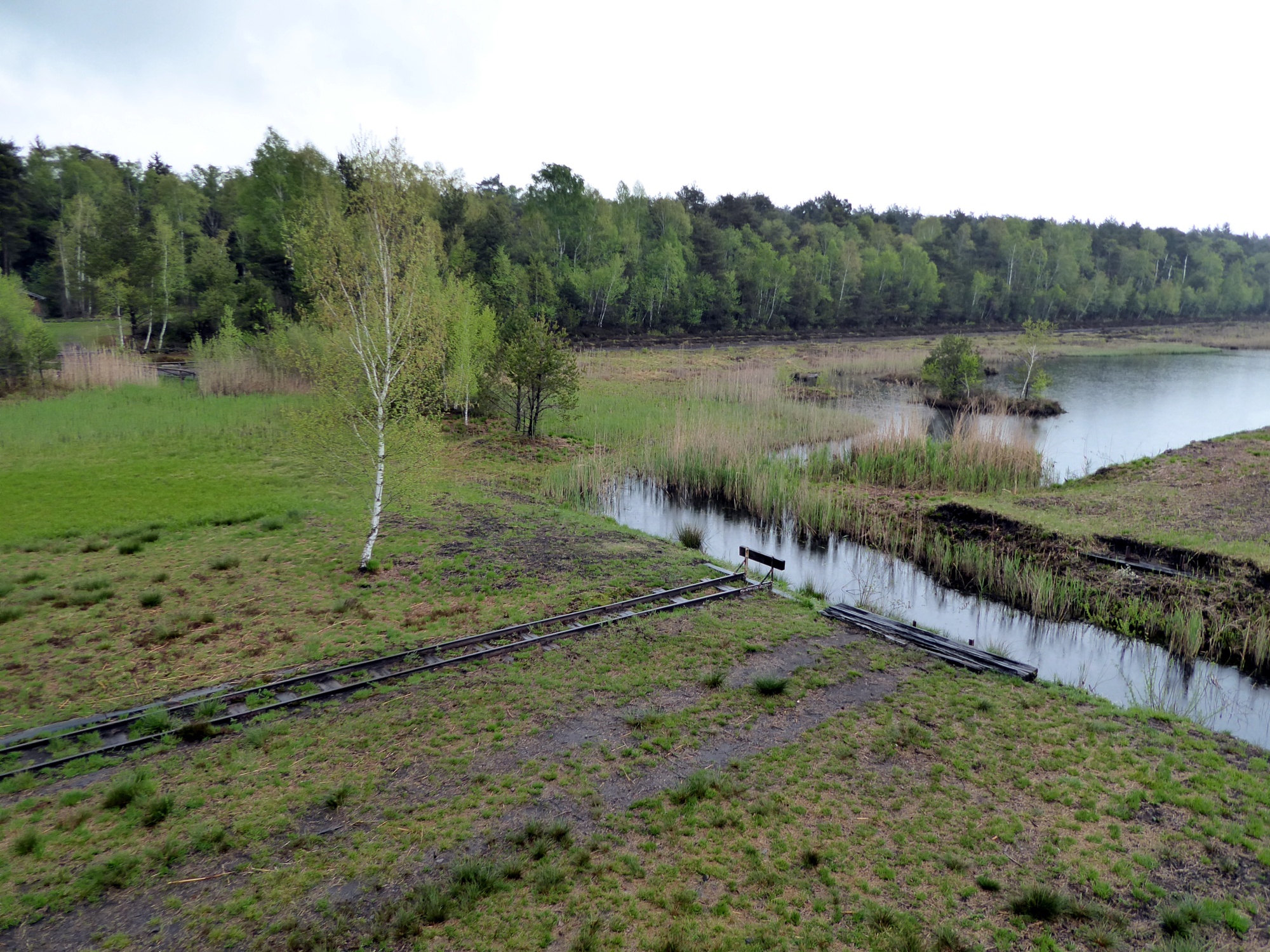
In the 20th century, the Ainringer Moos was intensively used for peat extraction; after renaturation, a fascinating natural jewel and bird paradise has emerged.
Bogs are not all the same. The fen has access to groundwater, the raised bog does not and grows steadily dome-shaped upwards. In Bavaria, raised bogs are called Filz and fens are called Moos. What all bogs have in common: although they store the climate-damaging carbon dioxide in large amounts, these soils belong to a highly endangered type. The Ainringer Moos is no exception; peat was still extracted here 20 years ago. Renaturation measures had already started on the 250-hectare site, but this valuable natural area has only really come into awareness in recent years. A particularly striking feature since 2020 is the new bog observatory near the peat station on the north side. Opposite it on the southeast side is another viewing platform offering the best views of the bog and birdlife. Two routes are available: the larger, almost 5-kilometer moor round around the entire bog area, or the smaller moor round (2.5 km) to the observation tower on the south side.
Direct arrival and details at: salzburg-erfahren.at
easy
3h 15min

12.73 km

Round trip

Ainring

Seasons


Directions
The starting point is Freilassing station. From the forecourt, bus 81 departs to Perach Buskehre stop (Monday to Saturday, 10 minutes after the full hour each time). The alternative 35-minute walk to Perach Buskehre stop leads from the station along the railway line 700 m out of town to the first left curve, but from there runs straight over a track, then crosses a small wooded area and follows Enzianstraße 500 meters to an underpass. Straight ahead along the railway track until the junction with Hallerstraße to the left and 200 m to Perach Buskehre stop. Signposting starts here; we first follow path 2 (Ainring via Adelstetten). After 500 m the paved brick path ends and Route 2 turns right over a beautiful forest and meadow path to Gasthaus Doppler in the district of Adelstetten. Federal road 304 is crossed, then we follow the green sign "Moosrundwege" past a nursery and a horse farm to the start of the "Small Moosrundweg" (3/4 hour). This stays on the south side and leads to the Vogelthenn observation tower. This could be followed by the "Large Moosrundweg" (1 1/4 hours), which passes the new observatory equipped with binoculars. Peat cutting areas and the impressive remains of the Moosbahn can also be seen. The return route or return trip from the Perach Buskehre stop (bus 82!) follows the already familiar route.
Information & contact
www.ainringer-moos.de; www.ainring-urlaub.de;
Mag. Christian Heugl
5400 Hallein
Photo credit: Christian Heugl
By public transport
From Salzburg main station to Freilassing station, from Freilassing station forecourt take bus 81 to Perach Buskehre stop. Return from Perach Buskehre stop to Freilassing station with bus 82 (total time saving 1 hour).
The Salzburg climate tickets are valid for both the train to Freilassing and the city buses 81 and 82!
Timetable information and download: Online at www.salzburg-verkehr.at or on your smartphone via the free Salzburg Verkehr app for Android and iOS.
Direct arrival and details at: salzburg-erfahren.at
Route profile
All content has been researched by the editorial team to the best of their knowledge. However, the editorial team of Salzburger Verkehrsverbund GmbH cannot guarantee the completeness, accuracy, or timeliness of the information provided. We kindly ask you to verify the details when planning your trip, as opening hours, admission prices, or other information may change. Any liability claims against the editorial team or Salzburger Verkehrsverbund GmbH relating to material or non-material damages arising from the use of the information provided, or from the use of incorrect or incomplete information, are generally excluded.