
From Weißsee to Medelzkopf
The fastest route to this destination
From Weißsee to Medelzkopf
Temporarily closedCONTRAST AREA IN THE MUNICIPALITY OF UTTENDORF: A SUMMIT HIKE WITH RESERVOIR IDYLL AND GLACIER VIEW
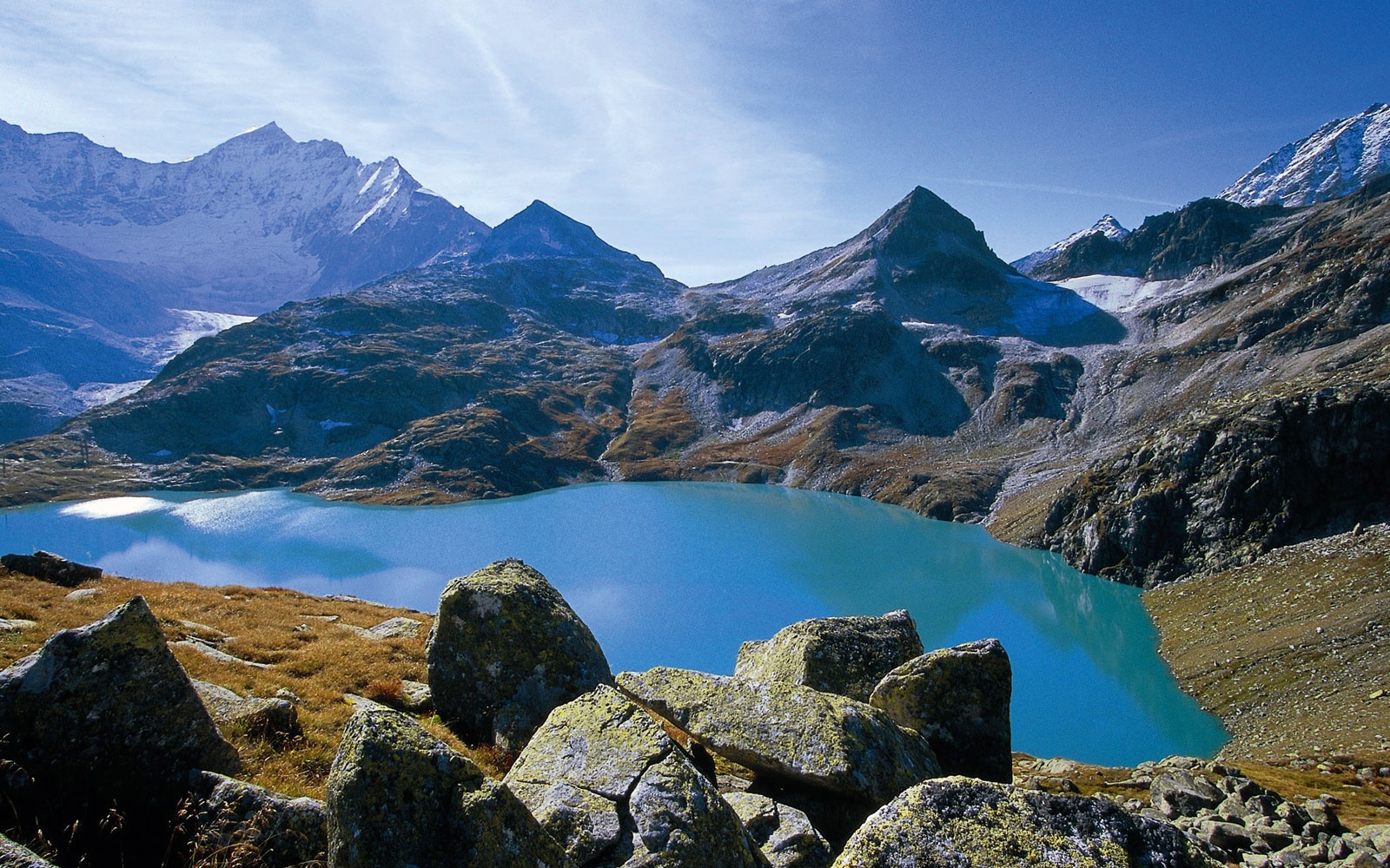
When the summer sun shines from the sky and higher mountain areas are finally free of snow, it’s time for an excursion into the glacier world of the Weißsee, located at 2,250 meters elevation. Lace up your best hiking boots. Our hike to the summit of the Medelzkopf requires sure-footedness, a head for heights, and good fitness. The day starts very comfortably: for the first approximately 800 vertical meters, you can relax in the padded gondola lift of the Weißsee cable car and watch the impressive mountain panorama passing by the window. The Weißsee shows human intervention in nature at its beautiful side: dammed since 1953, the glacier lake contributes to the environmentally conscious energy supply of the Austrian Federal Railways. After the dam was built, the old shelter from the 19th century sank in the waters and was replaced by the impressive Weißsee mountain hotel. How about a night on site with a view of the turquoise-blue lake? But for now, the rocky summit of the Medelzkopf awaits us. The three-hour route with 449 vertical meters leads over the glacier path up to the 2,760-meter-high mountain. Up here, the view of the untouched glacier world is simply breathtaking! Those who want it easier take the chairlift to the Medelz plateau and only have 160 vertical meters left to the destination.
moderate
3h 0min

10.36 km

A to B
Out and back

Uttendorf

Seasons


Directions
From Weißsee, the path to the Medelzkopf is well signposted: follow trail number 711 southwards to the 2,515-meter-high Kalser Tauern or choose the more comfortable option with the double chairlift. Walking time: Weißsee – Medelzkopf 3 hours; Medelz plateau – Medelzkopf 1.5 hours.
Information & contact
Weißsee Glacier World
Stubachstraße 90
5723 Uttendorf
Tel.: +43 (0)6563 20150
Image credit: Sochor
By public transport
From Zell am See station, regional buses and the Pinzgau local railway run to Uttendorf. With regional bus line 672, you travel through one of the most impressive valleys of the Tauern, the “Stubachtal”, to the starting point of the mountain experience, the Enzingerboden – valley station of the cable car at 1,480 meters above sea level.
Timetable information and download: Online at www.salzburg-verkehr.at or on your smartphone via the free Salzburg Verkehr app for Android and iOS.
Safety information
The route requires sure-footedness, a head for heights, and good fitness.Route profile
All content has been researched by the editorial team to the best of their knowledge. However, the editorial team of Salzburger Verkehrsverbund GmbH cannot guarantee the completeness, accuracy, or timeliness of the information provided. We kindly ask you to verify the details when planning your trip, as opening hours, admission prices, or other information may change. Any liability claims against the editorial team or Salzburger Verkehrsverbund GmbH relating to material or non-material damages arising from the use of the information provided, or from the use of incorrect or incomplete information, are generally excluded.