
The Taugler dialect Way of the Cross in St. Koloman
The fastest route to this destination
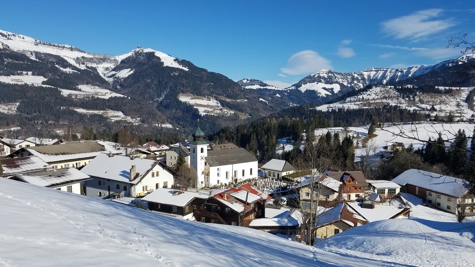
The Taugler dialect Way of the Cross in St. Koloman
A sunny route for almost every day and season, equally suitable for the quiet time around Easter as for a sunny winter walk.
The Taugler dialect Way of the Cross leads around St. Koloman from farm to farm, from wayside shrine to wayside shrine, presenting the place from its most beautiful and sunny sides. The idea for this folk Way of the Cross came from the former mayor Christian Struber; the artistic design was in the hands of the painter Edith Moser, and the texts come from August Rettenbacher. The perhaps most touching effect of this journey following the path of Christ’s suffering surely occurs during Holy Week. But even in winter, there is almost always a worn track following the marker posts and the fourteen Way of the Cross stations.
easy
1h 0min

3.49 km

Family-friendly

Round trip

Sankt Koloman

Seasons


Directions
The starting point is the stop in the village centre of St. Koloman. The extraordinary Way of the Cross begins at the church opposite (cemetery exit), where the first station is commemorated, in which Jesus is condemned to death. The route leads one kilometre uphill on the footpath along the road to Wegscheid to the impressive Wegscheid chapel (station 7) and then runs from this highest point (901 m) back 400 metres to a marked junction. On the Hohenauweg, one now turns left to stations 8 and 9 of the Way of the Cross, then at the 10th station turns right into the Thalheimweg. The 12th station (Jesus dies on the cross) is located somewhat separately on a particularly atmospheric hill with views of the church and the village. From this viewing platform, the visible surrounding mountains are also named and their origins explained. Thus, we learn that the distinctive Regenspitze has nothing to do with the Salzburg Schnürlregen, but rather arose from the gradual corruption of the original designation "Rigopert." Back on the main path, the village centre is reached within a few minutes.
Information & contact
Mag. Christian Heugl
5400 Hallein
cheugl@a1.net
Image credit: Christian Heugl
By public transport
By bus 460 from Hallein station west side to the St. Koloman Ortsmitte stop.
Timetable information and download: Online at www.salzburg-verkehr.at or on your smartphone via the free Salzburg Verkehr app for Android and iOS.
Route profile
All content has been researched by the editorial team to the best of their knowledge. However, the editorial team of Salzburger Verkehrsverbund GmbH cannot guarantee the completeness, accuracy, or timeliness of the information provided. We kindly ask you to verify the details when planning your trip, as opening hours, admission prices, or other information may change. Any liability claims against the editorial team or Salzburger Verkehrsverbund GmbH relating to material or non-material damages arising from the use of the information provided, or from the use of incorrect or incomplete information, are generally excluded.