
Border hike from St. Leonhard to Hallein
The fastest route to this destination
Border hike from St. Leonhard to Hallein
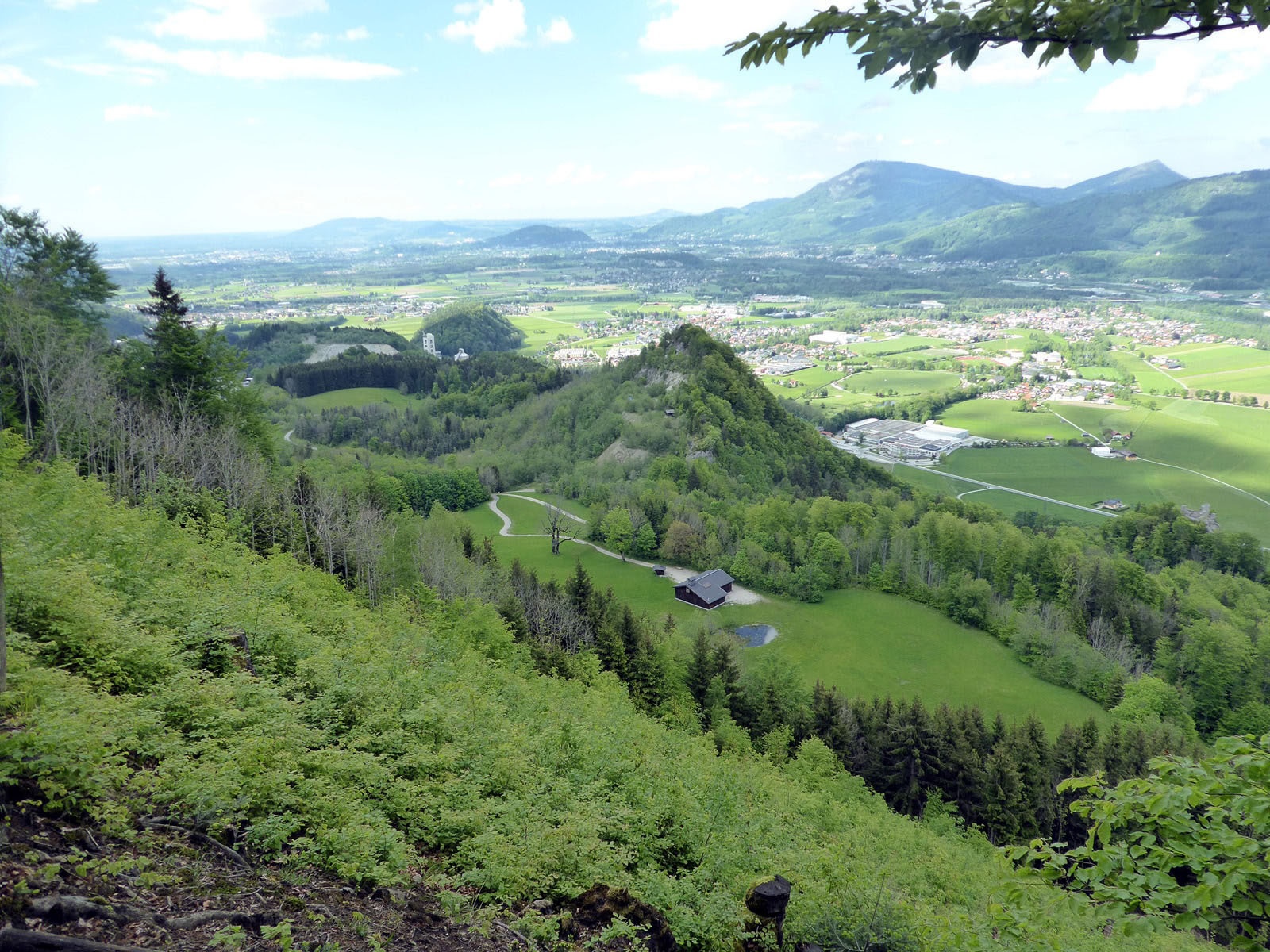
ON THE HIGH-ALTITUDE HIKE OVER THE KÖPPELSCHNEID TO HALLEIN, THERE IS MUCH TO EXPERIENCE: MODERN ART, OLD BORDER MARKERS, AND AS A REWARD THE BEST ICE CREAM IN HALLEIN’S OLD TOWN.
The ridge on the western Salzach side between Hallein and St. Leonhard acts as a natural border barrier. And it really is: several border stones dated 1818 as well as the ruins of former border fortifications along the path remind you of this. But this border wall contains much more: high-quality marl limestone, which is the most important basis for the Leube cement plant. The unexpected possibilities contained in the world’s most important building materials, concrete and cement, are then shown in a sculpture park at the beginning of the high-altitude hike. Along the Königseeache river, at the edge of the Leube company site, profound and witty concrete artworks are presented that handle the heavy material with astonishing lightness. For the hikers, it then becomes a bit steeper and more challenging, but after the successful crossing in Hallein, the well-known good ice cream or maybe a Radler from the nearby brewery awaits, depending on your mood and appetite.
easy
3h 0min

8.54 km

Family-friendly

A to B

Hallein

Seasons


Directions
From the Grödig Untersbergbahn stop, the route leads over the federal road, then along the Leube driveway over the bridge and immediately after to the left to the Königseeache. The narrow riverside path runs past original sculptures to a fork and now follows the left-turning direction to Hallein. The path, slippery and damp in places, quickly gains height; at a further fork we follow path 27 to the scenic Köppelschneid. Path 27 bypasses the Hoher Götschen (930) on the right side, but an unmarked trail also leads over this highest point. With a magnificent view of the Berchtesgadener Alps, the path leads over farmland down to Knollehen and runs along the foot of the Barmsteine either past the ruin of Thürndl via the Ödlsteig (path 459) or parallel below on the paved Kleinkirchentalweg. The last section, about 20 minutes to Hallein, follows the old Dürrnberg street. Return from Hallein station or by bus 170 from Hallein Stadtbrücke stop.
Information & contact
Mag. Christian Heugl
5400 Hallein
cheugl@a1.net
Photo credit: Christian Heugl
By public transport
From Sbg. main station (Südtirolerplatz) take trolleybus 5 or bus 25 to Grödig Untersbergbahn (bus terminal). Or from Sbg main station (Engelbert-Weiß-Weg) take bus 840 to Grödig Untersbergbahn (Berchtesgadener Straße).
Return from Hallein by train from Hallein station or by bus 160, 170 from Hallein station (forecourt).
Timetable information and downloads: Online at www.salzburg-verkehr.at or on your smartphone via the free Salzburg Verkehr app for Android and iOS.
Route profile
All content has been researched by the editorial team to the best of their knowledge. However, the editorial team of Salzburger Verkehrsverbund GmbH cannot guarantee the completeness, accuracy, or timeliness of the information provided. We kindly ask you to verify the details when planning your trip, as opening hours, admission prices, or other information may change. Any liability claims against the editorial team or Salzburger Verkehrsverbund GmbH relating to material or non-material damages arising from the use of the information provided, or from the use of incorrect or incomplete information, are generally excluded.