
Lämmerbach (Hintersee) – Holzeck – Königsberger Horn
The fastest route to this destination
Lämmerbach (Hintersee) – Holzeck – Königsberger Horn
Remote and scenic circular route with breathtaking views of the Osterhorn group
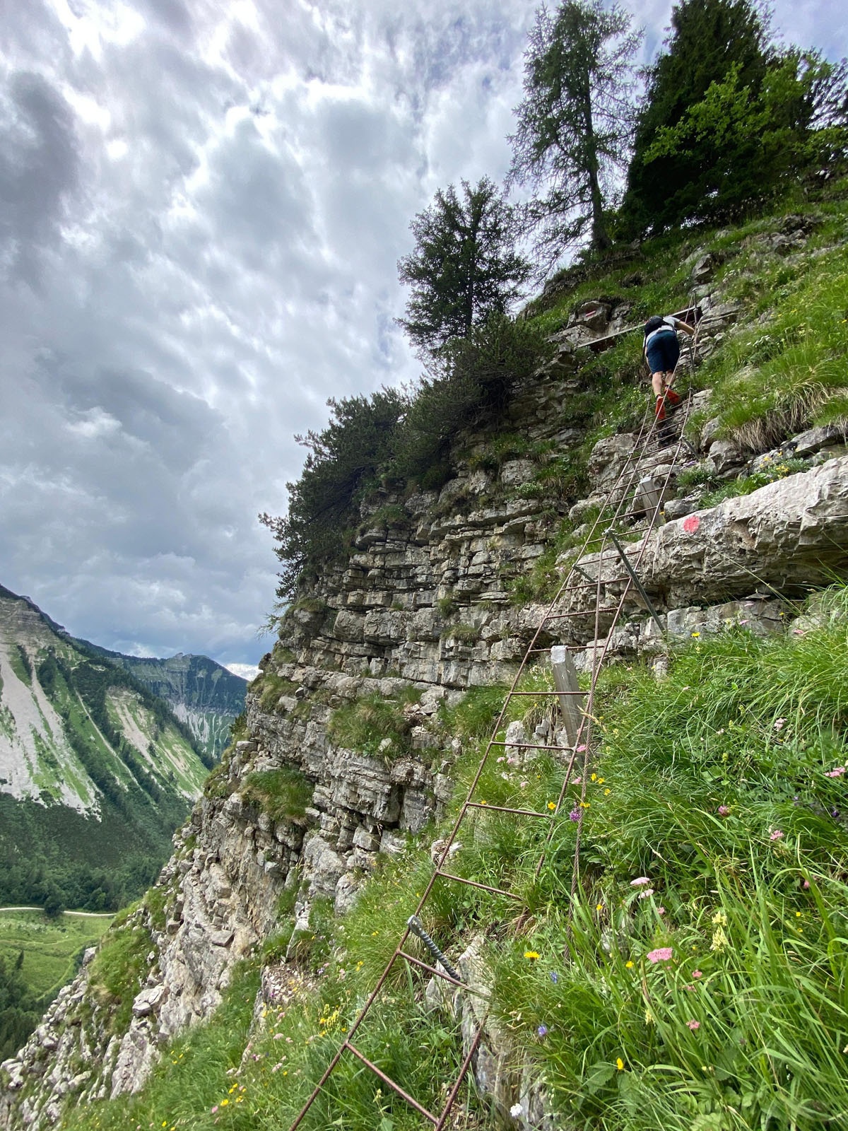
The Osterhorn group is a very popular hiking area. Those who like to be more alone will surely enjoy this flowery, easy ridge hike over Holzeck, Hochthron, and Königsberger Horn. The new 15m ladder on the way to Holzeck and an exposed crossing, which has been made safer by a steel cable, make this route quite a challenging undertaking, suitable only for very surefooted and sure-handed hikers.
The path over Hochthron – Königsberger Horn to Königsberger Alm is part of the Arno trail, which then leads to Sankt Gilgen, and in the other direction to Abtenau. (Wikipedia)
Direct arrival and details at: salzburg-erfahren.at
difficult
5h 19min

13.51 km

A to B

Hintersee

Seasons


Directions
Via the forest road or the “path to Genneralm” (slippery after rain) to Genneralm. There you can refresh yourself again at the Poschnhütte. Follow the gravel road from the Poschnhütte eastwards and after the alpine meadows turn left onto the path to Holzeck. It gets steeper over beautiful flower meadows into a gravel gully. Halfway there the path turns left to a rock wall, which is overcome by a 15m high iron ladder. Then you circle the rock briefly in a very exposed position but continuously secured with a steel cable before a flatter path leads right to Holzeck. Then a short piece back and follow the partly grass-covered ridge over Hochthron to Königsberger Horn. From there descend very steeply through the forest to Königsberger Alm (slippery after rain) and continue left down the forest roads to Hintersee.
Information & contact
Theresa Schilling
5020 Salzburg
theresaschilling@googlemail.com
Photo credits: Theresa Schilling, Per Oftedal
By public transport
Take bus 155 to Faistenau Schule and change there to bus 157 to Hintersee Lämmerbach.
Timetable information and downloads: Online at www.salzburg-verkehr.at or on your smartphone via the free Salzburg Verkehr app for Android and iOS.
Direct arrival and details at: salzburg-erfahren.at
Safety information
Surefootedness and sure-handedness required (15m ladder)Route profile
All content has been researched by the editorial team to the best of their knowledge. However, the editorial team of Salzburger Verkehrsverbund GmbH cannot guarantee the completeness, accuracy, or timeliness of the information provided. We kindly ask you to verify the details when planning your trip, as opening hours, admission prices, or other information may change. Any liability claims against the editorial team or Salzburger Verkehrsverbund GmbH relating to material or non-material damages arising from the use of the information provided, or from the use of incorrect or incomplete information, are generally excluded.