

From Sportgastein via the Zittrauer Tisch to Böckstein
The fastest route to this destination
From Sportgastein via the Zittrauer Tisch to Böckstein
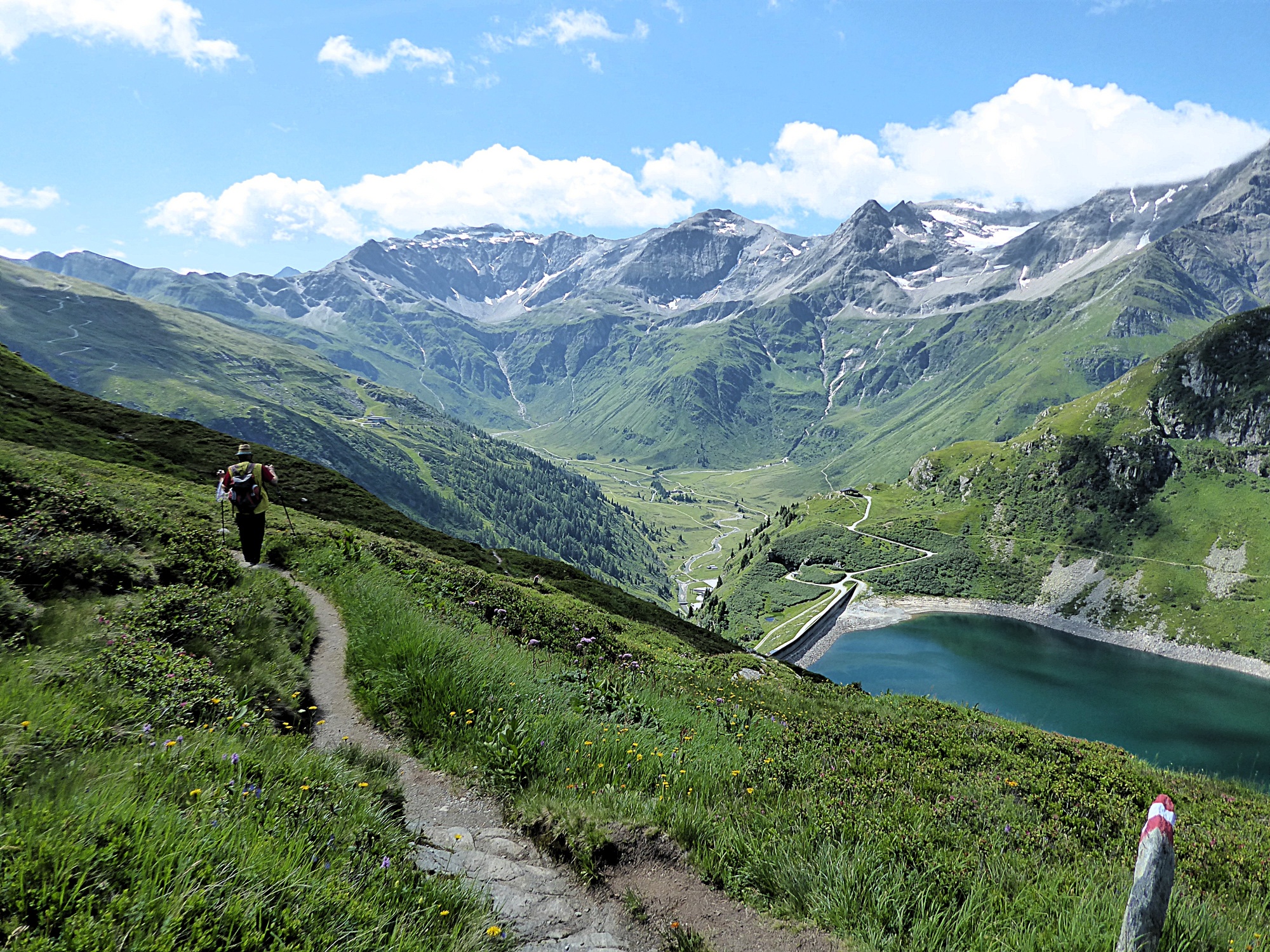
Passing by the Lower Bockhartsee, the alpine route leads along airy ridge trails to the historic mining town of Altböckstein, a designated historic site.
There are, of course, shorter routes from Nassfeld (Sportgastein) to the old mining town of Böckstein, but none offers such spectacular views and such variety as the alpine tour over the Zittrauer Tisch (2,463 m). The entire range of the Goldberg Group—from the Silberpfennig to the Sonnblick—spreads out directly across from you at eye level. The names clearly reveal the area’s significance for mining, which reached its peak in the 15th century. A center of gold mining was Altböckstein, where our traverse ends. With a bit of luck, one of the mighty bearded vultures from the Rauris Krumltal valley might even glide across the scene. However, you should also pay close attention to the trail; the steep ascent and descent over the Zittrauer Tisch, in particular, require sure-footedness and a head for heights. In between, two rest stops—the Bockhartseehütte (1,917 m) and the Zittrauer Alm (1,872 m)—offer culinary highlights.
difficult
5h 40min

12.64 km

A to B

Bad Gastein

Seasons


Directions
Next to the Sportgastein Goldbergbahn bus stop, the Hohe Tauern National Park information kiosk provides an initial overview. The trailhead for the one-hour hike to the Bockhartsee Hut is located diagonally across from the Valeriehaus restaurant. After the steep, one-hour ascent to the Bockhartsee Hut, the trail descends another 60 meters in elevation and runs along the dam. The dam, cleverly camouflaged with earth, must withstand the pressure of nearly 20 million m³ of water. The trail leads rapidly uphill through blooming alpine flora, and now, in addition to the 45-hectare lower reservoir, the small Upper Bockhartsee comes into view for a brief moment. Shortly after the wide Miesbichlscharte (2,237 m), the trails fork: the left path leads into the Angertal valley, while the right one heads toward the “Stubnerkogel” (Trail 111) via the Zittrauer Tisch. A somewhat arduous section over boulder fields follows, after which the trail continues along the narrow ridge to the Zittrauer Tisch. However, it looks more dramatic from below than it actually is. The wide trail over to the neighboring Tischkogel (2,409 m) is a pleasant walk, before another short, steep descent follows along the east ridge (Trail 130) toward the Zittrauer Alm. Before reaching the alpine pasture, the trail to Böckstein—a hike of just under two hours—branches off to the right; it crosses increasingly toward the steep south face but runs mostly through the shady forest.
Information & contact
www.gastein.comMag. Christian Heugl
5400 Hallein
christian.heugl@gmail.com
Photo credit: Christian Heugl
By public transport
Take bus 550 from the Bad Gastein train station (forecourt) or the Schwarzach–St. Veit train station (forecourt) to the Sportgastein Goldbergbahn valley station. Return via bus 550 from downtown Böckstein.
Timetable information and downloads: Online at www.salzburg-verkehr.at or on your smartphone via the free Salzburg Verkehr app for Android and iOS.
Route profile
All content has been researched by the editorial team to the best of their knowledge. However, the editorial team of Salzburger Verkehrsverbund GmbH cannot guarantee the completeness, accuracy, or timeliness of the information provided. We kindly ask you to verify the details when planning your trip, as opening hours, admission prices, or other information may change. Any liability claims against the editorial team or Salzburger Verkehrsverbund GmbH relating to material or non-material damages arising from the use of the information provided, or from the use of incorrect or incomplete information, are generally excluded.