
From Pfarrwerfen to Bischofshofen
The fastest route to this destination
From Pfarrwerfen to Bischofshofen
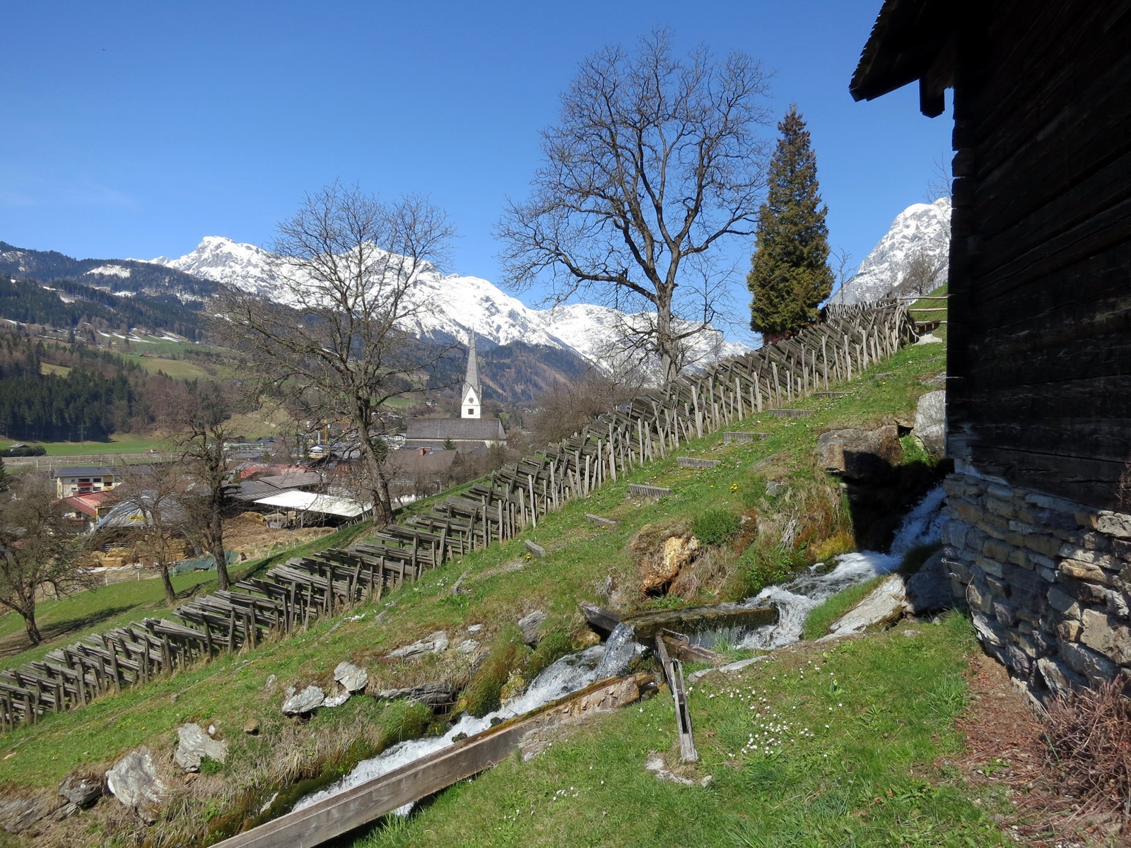
ON ANCIENT AND BRAND NEW TRANSPORT ROUTES, PAST SEVEN MILLS, THROUGH THE SALZACH VALLEY TO BISCHOFSHOFEN.
The area between Werfen and Schwarzach is a sought-after settlement location that dates back to the fourth millennium. The reasons can be easily understood on this valley hike. The relatively flood-proof valley expansions provided protection and the tributary side valleys good traffic connections. A stroke of economic luck was the copper deposits discovered on both sides of the Salzach. The Roman settlers also brought innovative ideas from 15 BC onwards. Among other things, besides the sophisticated road construction, these were the highly effective watermills. Both were of great importance for the functioning infrastructure. In Pfarrwerfen, the Roman Vocario, there was a horse change station, as well as grain cultivation and mills in the neighborhood. The seven mills located on our route remind of the former significance. The mills lined up one behind the other like a string of pearls were just saved in time from decay and can be visited. But today’s infrastructure also requires modern transport routes. These are, above the route, the Tauern motorway and below, the multi-track railway line. Between them runs the old Roman road, which we follow in sections.
easy
2h 30min

7.40 km

Family-friendly

A to B

Pfarrwerfen

Seasons


Directions
Starting point is the Pfarrwerfen train station. A somewhat faster but more monotonous route to Bischofshofen can also simply follow the Tauern cycle path along the Salzach. There is more to see on the route that turns right along the access road into the pretty town center for 700 meters and then follows the sign "Open-air museum 7 Mills" to the right before the Hasslwanter bakery. The turnstile in front of the mills opens after inserting coins or tokens (available at the bakery). At the top end of the steep mill path, the route leads to the right and then continues into the Römerstraße service road. From there, the direction "Bischofshofen Kreuzberg-Mauth" branches off to the right. Back in the valley floor, the path leads through an industrial area and turns right before the Lottermoser carpentry. Passing the premises of the waste disposal association, the Fritzbach is crossed and the route then follows the Tauern cycle path for 700 meters to the junction "Recreational area circular route" to the left. Along the sports field, the path stays on the eastern Salzach side and leads 1.3 km later over the new Stegfeld pedestrian bridge directly into the modern Bischofshofen station building.
Information & contact
Mag. Christian Heugl
5400 Hallein
cheugl@a1.net
Photo credit: Christian Heugl
By public transport
From Salzburg main station direct connection with S 3 to Pfarrwerfen station. Return from Bischofshofen station.
Timetable information and downloads: Online at www.salzburg-verkehr.at or on your smartphone via the free Salzburg Verkehr app for Android and iOS.
Route profile
All content has been researched by the editorial team to the best of their knowledge. However, the editorial team of Salzburger Verkehrsverbund GmbH cannot guarantee the completeness, accuracy, or timeliness of the information provided. We kindly ask you to verify the details when planning your trip, as opening hours, admission prices, or other information may change. Any liability claims against the editorial team or Salzburger Verkehrsverbund GmbH relating to material or non-material damages arising from the use of the information provided, or from the use of incorrect or incomplete information, are generally excluded.