


From Soderbauer to Thälernalm
The fastest route to this destination
From Soderbauer to Thälernalm
A SUNNY AND ENJOYABLE ALPINE HIKE AT THE FOOT OF THE DIETRICHSHORN IN THE AREA BETWEEN LOFER AND UNKEN. PERFECTLY SUITABLE FOR THE WHOLE FAMILY.
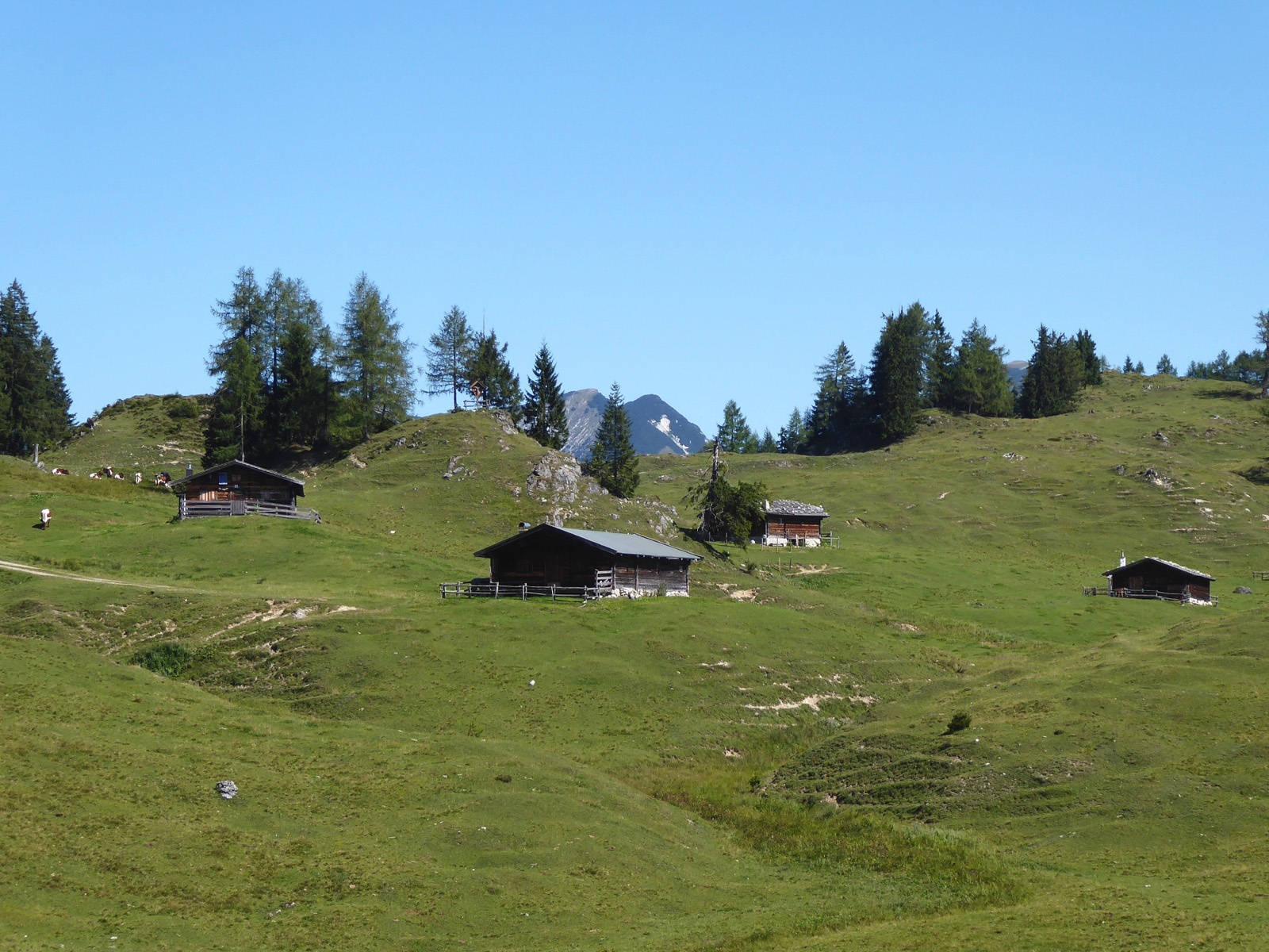
The Thälerer Kogel (1,337 m) between Unken and Lofer is, unlike the neighboring Dietrichshorn (1,542 m), a rather unspectacular but all the more enjoyable destination. Particularly charming are the huts of the Thälernalm, which are picturesquely scattered in the gentle valley between the two unequal peaks. It does get spectacular though, as the descent leads back via the enchanting waterfall trail into the Saalach valley. Also, the magnificent Erbhof Soderbauer, located just above the bus stop with its lively exterior frescoes depicting the most popular saint figures, is a real eye-catcher. The marble portal is dated 1655, and the family history even goes back to 1380. The house name Soder or the place name Hallenstein refer to the salt-rich springs found here. Due to its south-facing exposure, the round trip is ideal for a sunny late summer or autumn hike.
moderate
4h 30min

10.92 km

Family-friendly

Round trip

Lofer

Seasons


Directions
The path leads from the Lofer - Soderbauer stop back a few meters along the B178 and then branches left to the magnificent Soder farm. The comfortably ascending farm road reaches the junction to the somewhat remote Vockenalm (1,028 m) in one hour and continues in another 45 minutes into the picturesque valley with the huts of the Thälernalm. The alpine area is closed to the north by the lightly wooded Thälerer Kogel, which can be reached in 20 minutes. However, our path 9 A branches off to the left at the foot of the Dietrichshorn towards the Astenalm and a little later left again towards Schwarzeck to the Götzkas cabin. At this rustic alpine hut, the highest point of the round trip (1,370 m) is reached; the steep descent leads in 15 minutes to the Bimalm and now follows the waterfall trail 50 to the Loderbichl mid-station of the mountain railways (1,005 m). Two hairpin bends below the inn, path 54 (Krepper) branches left into the forest. After 20 minutes and several switchbacks, be careful again as path 9 leads left over the Steigbrückl and reaches the starting point Soderbauer 35 minutes later.
Information & contact
www.lofer.com/de/aktiv-im-sommer/wandern
Mag. Christian Heugl
5400 Hallein
cheugl@a1.net
Photo credit: Christian Heugl
By public transport
From Salzburg main station (Engelbert-Weiß-Weg) take bus 260 to the Lofer Soderbauer stop. Carry a valid passport.
Timetable information and download: Online at www.salzburg-verkehr.at or on your smartphone via the free Salzburg Verkehr app for Android and iOS.
Route profile
All content has been researched by the editorial team to the best of their knowledge. However, the editorial team of Salzburger Verkehrsverbund GmbH cannot guarantee the completeness, accuracy, or timeliness of the information provided. We kindly ask you to verify the details when planning your trip, as opening hours, admission prices, or other information may change. Any liability claims against the editorial team or Salzburger Verkehrsverbund GmbH relating to material or non-material damages arising from the use of the information provided, or from the use of incorrect or incomplete information, are generally excluded.