


Remstein in Grossarl Valley
The fastest route to this destination
Remstein in Grossarl Valley
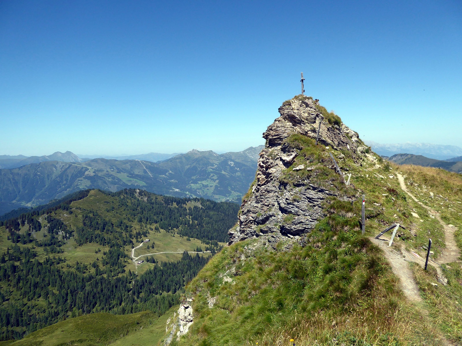
A LONG ROUTE OF THE SOFT SOUNDS FROM THE ELLMAUTAL TO THE FILZMOOSHÖRNDL, THE REMSTEINKOGEL AND FURTHER TO THE VILLAGE OF GROSSARL.
The Ellmautal is a five-kilometre-long side valley running eastwards from the village of Grossarl. At the end of the valley at Grund, there is a car park and the last bus stop of line 541 at 1,330 metres above sea level. From here countless circular routes and crossings are possible. If that’s not a good reason for an excursion into the Grossarl valley! A main destination is the Filzmoosalm (1,710 m), a good hour’s walk from the Grundlehen stop. The climb is cool and easy, as is the further path to the gentle Filzmoossattel (2,064 m) and/or the Filzmooshörndl (2,189 m). If the long, at least three-hour return path to Grossarl then goes via the Remsteinkogel (1,946 m), it becomes even lonelier and very atmospheric. From the managed Bichl-Hochalm (1,731 m), which is also accessible by mountain bikes, the frequency increases again.
moderate
6h 20min

16.19 km

A to B

Großarl

Seasons


Directions
From the Grossarl Grundlehen stop, the path crosses the bridge to the right and follows the direction to Filzmoosalm (path 57) either via the slightly shorter alpine trail (1 hr) or along the wide farm track. After a small refreshment, the further path 57 a towards Filzmooshörndl runs through beautiful pasture land and takes 1 1/4 hours to the summit. The fantastic view extends from the Dachstein across Hochkönig to the Großglockner. Just below the rocky summit structure, the high path 64 branches off to the left and runs via the Stangersattel in a further 1 1/4 hours to the Remsteinkogel. As with the Filzmooshörndl, this rocky peak also appears only slightly rockier in the very last few metres; otherwise, exquisite and incredibly varied hiking predominates. The beautifully situated Bichl Hochalm is reached in 50 minutes. The last section follows route 56, which follows 1 km of the wide access road, then branches off to the left to the “Himmelsleiter” and crosses the Finsterwald with a consistent steepness. When the Scouts’ European table appears, the goal Grossarl bus stop town centre is only 20 minutes away.
Information & contact
www.grossarltal.info/de/almen/bichlalm.html
Mag. Christian Heugl
5400 Hallein
Image credit: Christian Heugl
By public transport
From St. Johann im Pongau station (forecourt) take bus 540 to Grossarl town centre and bus 541 to Grossarl Grundlehen. Return from Grossarl town centre with bus 540 to St. Johann station (forecourt). Note the bus 541 summer timetable (runs until 25 October)!
Frequency, interval: hourly on weekdays, every 2 hours at weekends.
Timetable information and download: online at www.salzburg-verkehr.at or on your smartphone via the free Salzburg Verkehr app for Android and iOS.
Route profile
All content has been researched by the editorial team to the best of their knowledge. However, the editorial team of Salzburger Verkehrsverbund GmbH cannot guarantee the completeness, accuracy, or timeliness of the information provided. We kindly ask you to verify the details when planning your trip, as opening hours, admission prices, or other information may change. Any liability claims against the editorial team or Salzburger Verkehrsverbund GmbH relating to material or non-material damages arising from the use of the information provided, or from the use of incorrect or incomplete information, are generally excluded.