

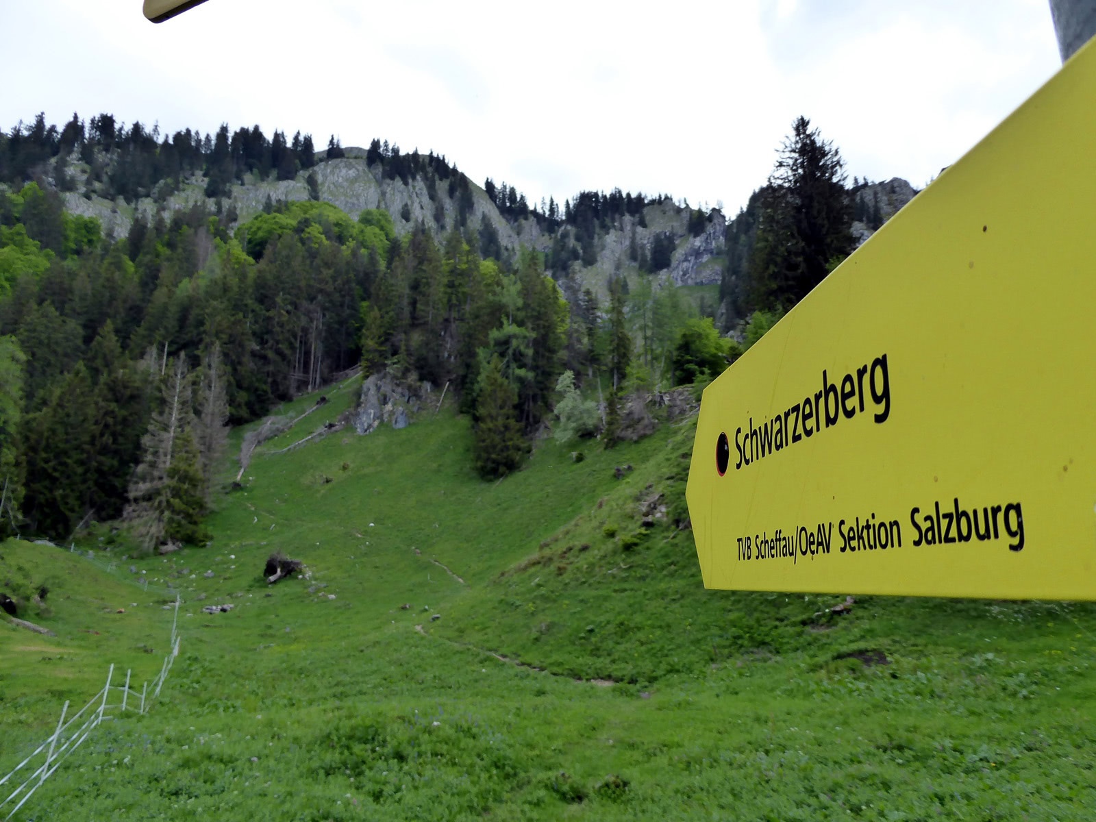

Schwarzerberg in Lammertal
The fastest route to this destination
Schwarzerberg in Lammertal
The trail to Schwarzerberg is without a doubt a difficult (=black) path. But it is also easier with the alternative pleasure route via the Steinhütte.
There are several Schwarze Berge in the state. This always refers to the type of forest, which consists mostly of dark coniferous trees, i.e. spruces, firs and pines. From the Lammertal side, however, our Schwarzerberg is not so dark; a beautiful mixed beech forest predominates. In addition, a storm event has created considerable clearings. For the trail makers in this consistently steep terrain, this was no easy task, but they have solved it brilliantly. The trail remains challenging and steep despite the technical refinements, especially the last 200 vertical meters to the summit pass through an airy maze of rock ledges and gullies. Those who are not sure-footed and free from dizziness should skip this last section and cross directly to the pleasure part to the Steinhütte (997 m). The 3 or 5.5-hour loop ends in the town center of Unterscheffau. Exactly between the magnificently equipped Gothic parish church and the inn Pointwirt opposite is the bus stop for the return journey.
moderate
5h 30min

10.40 km

Round trip

Scheffau am Tennengebirge

Seasons


Directions
At the starting point Unterscheffau-Bernhofer bus stop (one stop after the town center), the “Schwarzerberg via Lehngriesalm” is already generously signed with 3 3/4 hours. Initially, it is not too steep past the last houses and the Ölbrenner Chapel built in 2010 into the forest. Trail 91 crosses the streambed side several times and then branches off after the last crossing into the steep, gully-divided forest terrain. After an hour the trail meets a forest road. The gentle variant branches left to the romantic hunting lodge Steinhütte, the one-hour ascent to Schwarzerberg (1,584 m) continues straight ahead. Passing the last drinking water spot, the trail reaches the area of the ruined Lehngriesalm (1,270 m), which has been used as alpine pasture again for several years. Shortly after this fertile grass hollow, the final ascent becomes steep and exposed; please pay special attention to the trail here. After the well-deserved summit rest with incredible views, return on the same route to the fork and then turn right to the nearby Steinhütte. As steep as the way was so far, the 1 1/2-hour descent to Unterscheffau (trails 92 A, 92) is consistently comfortable on the scenic forest road.
Information & contact
Mag. Christian Heugl
5400 Hallein
cheugl@a1.net
Image credit: Christian Heugl
By public transport
To Golling Abtenau station by train or bus 470. From the forecourt of Golling Abtenau station by bus 470 or bus 471 to Unterscheffau Bernhofer. Return by bus 470 or bus 471 from Unterscheffau town center. Frequency: every half hour or hourly.
Timetable information and download: Online at www.salzburg-verkehr.at or on your smartphone via the free Salzburg Verkehr app for Android and iOS.
Safety information
Steep ascent. The last section on Schwarzerberg, partly secured with wire ropes, requires sure-footedness and a head for heights.Route profile
All content has been researched by the editorial team to the best of their knowledge. However, the editorial team of Salzburger Verkehrsverbund GmbH cannot guarantee the completeness, accuracy, or timeliness of the information provided. We kindly ask you to verify the details when planning your trip, as opening hours, admission prices, or other information may change. Any liability claims against the editorial team or Salzburger Verkehrsverbund GmbH relating to material or non-material damages arising from the use of the information provided, or from the use of incorrect or incomplete information, are generally excluded.