


The Saukarkopf and its winter summit
The fastest route to this destination
The Saukarkopf and its winter summit
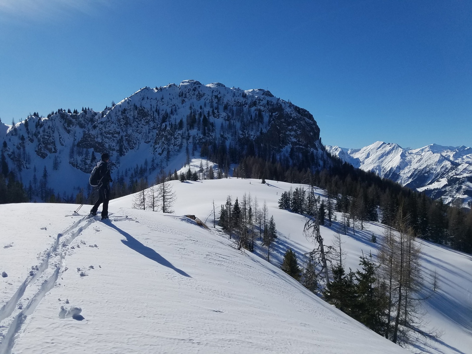
THE SAUKARKOPF (2048 m) IS A STEEP ROCK BLOCK AND ONLY ACCESSIBLE IN VERY SAFE CONDITIONS. Fortunately for the mountaineers, there is a gentle neighbor to the north.
The Großarltal is a true paradise for mountaineers. The further the journey goes into the valley, the more demanding the destinations become. The Saukarkopf at the beginning of the valley is really challenging only in the final part, but much more worthwhile and above all safer is the nameless elevation (1908 m) north of it, separated by a wide saddle. The north-facing route starts at the Großarl Auschulweg bus stop; there are no parking spaces available. Just behind it begin wonderful farm meadows which are followed by a high forest that transitions into a sparse forest before the wide saddle above the Saukaralm. A few minutes later, the gentle, loosely forested destination is already reached. Compared to the rocky Saukarkopf located visibly to the south, perhaps less spectacular, but from top to bottom with great certainty a pure pleasure. The ascent is mostly tracked and popular even in less ideal conditions due to the moderate avalanche risk.
moderate
2h 15min

6.69 km

Großarltal

Seasons


Directions
The starting point is the Großarl Auschulweg bus stop. The Auschulweg branches off steeply uphill (E) at a sharp angle and here begins the mostly tracked ascent over the first steep farm meadow to a gate passage. Passing left of a building, the track leads over a less steep slope to another farm. This first section can also be bypassed on the Auschulweg access road. Passing left of the farm building, the ascent follows the inviting wide and now completely open slopes in a southeast direction. Shortly after a striking rock in the middle of the meadow, the beautiful slope ends in a nook (1280 m above sea level), next to which are two comfortable benches and the gate passage into the high forest. A forest road is crossed, then the track meets the mostly cleared goods road to the Saukaralm. Either on this access road or shorter by turning left past the piped Höllingwald spring to a private hunting lodge (1650 m). The marked summer trail leads left of the hunting lodge and then briefly somewhat steeper past a striking larch through the increasingly sparse forest up to a flat saddle. In a wide left curve it goes over the south side to the inconspicuous endpoint (1908 m). Descent along the ascent or over the broad, partly steep northern ridge and then at the end of the open slopes half-left in northwestern direction through the high forest to the Saukaralm access road.
Information & contact
Mag. Christian Heugl
5400 Hallein
cheugl@a1.net
Photo credit: Christian Heugl
By public transport
By train to St. Johann im Pongau. From St. Johann station (forecourt) take bus 540 to the Großarl Auschulweg bus stop.
Timetable information and download: Online at www.salzburg-verkehr.at or on your smartphone via the free Salzburg Verkehr app for Android and iOS.
Route profile
All content has been researched by the editorial team to the best of their knowledge. However, the editorial team of Salzburger Verkehrsverbund GmbH cannot guarantee the completeness, accuracy, or timeliness of the information provided. We kindly ask you to verify the details when planning your trip, as opening hours, admission prices, or other information may change. Any liability claims against the editorial team or Salzburger Verkehrsverbund GmbH relating to material or non-material damages arising from the use of the information provided, or from the use of incorrect or incomplete information, are generally excluded.