

Waterfall Adventure Trail in the Grossglockner Valley
The fastest route to this destination
Waterfall Adventure Trail in the Grossglockner Valley
Breathtaking scenery, roaring waterfalls, and views of the Glockner Group. This hike rewards every meter of elevation gain!
Anyone looking for an adventurous hike in the Salzburg region that’s easily accessible by public transport will find this tour a particularly rewarding option.
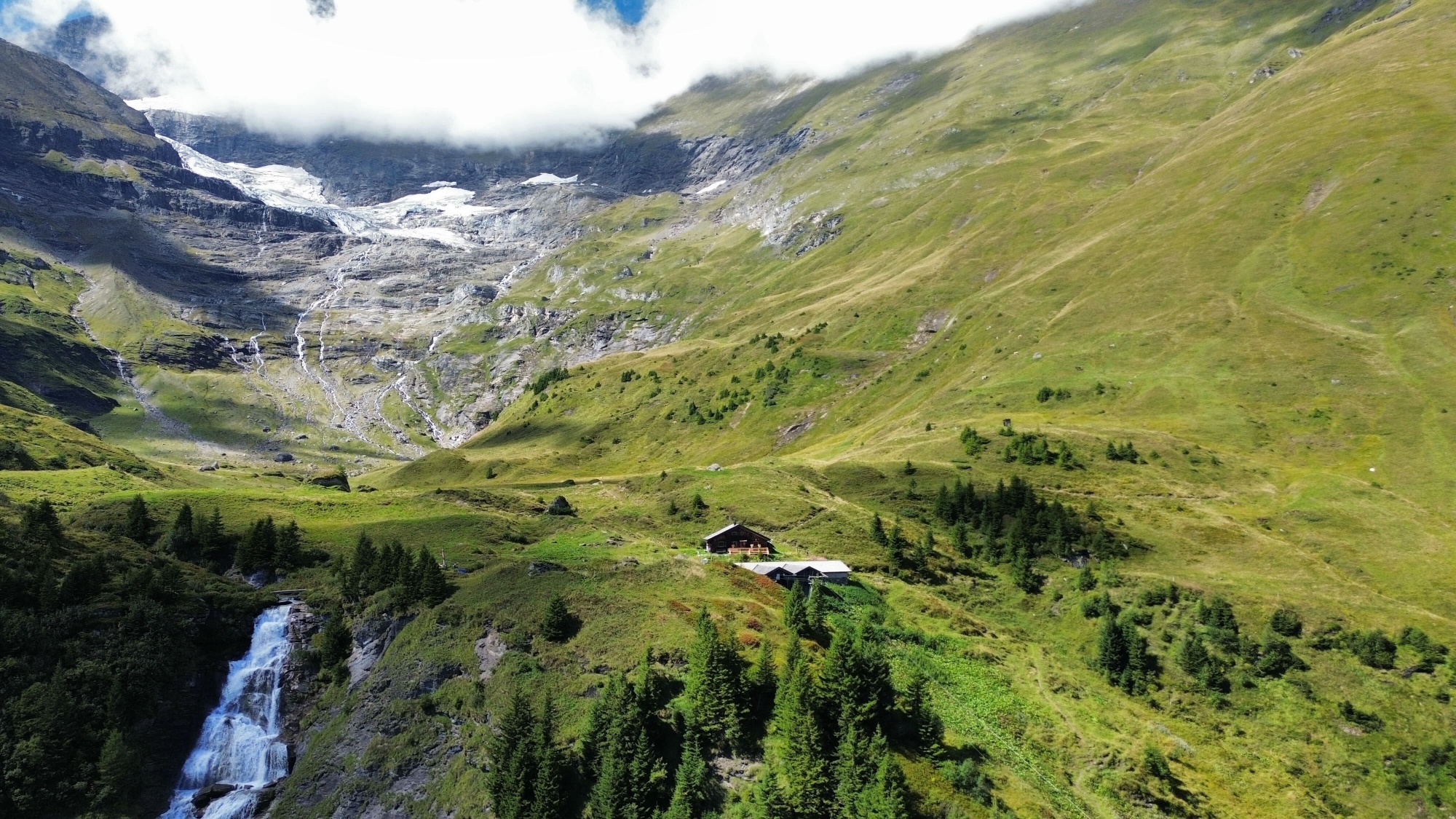
The challenging hike to the Walcherfall waterfall begins in Ferleiten in the Großglocknertal valley. The route winds its way up the waterfall adventure trail to the source of the falls at the Walcherkees glacier. Several highlights await along the way, with views of the waterfall constantly opening up. After an ascent of around 550 meters, you reach a rocky outcrop from which you can even stand behind the cascading water. Numerous viewpoints and opportunities for breaks are also available along the way.
The views of the Glockner Group, the roaring roar of the waterfall cascades, and the ever-changing landscape make this hike a truly special experience.
After the rocky outcrop, the second section continues to the Walcher-Hochalm alpine pasture and thus to the point where the fresh glacial meltwater begins its journey into the valley. From a small wooden footbridge, you can watch the water plunge down the mountain.
Here you are already at the alpine tree line. To the east, the view extends into the Grossglockner Valley, while to the west, a high plateau opens up, overlooked by the glacial massif of the Walcherkees Glacier. The diversity and impressive effect of this landscape are difficult to capture in photographs.
The route passes two alpine pastures: the Walcher Grundalm and the Walcher-Hochalm. Both are no longer actively managed. However, cold drinks are available for purchase at a self-service kiosk. Restrooms are also available.
Direct directions and details can be found at: salzburg-erfahren.at
moderate
4h 25min

9.39 km

Round trip

Glockner Group

Seasons


Directions
The tour begins at the Ferleiten Wildlife Park bus stop. First, cross the main road at the toll booth. You should already be able to see some of the waterfall's cascades from here. After crossing the Fuscher Ache stream, follow the signs for the "Waterfall Circular Trail" (number 3D). The route is generally well-marked. Only on the sections across the pastureland is it advisable to keep an eye on the existing footpath to avoid getting lost. After several switchbacks and a few hundred meters of elevation gain, you'll reach a fork in the path. From here, follow the signs for "Adventure Waterfall." After passing the waterfall, the path continues to the next junction. There, follow the signs to the Walcher-Hochalm alpine pasture. Once you reach the top, several options are available for the return journey. There are three points where you can cross to the other side of the stream. You can continue following the signs for the "Hochalm Circular Hiking Trail." Anyone who would also like to pass by the Walcher Grundalm should go back a few meters and at the fork in the path by the adventure waterfall follow the signs for “Walcher Grundalm / Ferleiten”.
Information & contact
Salzburg TransportImage credit: Simon Klein
By public transport
- From Salzburg Central Station, take the R3 bus (Saalfelden) or an InterRegio/long-distance train to Bruck-Fusch station. From there, take regional bus 650 to Ferleiten Wildlife Park.
- For the return trip, take the same connection, regional bus 650 (Zell am See) to Bruck-Fusch station. From there, take a suitable long-distance train or the R3 bus towards Salzburg Central Station.
Timetable information and downloads: Online at www.salzburg-verkehr.at or on your smartphone via the free Salzburg Verkehr app for Android and iOS.
Direct travel information and details at: salzburg-erfahren.at
Safety information
Dogs should not enter the pasture areas. Please observe the relevant signs on site. There are several sections of the route secured with chains. These require sure footing and careful movement. During the winter months, slippery and icy sections are to be expected on the trail.Route profile
All content has been researched by the editorial team to the best of their knowledge. However, the editorial team of Salzburger Verkehrsverbund GmbH cannot guarantee the completeness, accuracy, or timeliness of the information provided. We kindly ask you to verify the details when planning your trip, as opening hours, admission prices, or other information may change. Any liability claims against the editorial team or Salzburger Verkehrsverbund GmbH relating to material or non-material damages arising from the use of the information provided, or from the use of incorrect or incomplete information, are generally excluded.